🇨🇦 Canada Blog Index 🇨🇦
It was a random walk down a few alleyways in Toronto in 2016 that began my obsession with street art. At that time, this website was already well-established… but this was the first time I had taken so many pictures of murals that I felt the need to give them their own article. You can read vol. 1 here. Fast-forward almost 10 years, and this has become perhaps my favorite series on this website.
Well, today is a special one. It’s time for a return to—NOT ONLY the city that started it all for this series on street art—but the EXACT PLACE in that city. Almost 10 years later, we’re back into Toronto for vol. 2, and we’re going to start in the same area where I originally fell in love with collecting murals: Kensington Market.
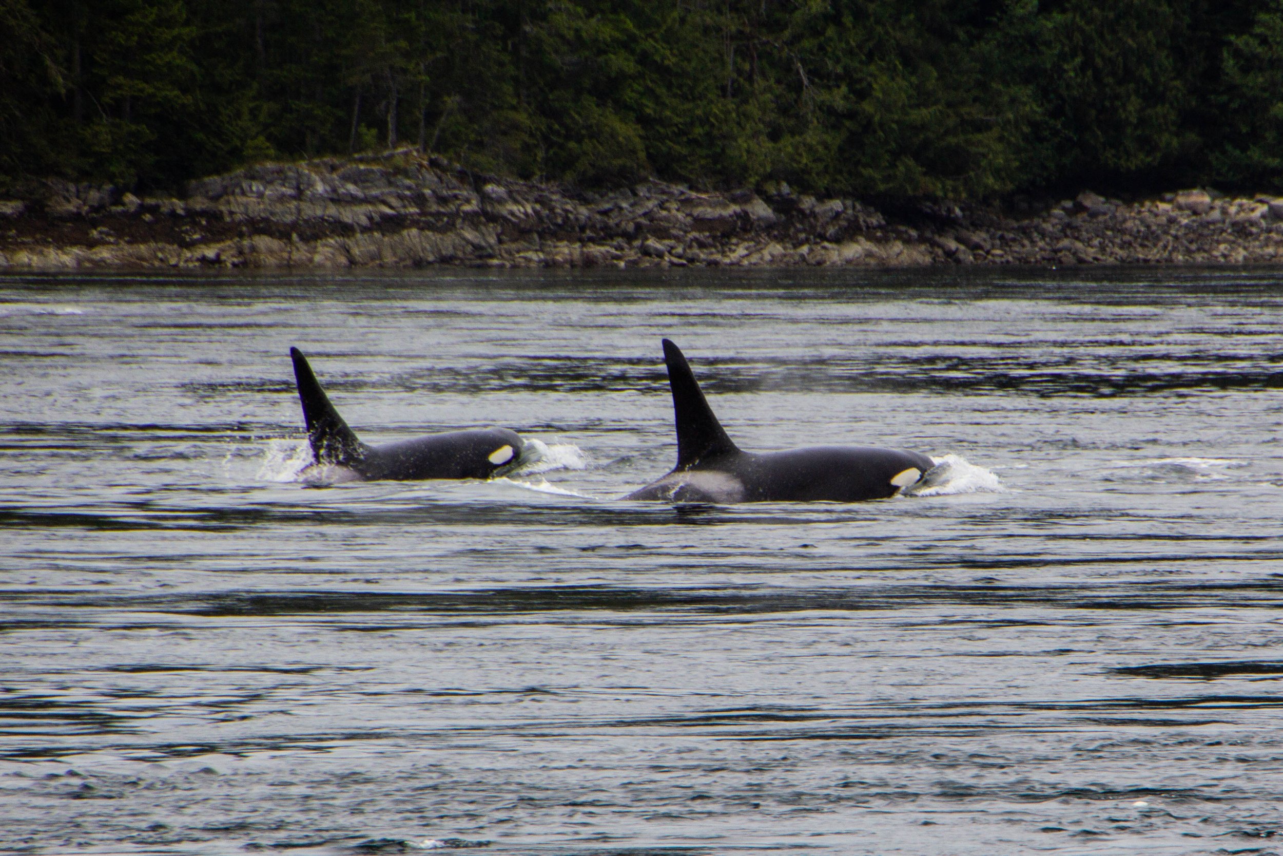
Orcas, or Killer Whales, were something of a feared creature in the olden days. Apparently, back in the 1800s when this part of the world was first being explored by Europeans, their technical/scientific classification was actually “Monster.” Hilarious as this might seem, it does make some sense. Black whales with sharp teeth and shark fins? Yeah, that would have definitely felt somewhat monstrous to me if I was an early sailor of these waters. The conventional wisdom of the day was that, if you fell in the water, you needed to get out ASAP so an Orca wouldn’t eat you. If you hadn’t already guessed this, there is, in fact, no record of an Orca ever eating a human. But this was still a legitimate fear as recently as the 1960s when they actually mounted a machine gun on a coastal bluff known as Chatham Point with the aim of shooting as many Orcas as possible. 🤯 Somehow, for the time when this gun was actively scouring the seas, the Orcas stayed clear of this area and there were no casualties. So Orca/human tensions have never escalated to be anything more than a cold war. And it was not long after this that human sentiments toward Orcas began to change for the better.
Cortes Island is perfect. I am not speaking figuratively. Literally perfect. Every little detail of this island was so effortlessly interesting, unique, and authentic… I don’t know that I have ever seen a place quite like it. It felt like I was living in a chapter of a book. It was like the entire place was straight out of a Wes Anderson movie. Think Moonrise Kingdom, but on an island off the coast of British Columbia, and mostly populated by adults. I could make a cool Pacific-Northwest-meets-Martha’s-Vineyard Pinterest board inspired by this place. Every property was tastefully weathered and clearly maintained with a personal, practical touch. There were no houses that screamed “VACATION RENTAL” here. Every single one of them looked like they were the active, primary residence of an eccentric gardener.
Our time in the wild, mossy forests of Western Vancouver Island is coming to an end. It’s time for us to make the journey northward toward a place called Campbell River. There are some really cool things in store when we get there, but before we jump into any of that, I wanted to share some miscellaneous exploits from our time between destinations. I often feel like it’s these “in-between” experiences where you really get to know a place, and Vancouver Island was no exception. The reason I feel like I “know” this place at all is because of the ground we covered in this article.
Avatar Grove is well-named; it really does feel like something out of Avatar. Or maybe Jurassic Park. It is a tangled, mossy labyrinth of ancient, knotted trees rising out of an infinite carpet of prehistoric-looking ferns. Each tree branch is draped with moss, similar to the way Spanish Moss hangs from every tree in Savannah—but in a green, lush, distinctly Pacific Northwest kind of way. Every little detail of this place was fascinating and photogenic. From the mossy, leafy forest floor, to the canopy high above our heads, every inch felt like its own world.
In the last article, we checked out Sombrio beach, which I think is likely the most easily-accessible stretch of coastline in the Port Renfrew area, and also the place that resembles the classic “beach” (i.e. sand, waves, etc) most closely. However, the majority of Vancouver Island’s coastline is not as easy to access and is NOT your classic sandy beach. This is a rocky, mossy, rugged, chaotic, windswept boundary zone, perpetually pounded with massive waves, riddled with lively tide pools, and entirely unaccommodating to the “beach vacation” experience. It’s also extremely cool.
To give you an idea of exactly how isolated this place is—the one gas station in the area was out of service during our visit, so we had to drive 2.5 hours EACH WAY to get to the next nearest gas station. We had been advised to stock up on groceries in Victoria before coming out here because we’d have to travel similar distances to find a supermarket. Also, Port Renfrew apparently experiences random rolling blackouts from time to time. When the power went out on our last day, we stopped by a local hotel & restaurant that had a generator running to ask how long these blackouts usually lasted—they told us that the last one lasted 2 days. 🤯 Suddenly, the flashlights we found waiting for us in our Airbnb made a ton of sense. That’s part of the deal out here!
“……Paraguay?” I asked through a confused squint. I did not recognize this name, but it sounded a bit like Paraguay, even though this guy was clearly not from South America.
“No… Haida (exaggerated pause) Gwaii.”
Google that. Google “Haida Gwaii.” I had never even heard of this place. And I have heard of most places.
That is the kind of place that Victoria serves as a way-point for. It’s a completely different world that awaits up here. But I’m getting ahead of myself. First, let’s take a walk around Victoria…
Making the jump from plain ol’ Richmond/Vancouver suburbs to historic Steveston happens unceremoniously. One minute you’re speeding through cozy residential neighborhoods, the next you’re slowing down as you drive along the docks. Having never been this far north on the west coast, my only reference points for what this place feels like were all about 2,000 miles eastward. Maine. Massachusetts. Nova Scotia. That’s what Steveston feels like.
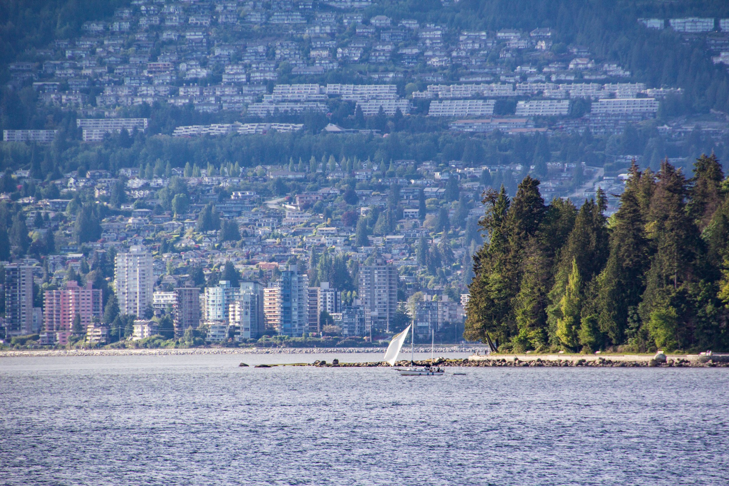
We already talked about how close into the mountains Vancouver is. I have never seen anything like it—at least not for a city as big as this. Northern Vancouver is literally built into the sides of the Cascades, with its streets and buildings sloping up the sides of the mountains as far as physics will allow. So when you start driving northward from Vancouver, you will find yourself in the mountains pretty much instantly. The drive up follows the coastline of a rugged Pacific fjord that comes to a head in the gorgeous little town of Squamish, and from there it’s all mountains. Here’s a map of the trip. It might not look like a huge distance on the map, but’s 2.5 to 3 hour drive to get up there from Vancouver.
Vancouver is kind of a perplexing place because it mashes together a lot of puzzle pieces that don’t really seem like they should fit. Or at least, they didn’t to me. When I first arrived, I was having a sort of dissociative experience trying to piece it all together and make sense of things.
First off, there’s the location. Looking northward, Vancouver is built into a landscape that seems entirely impractical for a major city. It’s hard to believe just how close the northerly Cascade mountains are to the city. The northern suburbs of Vancouver literally slope upwards as far as physics will allow before you’re headed towards snow caps. 🏔
Say what you will about Vancouver—there’s no debating that it makes an impression on you. Its iconic glittery, sparkling, glassy skyline set against a backdrop of imposing, snowcapped mountains and moody gray skies is nothing if not striking. But there’s a lot more to this place than whatever this image conjures up for you. Vancouver is an unlikely swirl of old and new, of chic and grit, and of sun and rain. And it will serve as the base camp for our next series of articles.
Toronto took me by surprise in a lot of ways, and one of the most compelling things about this city was the art. Yes, Toronto is home to a few famous art museums, but you don’t have to buy any expensive museum tickets to get a glimpse into Toronto’s art scene. There’s another side to that coin that costs a hot $0.00 to see.
Fun Peter-fact: I went on a class trip to Toronto when I was in 8th grade. Aside from being in an elevator that dropped 3 stories (before it caught itself) because the fat kid in my class wouldn’t stop jumping up and down, I don’t remember much about Toronto other than the bone-chilling cold. But now I’m going to return for Toronto Round 2.
🇨🇦 Peter’s Map Of Canada 🇨🇦
🔴 Red dots = Locations visited by Peter but not covered on this blog (yet!)
📸 Sneak-Peek At Canada 👀
Canadian Lofi Girl 🇨🇦 ✍🏼
This is a deep cut from the Internet, but I love seeing the Lofi Girl art translated to the backdrop of different countries. Even though I’m not really into anime (except for Miyazaki movies, obvs), there are very few things that make me more comfortable with the idea of traveling somewhere new than these illustrations. Here are some artist renderings of Canadian Lofi Girl that I liked. Left to right, credit for these illustrations goes to + u/uwu_so_warm_ + @mamenchii.
And we’re back with Volume THREE from Toronto. This is only the 2nd city after London to get multiple volumes in this street art series so far. It’s a great honor 😂 and one that Toronto is extremely well deserving of. This is undoubtedly one of the best cities in the WORLD for street art, which is a designation that I am more and more qualified to bestow with each passing month.
In vol. 2 we were in Kensington Market and Ossington. Now, we’re going to move a but closer to “downtown” Toronto, and explore an area called the Fashion District.