
States Covered So Far: 18/50
Total States Visited by Peter, Ever: 38/50
California | Colorado | Florida | Georgia | Massachusetts | Minnesota | Mississippi | Missouri | New York | North Carolina | Ohio | Oregon | Pennsylvania | Rhode Island | Tennessee | Utah | Washington | Wisconsin
🇺🇸 United States Blog Index 🇺🇸
California: THe Golden State
c. 1850 / #31

You can’t actually drive all the way out to Tomales Point. There’s a parking lot and a trailhead next to the historic Pierce Ranch. From there, it’s a 9.4-mile round trip hike to get all the way out to the tip and back. Over the course of this route, there’s a total elevation gain of 1,177 feet. Honestly, it’s a pretty easy hike. I did this when I was fresh off a particularly rough COVID infection, still trying to get my mojo back, so this should give you no pause.

Point Reyes National Seashore is a prominent peninsula/cape land formation that juts out of the California coast just north of San Francisco, in Marin County. Bounded by Bolinas Lagoon on the south and Tomales Bay on the north, it’s well known as a beautiful Northern California nature destination. There’s some mildly interesting history here, but mostly it’s just gorgeous. And to raise the geological stakes a bit, the San Andreas Fault is what separates this area from mainland California. That will show up in the pictures I have coming up for you in some cool ways.

Before we head out of the city and into some nature, we’re going to take one last photo-walk through a very specific slice of San Francisco: Haight-Ashbury. Today it would be easy to pass through this area and think it’s just a pretty neighborhood, but there is actually some really cool history here from the not-so-distant past. There was a time when Haight-Ashbury was the epicenter and headquarters of a national zeitgeist whose iconic status endures to this day.
I’m talking about the Summer of Love.

I have been doing this blog for like 8 years now, so I am really only just now arriving at the point where I am running out of things to cover in certain cities. My first articles on San Fran were relatively early in the lifespan of this site, so I would probably do things differently if I were to write about those same things now, but the fact remains that—for the time being—there’s a lot that has already been “checked off the list” here. In other cities that might deter me from taking as many photos or visiting as often, but not here. In San Fransisco, I don’t need an angle. I am happy just to exist here, and walking around it always feels like I shame to leave my camera behind.

San Francisco is not a flat city. The word “hilly” doesn’t quite cover it. So it should come as no surprise that there are lots of interesting staircases (600+) scattered throughout the city, helping pedestrians scale the city’s steepest nooks and crannies. This much is to be expected. But what I did not expect was that many of these staircases have been turned into hidden works of art. I’ve been to San Francisco a few times, and I have somehow never stumbled across even one of these before. And what you’re about to see isn’t even all of them! We’re going to start in the Richmond District, but then we’re going to head south and spend the rest of this article in the Sunset District.

When you picture LA, what comes to mind?
I’m guessing that most of you didn’t say “mountains.” Or maybe all of you did and I’m the one who wasn’t “hip”. But the following was actually news to me: LA is actually surrounded by some formidable topography! And a lot of it is a lot closer to the city than you might think. The map below shows the terrain in 3D, and you’ll see that there are a number of different mountainous areas to be considered here, but today we’re going to be in the one highlighted in blue. Those are the Santa Monica Mountains.

I’ve gotten to the point with these street art features that I plan my trips around them. If I can get a day to myself, I’m gonna wander around with my camera all day until I find 100 murals I love. And I’m not just doing it “for the ‘gram” anymore! Seriously, these days of wandering are often what makes me feel like I have gotten to know a city at all. That is especially true for a place like Los Angeles.
In a city where most of the time spent between two points is in the back of an Uber, staring at your phone, walking the streets isn’t exactly “normal.” This is a car city. So going through the exercise of walking 10 miles in day, exploring this city street by street, looking in nooks and crannies for murals, poking around small businesses—this can really give you a feel for the DNA of Los Angeles. Of course, whatever I’ve managed to see so far is just a drop in the bucket! But it’s exposed me to a lot. And it helped me internalize the map of this city, so that I started to be able to find my way around without a map.

The observatory was/is equipped with a 12-inch Zeiss refractor telescope that you can actually go look through. Since 1935, an estimated 7 million people have looked through it to catch a glimpse of the stars, which makes it the most used telescope in history by far. In WWII the planetarium was used to train pilots in celestial navigation. Later, in the 1960s, it would be used for that same purpose as a part of the NASA space program. In 2002 this place underwent a major renovation mostly focused on its visitor-facing amenities. Now there’s a café, a gift shop, and a movie theater. I’m sorry to tell you we’re not going into much of this stuff today though. We’re here to catch the sunset!

For my American readers, I’m gonna go out on a limb here and say that there is no way in hell that you don’t know what Napa Valley is. But for my readers from abroad, I’ll explain just in case. Napa Valley is America’s postcard wine country. There are pockets of vineyards all over the country of course (Oregon is a notable wine producer as well), but Napa Valley is the epicenter of wine culture and cultivation in America. Napa Valley refers to a large fertile valley full of vineyards in Napa County, California, which just on the north side of the San Francisco Bay. Driving north through Napa Valley, there are a few towns that you will pass through, the first of which is also called Napa. The next major towns before the northern end of the valley are Yountville, St. Helena, and Calistoga.

I could talk about the history of San Francisco for ages, but this article is about what has been happening much more recently. Historically, the Mission had been home to a large part of SF’s Chicano/Latino population, but starting as early as the late 1960s, the LBGTQ community began to play a much more defining role in the neighborhood’s identity. You are probably already familiar with San Francisco’s reputation for being the gay capital of the U.S., but what you might not know is that much of this reputation was built right here in the Mission.
However, by the late 1970s, the Mission had become a much more multidimensional haven for fringe culture. It actually developed a thriving punk rock scene, and helped produced such bands as the Dead Kennedys, Jawbreaker, Rancid, and Green Day! Even today, you’ll see remnants of this scene walking around the streets of the Mission with colorful mohawks and studded belts.

First off, what I’m defining as “Richmond” here is actually made up of 4 smaller districts: Inner, Central, and Outer Richmond… and a little area to the north called Lake Street. This neighborhood (or group of neighborhoods) is essentially a big grid system, which, despite occupying an extremely urban area of San Francisco, is surrounded on almost all sides by nature.
![Peter Goes West: San Francisco [Part II]](https://images.squarespace-cdn.com/content/v1/5876d8d6e3df28c4d83ae377/1486136244657-0UUTSJITONG77GJML218/twin+peaks+sunset+san+francisco+4-2.jpg)
And so the saga continues of my much-anticipated trip to San Francisco. I was tired, but this city was so compelling to me that I found the energy to walk all over it. With a couch in the Marina District as my home base, I walked (and Uber'd) all over town, from Russian Hill to the Mission District. San Francisco unfolded before me like a unending yuppie playground. It was diverse, beautiful, and hilly.
![Peter Goes West: San Francisco [Part I]](https://images.squarespace-cdn.com/content/v1/5876d8d6e3df28c4d83ae377/1486133831874-4Q1LFOXNBLZXMXLR9Y0B/san+francisco+california+streets+1.jpg)
Prior to my arrival, I had no concept of how huge this place was going to be! San Francisco is deceivingly large because it’s hilly to the point that if you stand at the top of the right hill (and find the right angle) you can get the Golden Gate Bridge, Alcatraz, and the city all in the same shot. Seeing my friends post these sorts of photos had, throughout the years, given me the false impression that San Francisco was a small place. Adding to this fallacy was San Francisco’s position at the end of a long peninsula, which can make it look pretty small on the map. Well let’s set the record straight right now: San Francisco is anything but small.
Colorado: The Centennial State
c. 1876 / #38
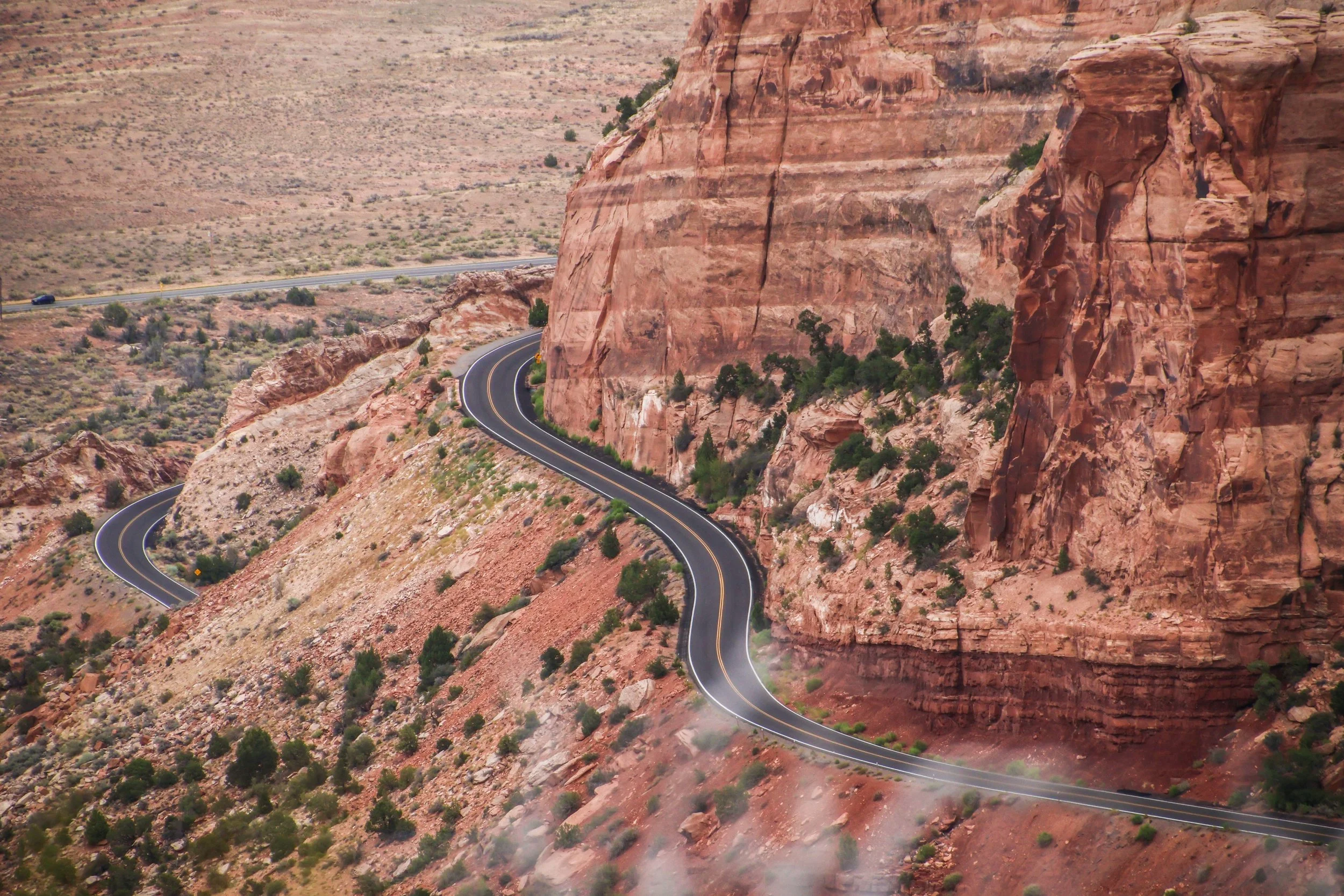
Colorado National Monument isn’t a single landmark, but a large area of landscape, which includes massive rock formations, deep canyons, and rugged plateaus, all of which were carved over millions of years by wind and water. The primary thing to do here is the Rim Rock Drive, which is a 23-mile-long paved road that brings you past a great many breathtaking views over dramatic sheer cliffs and expansive valleys. There are lots of places to stop along the way, many of which have their own hiking trails and camp sites. Today, we’re going to drive the Rim Rock Road.

This place is DENSE with street art. I have a ton to show you, and I didn’t even get all of it. I mean, I doubt that I ever get 100% of this stuff, but I at least try to exhaust everything that I am aware of. But I have never knowingly left so much on the table as I did in Denver. There were lots of incredible murals that I saw out the window of a car, or when I didn’t have my camera with me, and I was never able to circle back to capture them. So as much as I have for you, this does not NEARLY cover it.

Boulder, Colorado. With a population of just 97,385, it’s definitely one of America’s most famous small towns. Sitting at an elevation of 5,430 feet above sea level, its reputation as a beautiful mountain town has made it a household name. But, to the un-indoctrinated among us, it may come as a surprise to learn that it’s actually not in the mountains per se… it’s a smaller moon in the orbital of the Denver metro area, and as such, it is merely mountain-adjacent. It’s pressed right up against the mountains, but it’s not actually in them. This was a surprise to me at least. The drive time from Denver to Boulder is like 40 minutes, and it’s not exactly an undeveloped stretch.

Denver is famous as America’s “mile-high” city. This is because its geographical position as the gateway to the Rocky Mountains places its elevation roughly a mile above sea level. Indeed, its reputation is inextricably tied to the Rocky Mountains, but I actually think that this is a bit misleading. Denver is a decidedly flat city. It is the last city in the Great Plains before the beginning of the Continental Divide. You’ll see this illustrated on the map below. Denver’s urban sprawl pushes right up the edge of the mountains!
Florida: The Sunshine State
C. 1845 / #27

On our final day we did a dolphin boat tour around the protected waters between Anna Maria and mainland Florida. We did see a bunch of dolphins, which was cool, but what I remember most from that tour was our cruise through a little area that is apparently known locally as the “redneck riviera.” At the very bottom of Anna Maria Island, between the barrier islands and a small interior island called Jewfish Key 🫤 there is a sandbar where the water is shallow enough for a child to walk around. The cool thing is that it’s surrounded on all sides by deep water, so it’s basically only accessible by boat. So there were a number of boats floating nearby, encircling this sandy, teal-water playground, with people walking around in the middle. It was really cool. And of course, the Florida gulf-coast water is as warm as bath water.
Georgia: The Peach State
c. 1788 / #4

In the last article we did a quick introduction to Savannah, and then did some good old fashioned ‘sploring of its enchanting brick streets. To say that this city is beautiful would be an understatement. It’s one of the oldest cities in America, and one of the few surviving time capsules from the pre-Confederate South. Indeed, this city has so many skeletons in its closet that it’s become something of a destination for history and ghost stories. Today we’re going to visit a few sites that are of particular significance in Savannah.
And then we’re going to evacuate before hurricane Dorian gets here!

Stepping out the door of our Airbnb, just a couple blocks away from Forsyth Park, the air was thick with humidity. It was so humid that my camera lens was quickly covered in a dense fog that took a few blocks to wear off. Roots run deep here. Everybody knows everybody. Sure there are lots of visitors that pass through, but in every living room of every house on every quiet Savannah street, there is a thriving community of families living here that are constantly going to school together, growing up together, marrying into one another, and so on.
Massachusetts: The Bay State
c. 1788 / #6

Today we’re going to start with a clerical note that was once confusing to me. The instant you start talking about Boston neighborhoods, you will hear the terms “South Boston,” “South End,” and “Southie” come up fairly often. When I first moved to Boston back in the day, this was confusing to me. I knew there was more than one neighborhood in the mix, but all of these terms sounded the same to me. Well let me break this down for you: South Boston and South End are different neighborhoods. And “Southie” is the common nickname for South Boston. Historically, these were very different places, and today we’re going to check out both of them…

Boston has a lot of cool history. Even if you don't feel like you know very much about Boston, you still probably already knew that. This was the city where the Revolutionary War started! The Boston Tea Party, Paul Revere's Midnight Ride, the Salem Witch Trials—the early history of the Boston area is rich with some of the most riveting stories that American history has to offer. And moving into the modern era, Boston still managed to be the site of some of America's most interesting historical sagas, from the Boston Strangler, to the Great Molasses Flood. However, to me, one story stands out above the rest, and it didn't happen all that long ago.
The story I'm talking about is the heist of the Isabella Stuart Gardener Museum, which happened in 1990.

Today, we're going focus in on a couple of my favorite pieces of Boston. The first is the famous Boston Public Library, and the second is the unusual measuring system that is painted onto the Mass Ave bridge. These have both been the source of some intrigue for me, and are academia-adjacent, so I’m combining them into the same article.

Today, Boston's North End is known as the Italian neighborhood. When people tell you that they're headed to the North End, it's a good bet that they're going to dinner, because this neighborhood is absolutely packed with incredible Italian restaurants and bakeries. However, the North End is famous for more than just its food. The history here is legendary.
In this article I’ll run through some old and some new from Boston’s North End, and then show you lots of beautiful pictures.

In Boston, things move fast. The city is lively, dynamic, and ever-changing. However, there are some pieces of the Bostonian puzzle that are quintessential, and eternal. No matter what's going on around them, somehow, they never seem to change.
Today I'm going to single out a couple of those places: Bay Bay and Beacon Hill.
Minnesota: The Gopher State
c. 1858 / #32

When I arrived in Minneapolis, the one thing that I knew I 100% wanted to go see was the famous, original George Floyd mural. Ya’ll know I love street art. This is arguably the most famous mural in the world right now, so I had to make the pilgrimage. I had some vague awareness that there would be some remnants from the protests around it… but I was not prepared for what I found here.
George Floyd Square was one of the most powerful places I have ever visited. I’m not sure how long it will stay in its current form… but I hope some sort of city ordinance intervenes to preserve it this way forever. Let me show you what I saw here.

I think this post takes the cake for the farthest total distance traveled within a single street art post. These murals were SPREAD OUT. The Twin Cities is a massive place. And on this particular weekend, it was hotter than the devil’s butt crack. I hope you are reading this in a nice climate-controlled space because when I think back on this weekend… I feel sweaty.
Well, I won’t bury the lead. Let’s see some STREET ART, EH?
Mississippi: The Magnolia State
c. 1817 / #20
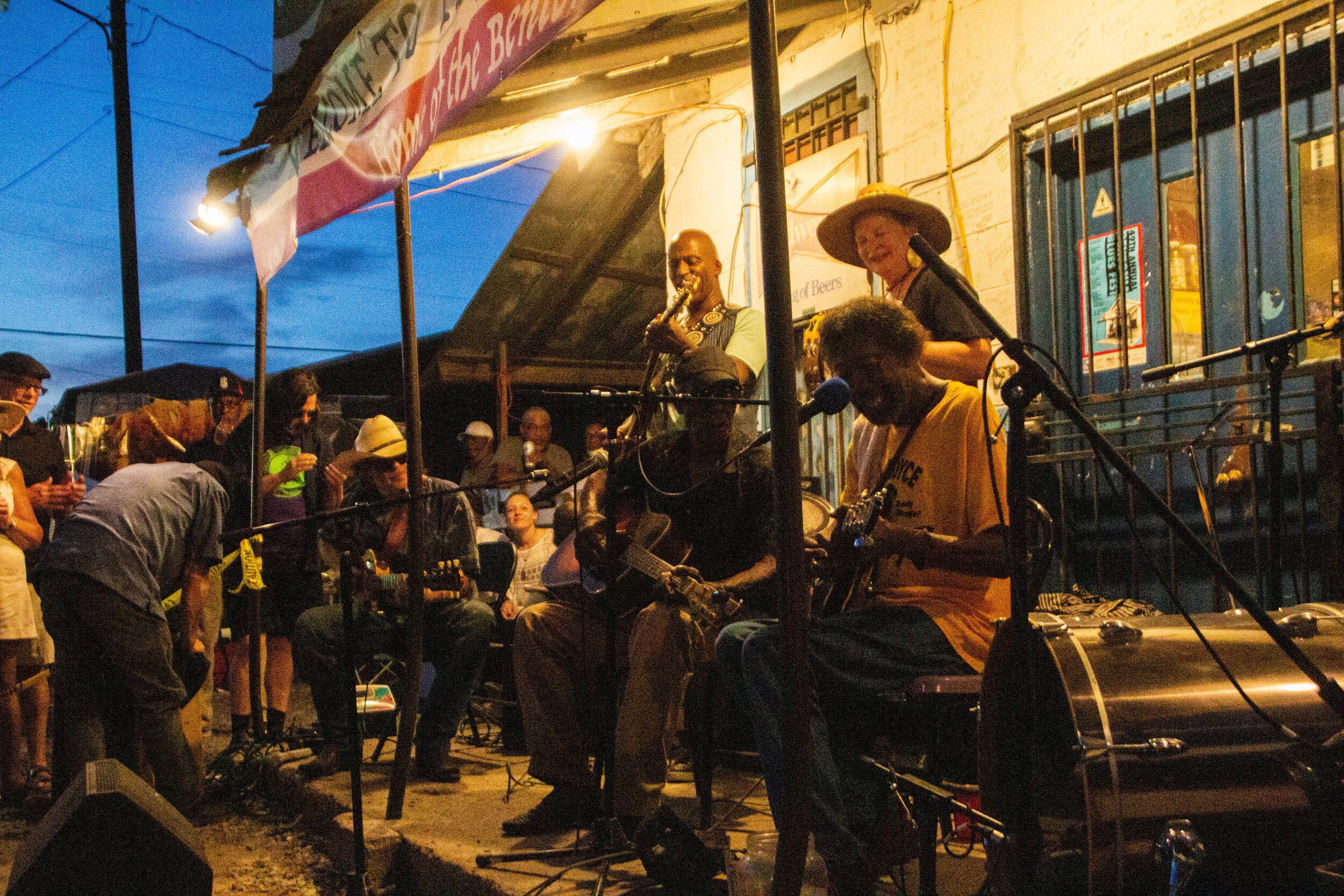
I don’t know what I expected when I showed up in Mississippi. I had some vague aspirations about getting out into the legendary Delta to see pieces of the Blues Trail, but I wasn’t sure how realistic it was to cover all of that ground in the short time I had. I thought it would be cool to visit the Crossroads, but everybody I know that has been there told me it’s literally just an intersection in the middle of nowhere. So I wasn’t sure it was worth the drive. This probably doesn’t sound like the beginning of a great article. I really thought of the Blues mostly in the past tense so I wasn’t expecting to find anything in Mississippi but some history. But OHHHHH MAMA! I have never been more wrong in my LIFE!

I got the chance to visit Mississippi recently, and that just so happened to be on the weekend of Juneteenth, 2021. Mississippi is not a place that tends to be high on anybody’s travel bucket list—least of all mine—but the opportunity presented itself, so I went for it! Honestly, I have always been curious.
Today we’re going to talk about the elephant in the room: race in the Deep South. And just like with any other article I write, I don’t claim to be an expert. I’m just a white dude trying his best to understand the world around him and become a better person along the way. And I am, like the rest of us, a work in progress.
Missouri: The Show-Me State
C. 1821 / #24

St. Louis, Missouri. In the previous article, I opened by talking about how I didn’t have much more than a vague awareness of this place before fate landed me here for a long weekend. And that is true, BUT—since I have become obsessed with doing these articles where I compile collections of murals in a particular place, I have had my antenna up for information about where I can find the best street art. And I had heard that St. Louis was actually one of the street art capitals of America. Who knew!

St. Louis, Missouri: Gateway to the West.
I can’t say that I ever thought much about this place until a wedding landed me here for a long weekend. I think that in the past I had a vague notion that St. Louis wasn’t the nicest city in the world, but I wouldn’t have been able to tell you why. In more recent years, when St. Louis somehow came up in conversation, there was usually somebody there to say “Ya know what—St. Louis is actually pretty ok.” And that’s about all I knew.
Well now that I’ve been here for myself, I have thoughts of my own share. And those thoughts are positive!
New York: The Empire State
C. 1788 / #11

There’s a lot more to Bushwick than I’m going to cover here; it’s known for having a large Latino community, especially Puerto Rican and Dominican, and since the gentrification of Williamsburg, it has also become the new center of indie culture in Brooklyn. But that’s not what this article is about. Today, we’re here to go mural hunting!
We rode the L train to the Jefferson Street station in Bushwick, and basically from the moment I stepped out of the station, I was in mural heaven.
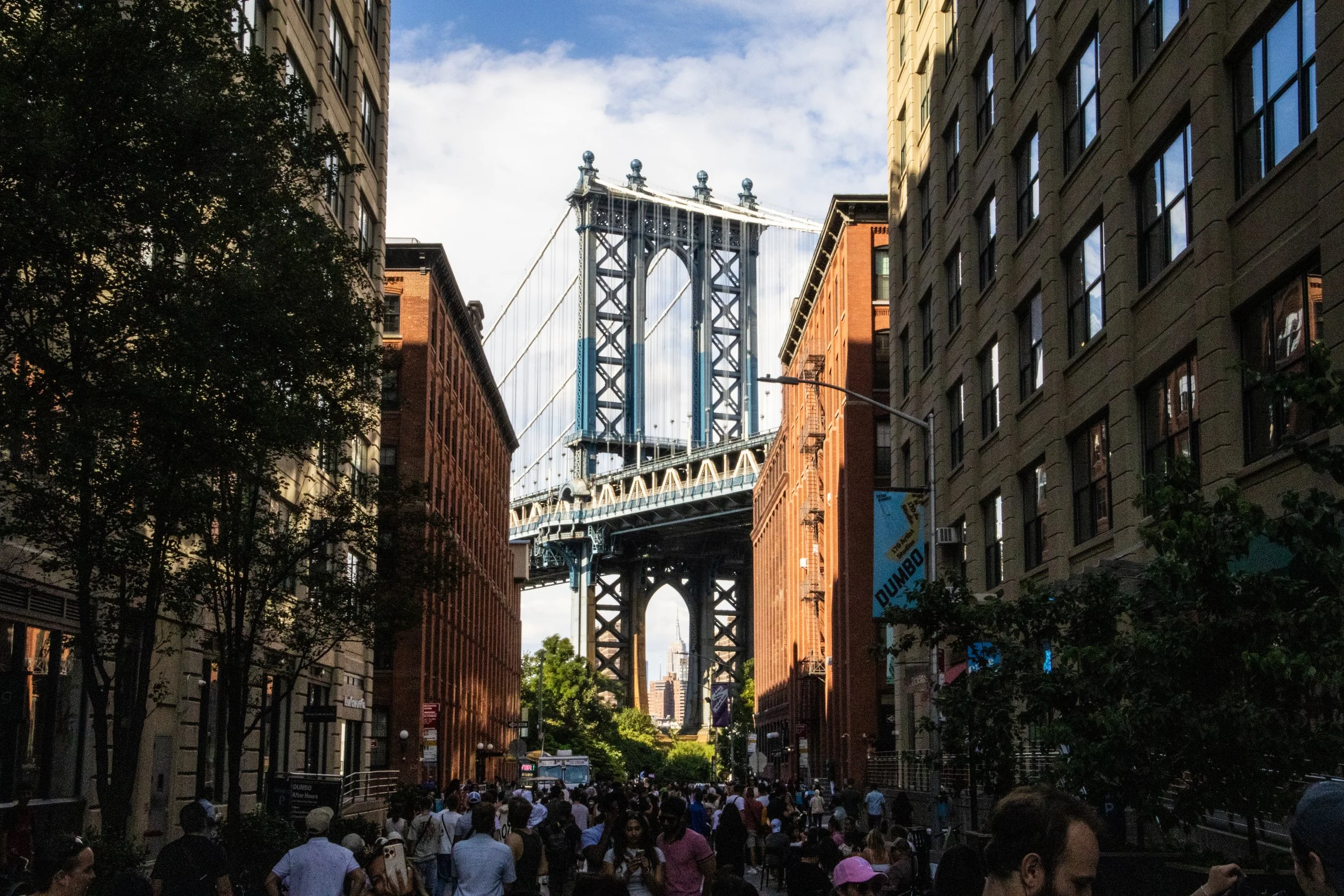
As one of the 5 boroughs of New York City (the others being Manhattan, The Bronx, Staten Island, and Queens), it’s home to some 2.6 million people, which—if it were a stand-alone city—would make it America’s 4th largest city, nearly as large as Chicago! It has a stand-alone GDP of approximately ~$120B, which—for context—is more than the country of Ethiopia.
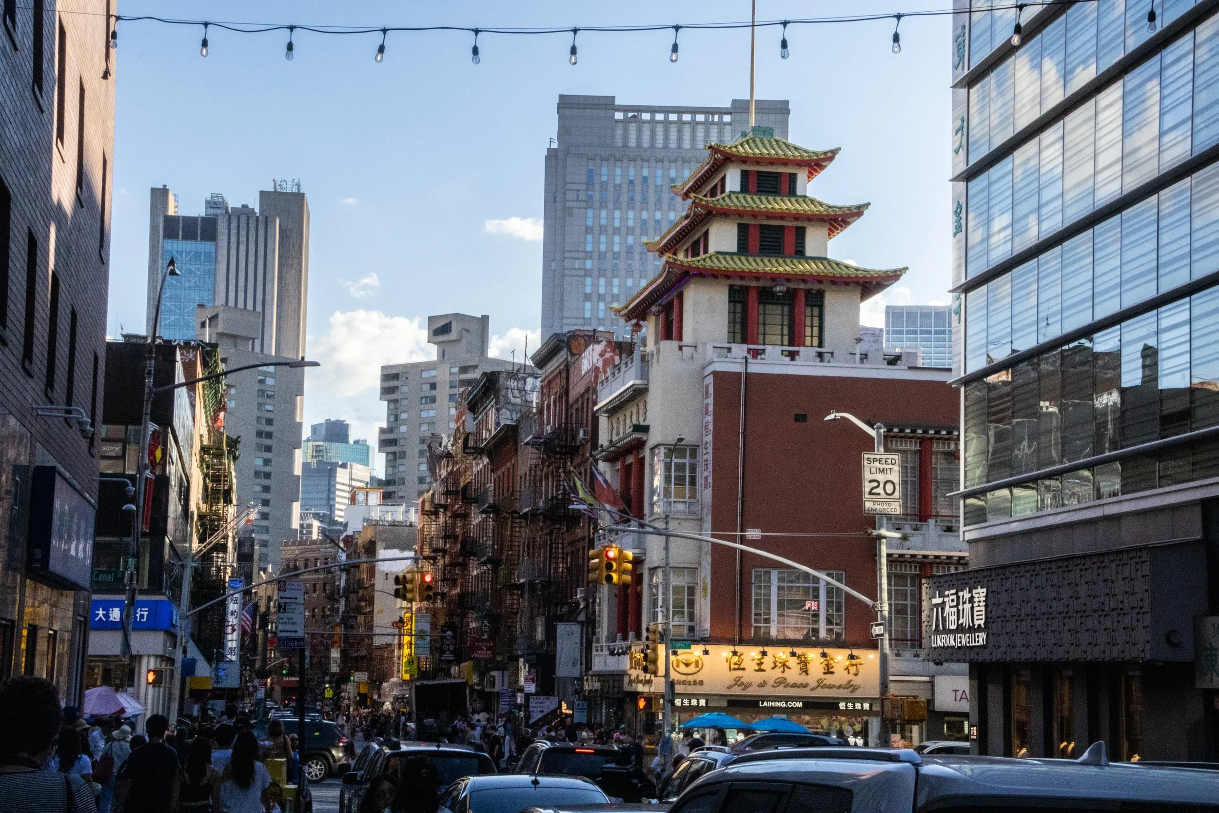
While the ascent of NYC’s Chinatown may have coincided with the shrinkage of Little Italy, giving the impression that the former was “taking over” the latter, the truth is that, by the 1990s, both of them were under equal economic pressure from encroaching gentrification and rising real estate costs. In spite of that Chinatown didn’t start to shrink until the early 2010s. By that point, as had been the case with the Italian immigrants who’d followed a similar path before them to achieve widespread integration into American society, the next generation of this Chinese community soon relocated to other parts of the city, especially Queens and Brooklyn. And just like Italians are now an integral part of the New York identity, this Chinese community is part of the deal now! There are 4th and 5th generation people of Chinese descent walking around New York, which means their families have been here longer even than mine! Cue my recommendation for you to go watch Nora From Queens. Great show.
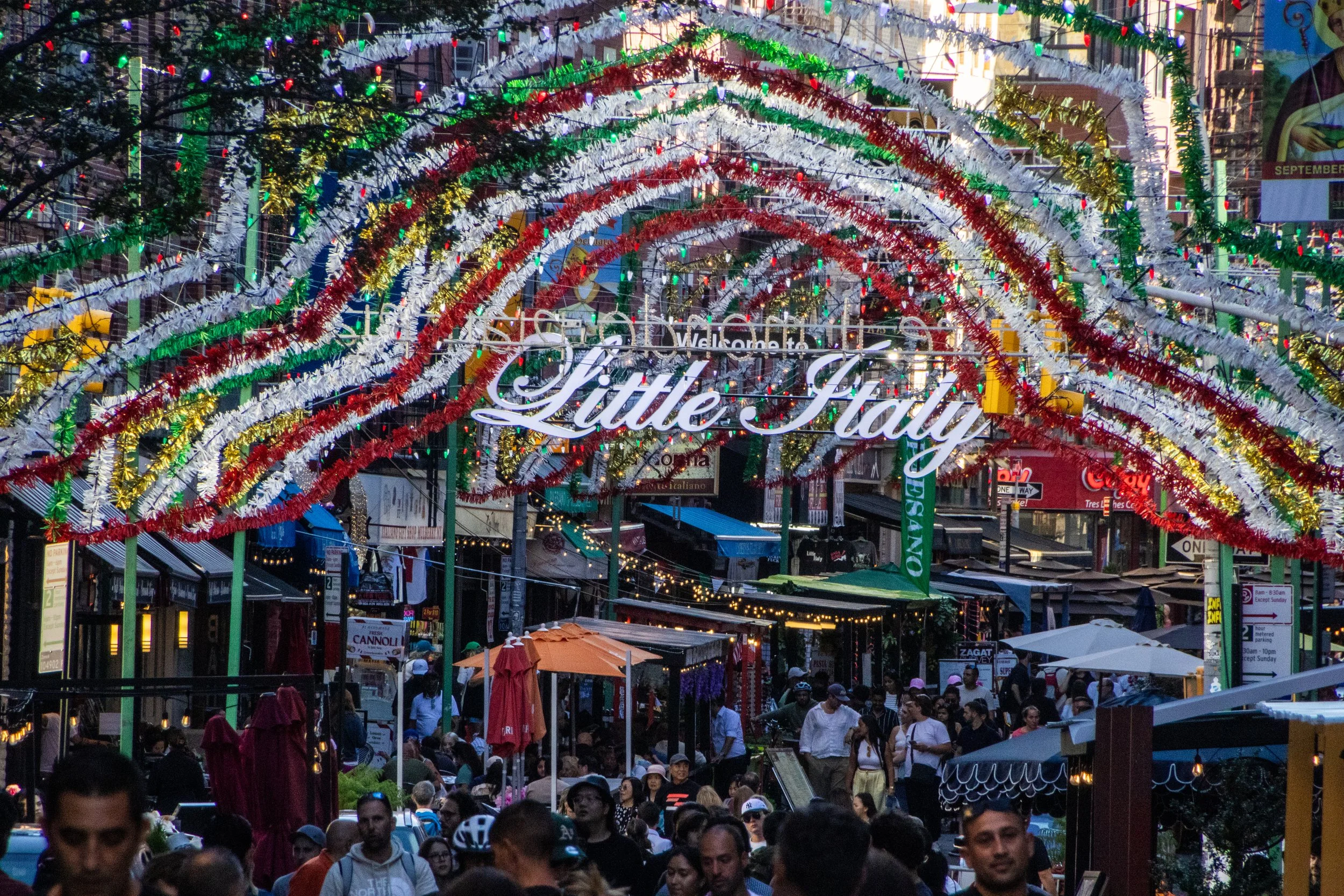
New York City not just one thing; the whole is formed of many thousands of individual threads woven and intertwined together. All of these parallel realities existing on top of each other is a big part of what makes New York so captivating… but some of these threads are more visible to the outside than others. One of New York’s most visible threads is its status as ground-zero for Italian-American culture. Yes, from Frank Sinatra to George Costanza, few immigrant communities in the US managed to balance the simultaneous integration with American society with the maintenance of a shared collective sense of identity like the Italians. Ironically, Italian-American culture has strayed hilariously far from actual Italian culture at this point; the two groups barely even claim each other at this point! But, within the U.S. at least, this shared homeland is a powerful unifier. Indeed, there are about 16 million Americans (~4.8% of the population) that have some level of Italian lineage, including yours truly. 🍕
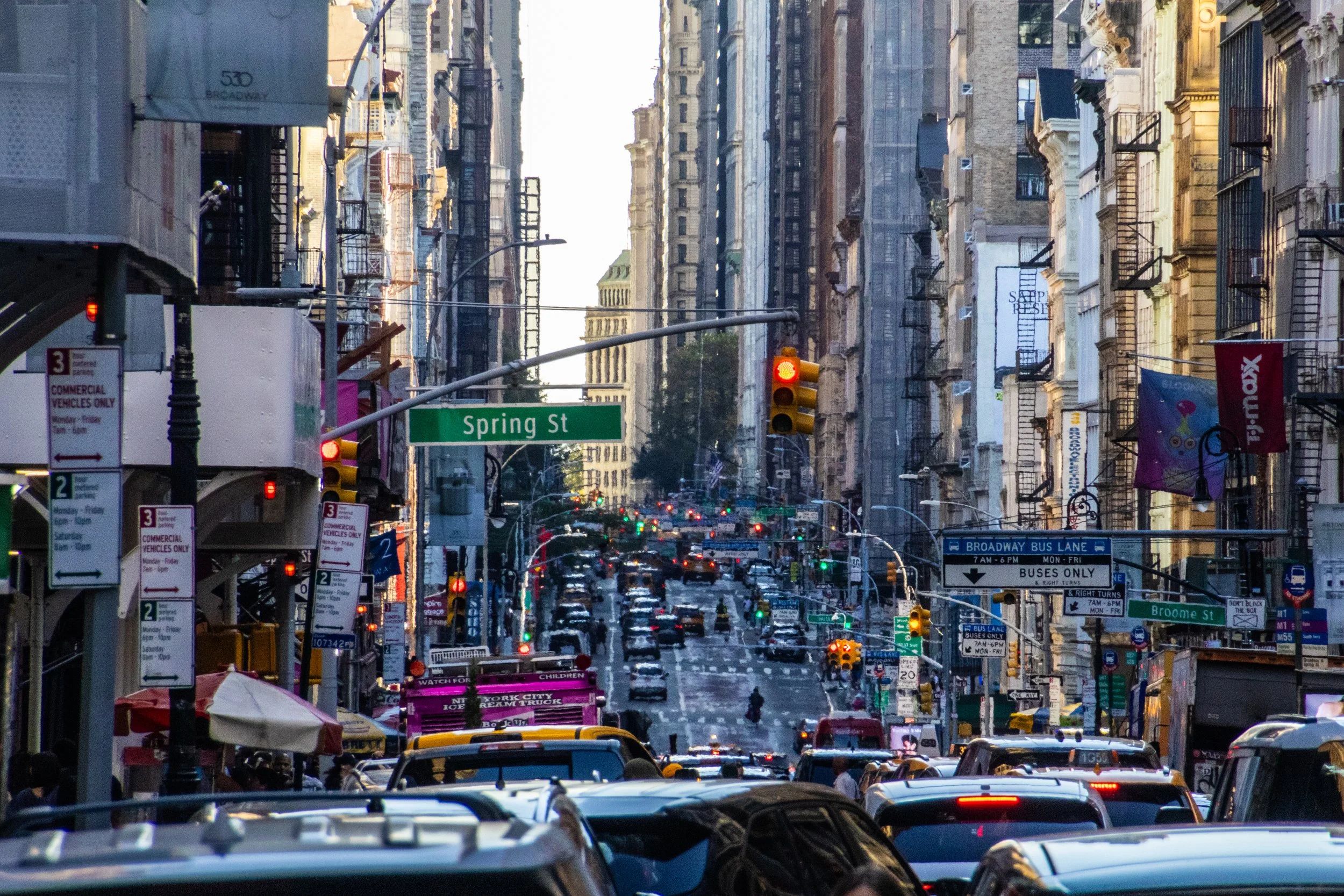
Although the beginnings of the U.S. as we know it today began with British roots, New York City actually began as a Dutch colony called New Amsterdam. It passed into British hands in 1664 and actually served as the capital city of the newly independent United States from 1785 to 1790. So it has been vitally important since the very beginning. As of 2023, the city alone (its metro area, that is) had a stand-alone GDP of $2.30 trillion, making it the most valuable city in the world. In fact, if treated as an independent country, New York City would rank within the top 10 largest economies in the world, ranking above Italy, Canada, and Australia, to name a few. For a domestic point of comparison, the next largest economy in the United States is Los Angeles with an approximate GDP of $1.1 trillion.
North Carolina: The Tar Heel State
C. 1789 / #12

It’s time for our last article on Asheville. We’ve covered some serious ground in this city, and have already had a few surprises, but to me, there were none more pleasant than the ones I’m about to share with you in this article. This is Asheville’s “Street Art” installment; a segment that I am becoming quite fond of. Not every city has a visual arts scene that will support these kinds of public works… but those that do, typically don’t look much like Asheville. I tend to associate street art with giant urban areas like New York, San Francisco, or Toronto.
But Asheville threw down the gauntlet!

Asheville, North Carolina has little trouble attracting visitors from across the country and abroad on its own. Literally smack-dab in the middle of America’s Great Smoky Mountains, this crunchy enclave is a Mecca for outdoorsmen (and women), beer-lovers, weekend warriors, and hippies from around the country. Indeed, this little Appalachian gem has become a destination in its own rite… but it’s still veiled in a level obscurity. So people are usually surprised to learn that Asheville ALSO happens to be the location of the largest private home in America.
Did you know that? This whole experience was sort of a shock to me!
Today, let me introduce you to the famous Biltmore Estate.

In the last article, we talked through a lot of the context surrounding the city of Asheville, North Carolina, as well as a few notable areas in and around the city. Today we’re going to get a bit more specific and highlight a few of my favorite Asheville establishments and landmarks.

Tucked away in almost the exact center of the Smoky Mountains, this city an artsy, crunchy, progressive safe-haven, full of art galleries, beer breweries, wilderness exploration outfitters, and organic grocery stores. It’s pretty much the dream! Many people who come here do so as a stop-over before excursions into Great Smoky Mountains National Park, but the city itself is becoming a destination in its own rite. Cue our visit.
Ohio: The Buckeye State
C. 1803 / #17

Columbus hasn’t historically been quite so colorful as it is today, but now that this is beginning to change, it feels natural. It feels like an actualization of the identity Columbus has always had. Some of the murals you will see in this article have been around long enough to attain “landmark status” in Columbus, but most of them are new… ish.


Oregon: The Beaver State
C. 1859 / #33
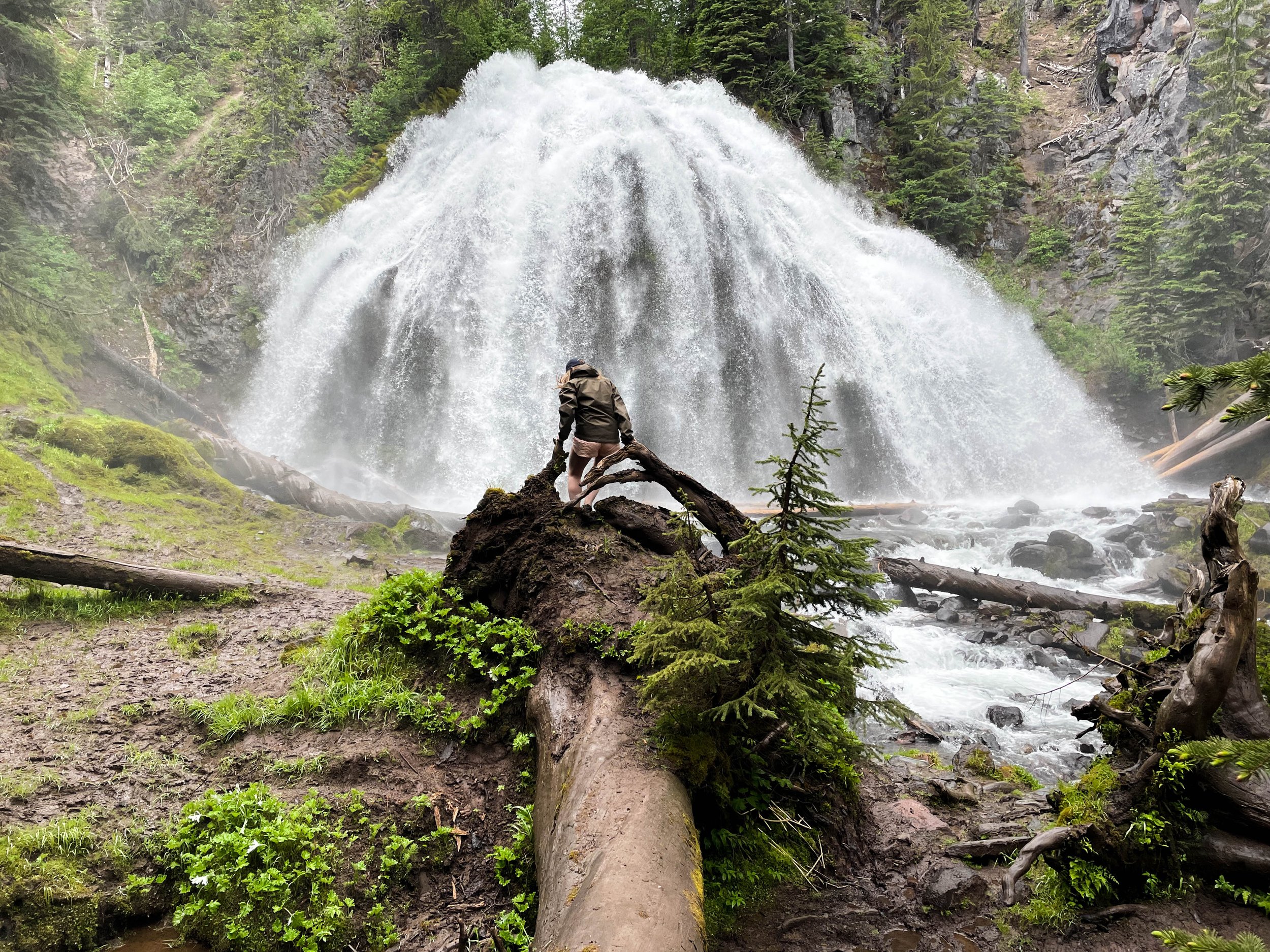
Chush Falls (pronounced “shoosh”) is actually nestled right up against the Sisters Mountains and Broken Top. The drive to get to this trailhead was about an hour from Tam McArthur Rim, all over gravel roads. Oh, and it was absolutely STUNNING. Honestly, even if you don’t do this hike, the drive is still well worth the effort. This was already bringing me closer to these mountains than I had yet been. Looking up at the snowy slopes, I could see every little rock and wisp of cloud clearly and was able to even capture some of this with my camera. And, miraculously, the weather really was clearer over here.

This many mountains is just insane to me. Prior to this trip, this was not what I pictured when I thought of Oregon. This was downright RUGGED! And it was gorgeous. The three mountains in closest proximity to Black Butte, and to one another are the Three Sisters for which this area is named: Middle Sister, North Sister, and South Sister. All three of these mountains are sleeping volcanoes. The North and Middle Sister last erupted ~14,000 years ago and scientists think it’s unlikely that they’ll ever erupt again. However, the South Sister erupted as recently as 2,000 years ago, and could feasibly erupt again. There have been sporadic reports of volcanic rumblings deep within South Sister since 1866, and there have been a couple of minor scares since the late 1980s. Nothing has ever happened, but there is a big pot of magma a few miles beneath the peak of South Sister. Did I mention that South Sister is also the easiest of these mountains to climb? Sign me up for that!! 😵

Making our way out of the Cascades, winding through these forests was very cool, but to really understand why this region is so jaw-droppingly gorgeous, you have to zoom out. I don’t know what I expected to find out here, but it sure as hell was not a bunch of majestic snow-capped mountains! I had heard of the “3 Sisters” mountains before, but I had no idea just how large they loom over this area. Also, they’re not alone. There are a whole bunch of other peaks around them that make Central Oregon feel like a high-altitude fortress. THIS is where the Wild West still exists. Eastern Oregon/Washington, Northern Nevada, Idaho, Montana… there’s a whole lot of empty space out here. As somebody who has never lived west of the Mississippi River, it kind of blows my mind that all of this exists in the same country I live in. In the next 2 articles, we are going to get out into these mountains, so I am not going to explain much more of this right now. For now, the following gallery will have to be as mysterious to you as it was to me when I first arrived here.
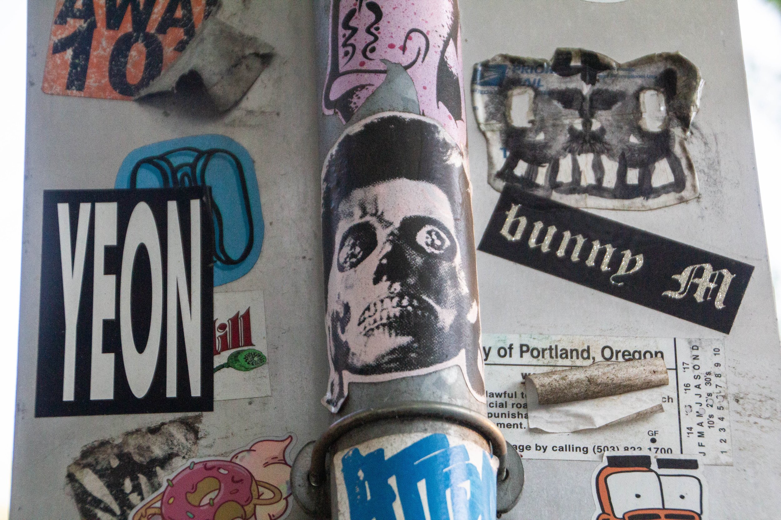
I’m going to do something a little different today. I love piecing together articles on street art wherever I can. It’s a great way to get to know a place! I had a hunch that Portland was going to have some really cool street art, but to my surprise and slight disappointment, I didn’t find quite the density of murals that I would have needed to merit a full article.
However, as I walked around the city, I began to notice that nearly half of all public surfaces that I walked past—be they street signs, telephone poles, or brick walls—were absolutely PLASTERED in stickers. And I’m not talking about some garden-variety smiley face stickers. Each of these was custom-made, artistic, and—for the most part—completely outrageous. Seriously, viewer discretion is advised. This collection of stickers would make my childhood pastor WEEP!

Portland is the southernmost major city in the Pacific Northwest, and, driving northward from Sacramento, it’s the next major slice of civilization you’ll find on the West coast. Although, I should clarify that Portland is not actually coastal. It is a “port city” because it sits at the convergence of two major rivers that are connected to the Pacific Ocean: the Willamette and Columbia rivers. It’s about a 1.5 hour drive to the Pacific coast, which leads me to another thing that I want to highlight about Portland: it’s proximity to nature. This is a common theme among cities in the Pacific Northwest—including Seattle and Vancouver. All of these places are great gateways to some incredible natural beauty. And Portland is no exception. With Portland as your “home base,” you can (for example) do day trips to 1) surf, 2) snowboard, 3) hike, 4) rock climb, and 5) sail on 5 back-to-back days. For the “outdoorsy” among us, it’s a great place to be.
Pennsylvania: the Keystone State
C. 1787 / #2 🥈

Here’s the thing about State College: it’s in the middle of goddamn nowhere. It’s notable because it’s the college town corresponding Penn State, which is one of the biggest universities in the country. And what is Penn State close to? Nothing. It’s the place that other things are close to. So we had to fly to Pittsburgh and then drive 3 hours in a rental car to get here. All that sounded like a huge hassle to me, until we got off the plane and promptly entered fall paradise. The trip turned out to be the biggest and best dose of autumn that I have gotten in a LONG time. Here are a few snapshots of the nice fall weekend that was to come.
RHODE ISLAND: the Ocean State
C. 1790 / #13

With a population of only ~25,000, Newport might be better described as a “town” than a “city.” Whatever it is, it’s one of the prettiest New England places I’ve ever seen! It’s like if Boston was only Beacon Hill. Founded all the way back in 1639, it completely embodies the best of this region, with historic buildings, charming local shops, cobblestone streets, and all sorts of plaques and details on each street to remind passersby of its seafaring, colonial past. I think this place becomes quite the tourist destination in the summer, but on this cold spring day, we could walk these city streets in relative anonymity.

Founded all the way back in 1636, Providence is one of the oldest cities in America. It was founded by puritan exiles from the Massachusetts Bay Colony, and would ultimately become one of America’s original 13 colonies. So, Providence is one of the O.G.s.
What is Providence like today? Well, it turns out that being the “most populous city” in the smallest state in the US doesn’t mean much in terms of population. Boston, which is less than 2 hours away, absolutely dwarfs Providence, whose population is even less than that of Worcester (“wus-tah”), MA. So, Providence is a relatively small place. However, it still manages to play an active role as a regional hub, boasting 8 major universities, including Brown, RISD, and Johnson & Wales University.
Tennessee: The Volunteer State
c. 1796 / #16

East Nashville is the neighborhood that served as home base for me throughout the duration of my time in Nashville, and there was never a moment when I didn’t love this slice of the city. Even at the height of my dissatisfaction with Nashville, I remember saying how much I still loved East Nashville itself. I’d be happy to live in a neighborhood like this one again someday. I just hope it’s not in Tennessee. The casual passerby might not see much past the monstrosity known as Gallatin Pike (which is the main “stroad” of this neighborhood), but once you get off this excruciating wasteland, there is a beautiful neighborhood waiting to be discovered.
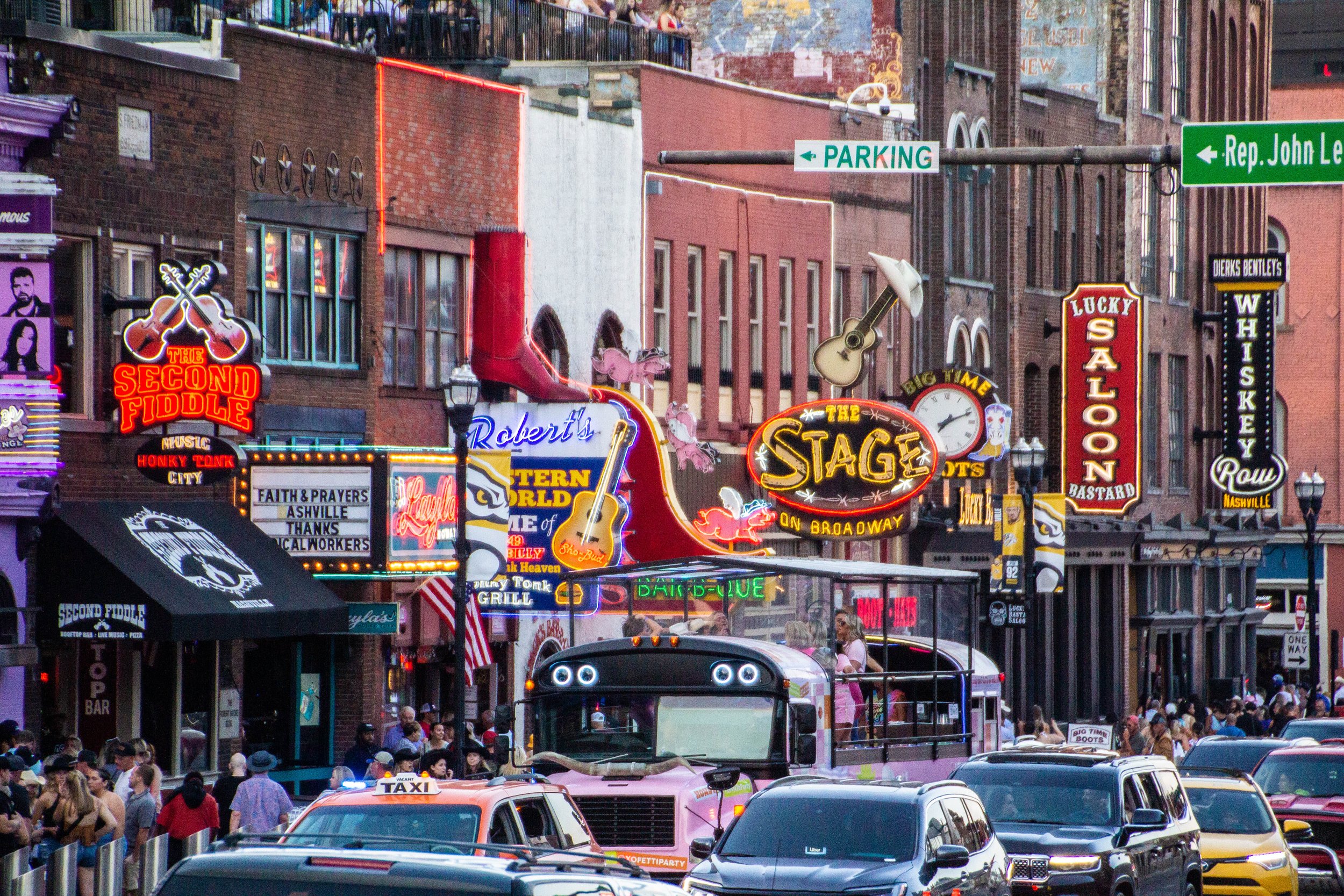
I lived in Nashville for many years, pursuing my own musical endeavors. And while it was a great place to make music, I always felt a bit at odds with the larger-than-life, cowboy-hat-wearing, beer-swigging, Trump-voting, bachelorette-party-hosting persona of Nashville’s calling-card genre: country music. At the height of my involvement with Nashville’s music scene, I definitely had a bit of a stick up my butt about country music. The two main reasons for this were, (1) as a non-country musician working the Nashville circuit, I was eager for this city to be more known for music *in general* than for country music specifically, and (2) the novelty of this scene had LONG-since worn off, leaving me annoyed in the way only locals can be in regard to tourist attractions. Therefore, I always refused to cover any of Nashville’s country persona on this website.
Ironically, I actually do like country music.
And now that I am (SPOILER ALERT) leaving Nashville, I thought it’d be prudent to cover the country scene here… you know, for the court record. Afterall, this can make for a super fun trip if you’re visiting from out of town. So without further ado, let’s get country!

Dunno if anybody will read this, but I have learned so much about this subject that it seemed like a shame not to write it down. So here goes nothing.
I should start with one massive disclaimer: I am not now—nor was I ever—a “rock star,” so if you want to write off my advice due to the modesty of my success with this endeavor, I’d understand. But I would have killed (metaphorically) to get this information from somebody like me when I first showed up in Nashville. This is gonna be some insider shit. It won’t all be super tactical, but it should be pretty evergreen. And I can almost guarantee that this information is not written anywhere else on the internet. Or, at least not anywhere easy to find.

Whether or not these kinds of country bars are “your scene,” there is one thing that can be said for certain about Nashville’s Honky Tonks: they are the genuine artifact. Almost anywhere else you would encounter this kind of atmosphere, it would be a rip-off of something else. But THESE bars are the O.G.s. It was here that the “Father of Country Music” Jimmy Rogers started playing at bars almost a century ago in the 1930s. The area has gone through some ups and downs over the past 100 years, but today Broadway is enjoying multiple consecutive decades of economic growth.
Yes, if the articles on the Internet are to be believed, Music City is the place to be! Over the past few years, it has become an oft-recited fun fact that more than ~100 people are moving to Nashville each day. I can guarantee you that almost every single one of these people knows Nashville’s nickname, ‘Music City,’ and will visit Broadway—and maybe even the nearby Country Music Hall of Fame—in the first 6 months of living here.
However, very few of them will have ever heard of the other side of this coin: Jefferson Street.

The Welshman Gareth Bale has been one of the most notable players in the world since the late 2000s when he transferred from Southampton to Tottenham Hotspur. This was before my days of fandom, but I think he really became a star after his 2013 transfer to Real Madrid. His is a name that American kids grew up knowing, mostly likely, thanks to the FIFA video games. He’s a big deal. But he’s getting older now and hadn’t been playing much at Real Madrid anymore, so ahead of his appearance in the 2022 World Cup, he made a surprise transfer to LAFC. Honestly, the golden age of Gareth Bale was a bit before the start of my fandom, but this was a huge “get” for MLS! You can find his insane highlight reel here.

In the last article, we went through a pretty typical Chattanooga sight-seeing itinerary, but I wanted to take some time to highlight another dimension of the city that actually feels much more defining of the time that I spent here. I’m talking about all the great bars, restaurants, and coffee shops that we visited while we were here. I can’t claim that they are necessarily the best or worst of Chattanooga—I didn’t stick around long enough to be making those sorts of assertions—but I CAN tell that each and every place I’m about to show you is really freaking cool.

With a population of just 179,139 (as of 2017), Chattanooga is the 4th largest city in the state of Tennessee, behind Nashville, Memphis, and Knoxville. It's just over a 2 hour drive southeast from Nashville, and is a relatively short commute to other major metropolitan areas such as Atlanta and Huntsville. The biggest sectors of Chattanooga’s economy are automotive manufacturing, shipping, and logistics, which are all quite industrial. However, this came as sort of a surprise to me given how quickly the “hipster” demographic is taking control of Chattanooga. This place is a serious contender to become Appalachia’s Brooklyn in 10 years, but it’s true identity is never really going to change.

Nashville has a vibrant coffee shop scene. All across the city, these coffee shops are oases, filled with entrepreneurs, musicians, students, and more. And between Nashville’s many small, office-less companies, budding start-ups, and already-huge-but-still-rapidly-growing community of musicians, many of these coffee shops function as co-working spaces during business hours. Coffee in Nashville is a world unto itself, and if you ask me, the following 18 establishments embody the best of that world.

It might surprise you, but Nashville is actually a total foodie town... randomly. This guide will take you through 21 of Nashville's best and coolest restaurants. Take some notes so the next time you need to go out to dinner in Nashville, you've got some options at your disposal.

This is the all-you-need-to-know guide to Nashville's indie side, including all the best bars/venues/music. We're even building out a section for Nashville's frequent but elusive secret shows. And you won't see a single cowboy hat! Probably.
Utah: The Beehive State
C. 1896 / #45
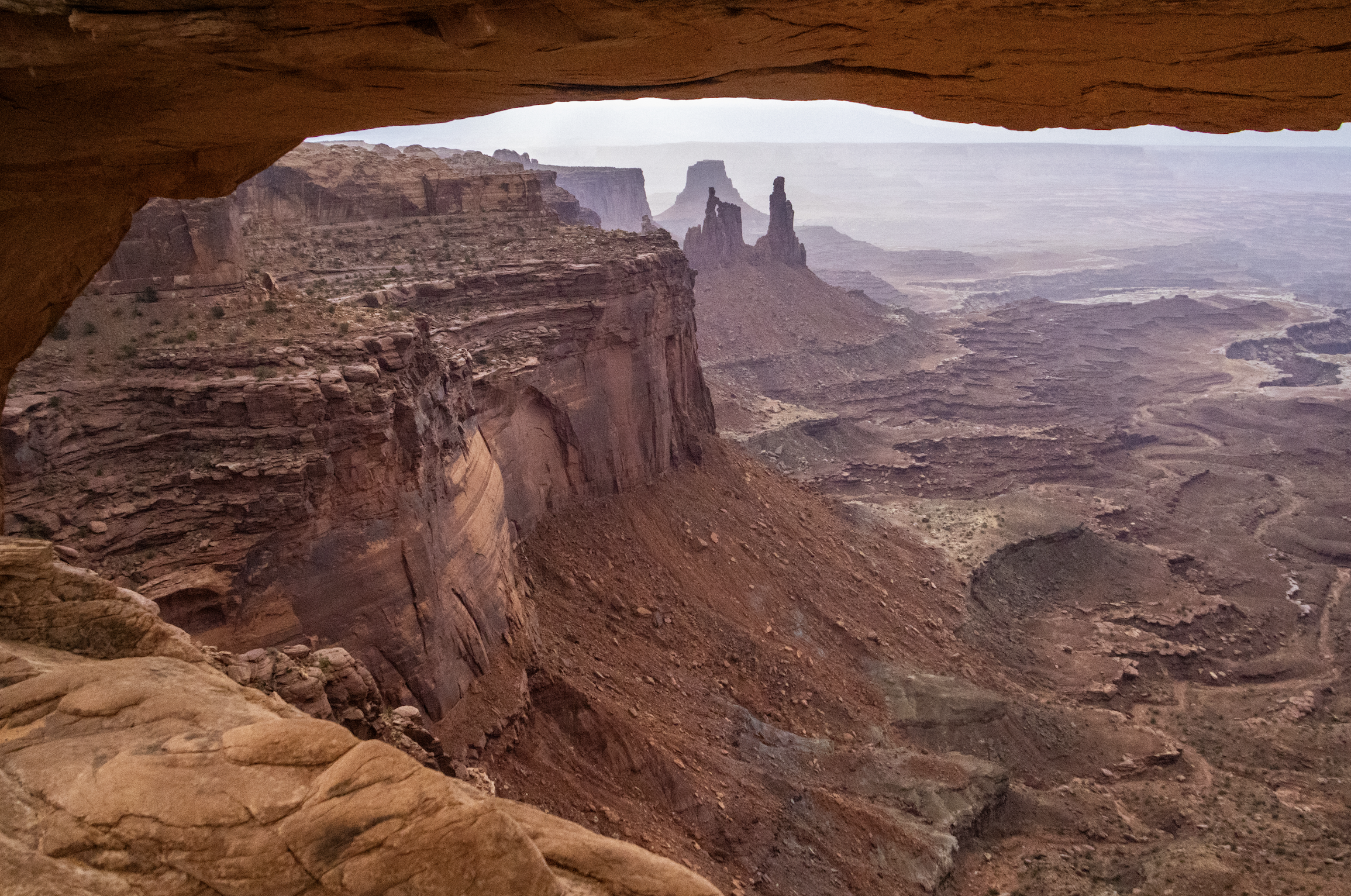
Finally, we arrive at Canyonlands National Park, which is the largest and most remote place we will visit on this trip by far. A couple hours southwest of Moab and Arches, Canyonlands spans an area of more than 300,000 acres. It is not a place that can be seen fully in a single day… but we’re going to do our best. Indeed, this particular trip will be most confined to the northern regions of the park, but I want to underscore that there is a LOT more of this landscape that we won’t see today.
As you will see, Canyonlands is a VAST area of canyons carved by mighty rivers that still flow through them to this day. Thousands of feet above the water, towering mesas look out across seemingly endless canyon-scapes. It offers more than a few STUNNING views.
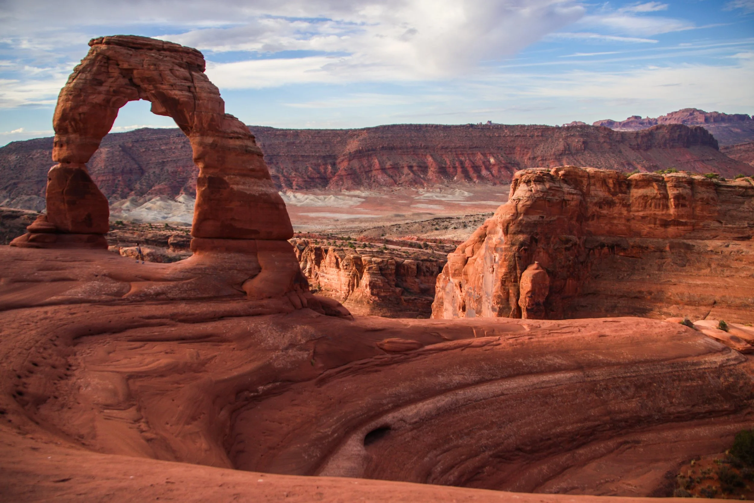
There are lots of famous rock formations in Arches National Park, but the most famous of them all is called “Delicate Arch”. We wanted to get there early in the day and experience sunrise within the park, which meant that we have to get moving at the butt-crack of dawn. In the gentle early morning light, our rental car carried us out of Moab and up a steep switch-back road into the park. Mind you that Moab is already ~4,025 ft (1,227 m) above sea-level. Arches actually gets as high as ~5,653 ft (~1,723 m) above sea-level, and—despite being only ~5 miles (8 km) away from downtown Moab—is usually 5–10°F (~3-6° C) colder. That being said, both Moab and Arches get HOT in the summer. The record high in Moab was 114°F (~46°C), and summer highs frequently exceed in 100°F (38°C) within Arches. So, heat is a hazard here! Consequently, sunrise/sunset exploration tends to be preferred, with many visitors retreating to Moab for a nice air-conditioned siesta in the middle of the day.
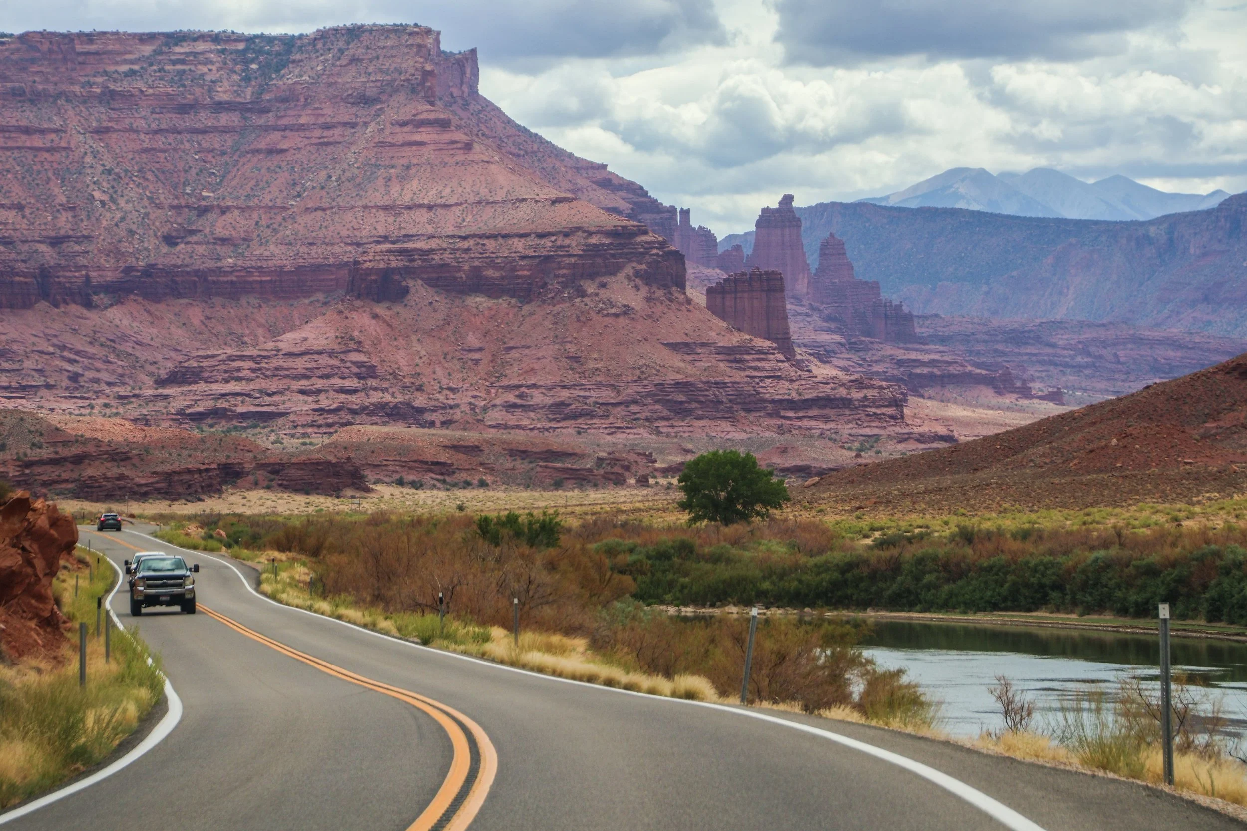
The road you are about to see was an important regional access point long before Moab was ✨M0aB✨—it was (and still is) important for ranching and river access. AND, it was apparently an important area for Uranium mining in the mid-1900s. But the human element of this road is really besides the point; unlike the rigid grid systems you will find in a lot of US infrastructure, this road works with nature, snaking through this canyon, following the river wherever it goes. In this sort of geography, you’d really have no choice but to build this road this way. That’s one of the magical things about traveling out west: the natural features become far too big for humans to tame.
Washington: The Evergreen State
C. 1889 / #42

And we’re back in mainland Seattle from our little trip over to Bainbridge Island! In our first installment, we checked off some of Seattle’s more obvious tourist attractions (i.e. Pioneer Square, Pike Place Market, the view of the Space Needle from Kerry Park, etc.). It was very cool, but TODAY we’re going to peel a few more layers off the onion and get into some of Seattle’s quirky b-list attractions. As a city, Seattle has a stronger and more distinct personality than most. I think this cross-section of less-notable items actually did more to help me get to know this place than the major tourist attraction did. It’s all about details.
SO LEMME HITCHU WITH THE DEETS.

I’ve heard Seattle described as “Portland’s mainstream older brother.” It’s true that Portland (Oregon) has long enjoyed a reputation for being one of America’s “weird” cities, as evidenced by its famous slogan, “Keep Portland Weird.” However…
I’ve been to Portland. My main man Buddy who accompanied me on this trip even lived there for a hot minute, and we both agree: Seattle is definitely weirder. In fact, I think I can conclusively say that there is more unabashed weirdness walking around the streets of Seattle than any other city in America. I’d be lying if I told you it didn’t make me feel uncomfortable a time or two (spoiler alert: there’s a nude beach in this article) but after some reflection, I think the problem is me. Because if you really think about it, the amount of weirdness walking around the streets of any city is likely the same no matter where you go. The difference is that, in Seattle, people feel empowered to be themselves. So they let their freak flags fly. And that’s pretty cool.

I’ll start with a quick introduction to Bainbridge Island. The first thing I should probably tell you about Bainbridge is that it’s not just some tourist haven—it’s actually a commuter suburb of Seattle. Lots of people live here! In fact, there are more islands out here than just Bainbridge, and many of them fall into this same category. Bainbridge alone has a population of about 25,000. I actually had a friend in college who grew up here, which now makes me jealous.

Some places hit you with vibes the second you step out of the airport. The air is different. The energy is different. Even the industrial in-between areas around the airport and the highway have a strong sense of character. Seattle is one of those places. In a happy twist of fate, I unwittingly ended up on the same flight to and from Seattle as one of my buddies in BNA, so I got the express pass into the city riding shotgun in the car that he had rented. Seeing the breathtaking Cascadian landscape unfold before us, I could not stop talking about how cool it all was. The mountainous terrain makes it so you are always either arriving at or leaving from a scenic vista, each of which provides a more gorgeous view than the last. Looking out in any direction, there are always multiple layers of water, city, and evergreen-dominated foothills between you and a background of MUCH larger mountains. And those mountains are always set against an expressive sky, which alternates between a clear, northerly baby-blue color, or a swirling moody mass of clouds.
Wisconsin: The Badger State
c. 1848 / #30

Dude, I smell like shit."
"Thats okay... It's Milwaukee!"
I think that interaction was what I remembered most about Milwaukee prior coming back here in 2018. I don’t remember a lot of specifics from that trip, save for the realization that Milwaukee is actually a pretty cool place. So when I returned in the summer of 2018 for a wedding, I made a point to break off a bite-sized piece of the city and take a long walk with my camera.

Madison is the second largest city in the state of Wisconsin, behind Milwaukee. Although it has a population of about 253,000, its metropolitan area is closer to half a million. It's also the capital city of Wisconsin and the home of the University of Wisconsin's main campus. UW is actually a massive university, so it is absolutely defining to the topography of this city—Madison is largely a college town. However, there's quite a bit more going on here than just Badgers games.
🇺🇸 Peter’s Map of America 🇺🇸
🔴 Red dots = Locations visited by Peter but not covered on this blog (yet!)
📸 Photos From The U.S.A. 👀


American Lofi Girl 🇺🇸 ✍🏼
This is a deep cut from the Internet, but I love seeing the Lofi Girl art translated to the backdrop of different countries. Even though I’m not really into anime (except for Miyazaki movies), there are very few things that make me more comfortable with the idea of traveling somewhere new than these illustrations. Here are some artist renderings of American Lofi Girl that I liked. Left to right, credit for these illustrations goes to u/holdenmccawfield + @nikkiponpon + u/wandering-monster.


I actually came to love Los Angeles during my last visit (right before COVID hit)—it is a very distinct place. And as Venice beach unfolded before me like some sort of surreal virtual reality, I realized that this might be the most “LA” place I’d yet seen. It is the stereotype of what this place is. It was Saturday night and everybody was out having fun. I hurriedly crossed the boardwalk and made a B-line for the beach so I could catch the sunset. It did not disappoint. I’ll postpone additional narrative in favor of just showing you the pictures I took.