

Major Series in Season 4 (so far) 📎
Moving To & Living In: London 🇬🇧 + Paris 🇫🇷
Scandinavian Hat-Trick: 🇸🇪 + 🇩🇰 + 🇳🇴
Spring in Lisboa + Hiking Madeira 🇵🇹
Exploring Spanish Basque Country 🇪🇸
Return to India: Rajasthan, Goa, & more 🇮🇳
US Adventures: Utah, Colorado, NYC 🇺🇸
Sub-Saharan Africa: Kenya 🇰🇪 & Tanzania 🇹🇿
Autumn in Vienna, Austria 🇦🇹
Roadtripping Oman 🇴🇲
Wandering Around Istanbul, Türkiye 🇹🇷
Assorted European Soccer (Football) Matches ⚽️
As Always, Lots of Street Art 🎨
Most recent season 4 Articles ⭐️
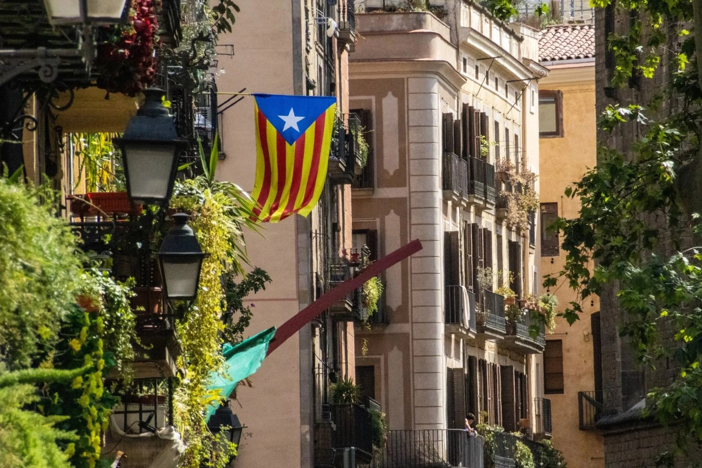
With a metro area population of ~ 5.5 million people, Barcelona is the 2nd largest city in Spain, behind only Madrid. By basically every quantifiable metric— population, economy, political power, etc.—Madrid is the larger city. But when it comes to travel, especially international travel, this relationship reverses. Barcelona is far-and-away the favorite destination for international tourists visiting Spain. And, when you consider the fact that Barcelona also covers a much smaller land area than Madrid, the concentration of international tourists becomes much more intense. Barcelona has indeed struggled to accommodate the levels of tourism it is now receiving, but it’s easy to see why the whole world is so interested in coming here! Sandwiched between the Collserola mountains and the Mediterranean Sea, Barcelona is an absolutely idyllic city. And once you’re in the middle of it, it’s incredible how quickly the Catalan identity eclipses that of Spain.
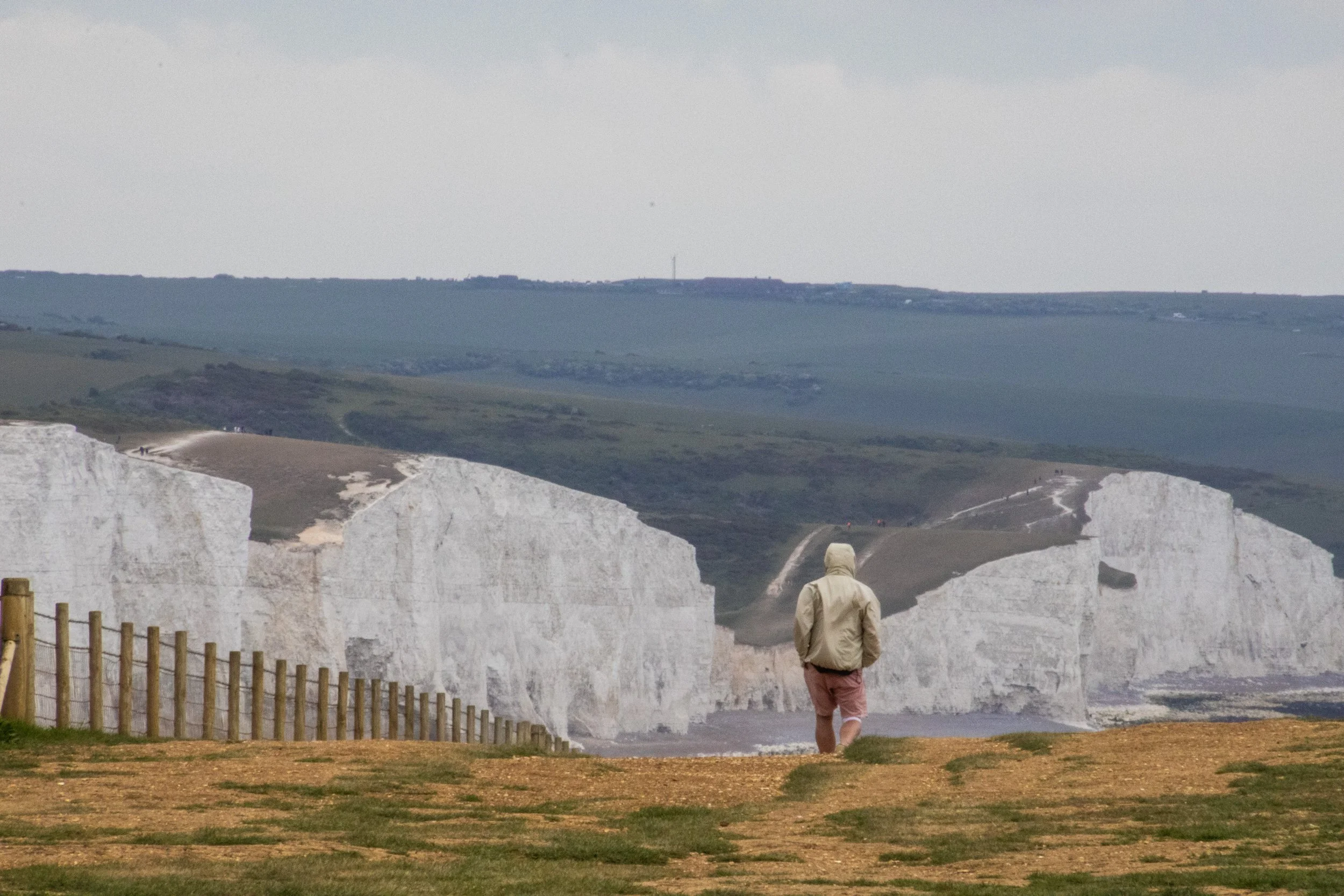
So, the “Sisters” are a series of massive hills that have each essentially been sliced down the middle by natural erosive processes to reveal massive, sheer cliffs that stretch along the English coastline like a series of rolling waves. To make the scene all the more striking, these cliffs are entirely white. Perhaps you’ve heard of the “White Cliffs of Dover”? This is part of the same system of cliffs, which is called the “South Downs”, but Seven Sisters is arguably even more iconic because the entire stretch has been kept completely natural and undeveloped. The white color comes from the fact that the earth here is made of an extraordinarily pure form of limestone: chalk! Indeed, the earth here contains about 98–99% calcium carbonate, with very little clay or sand, making them appear dazzlingly white! They stay so white because they are in a constant cycle of erosion, where after some time the outer layers of chalk crumble away revealing fresh, white chalk.
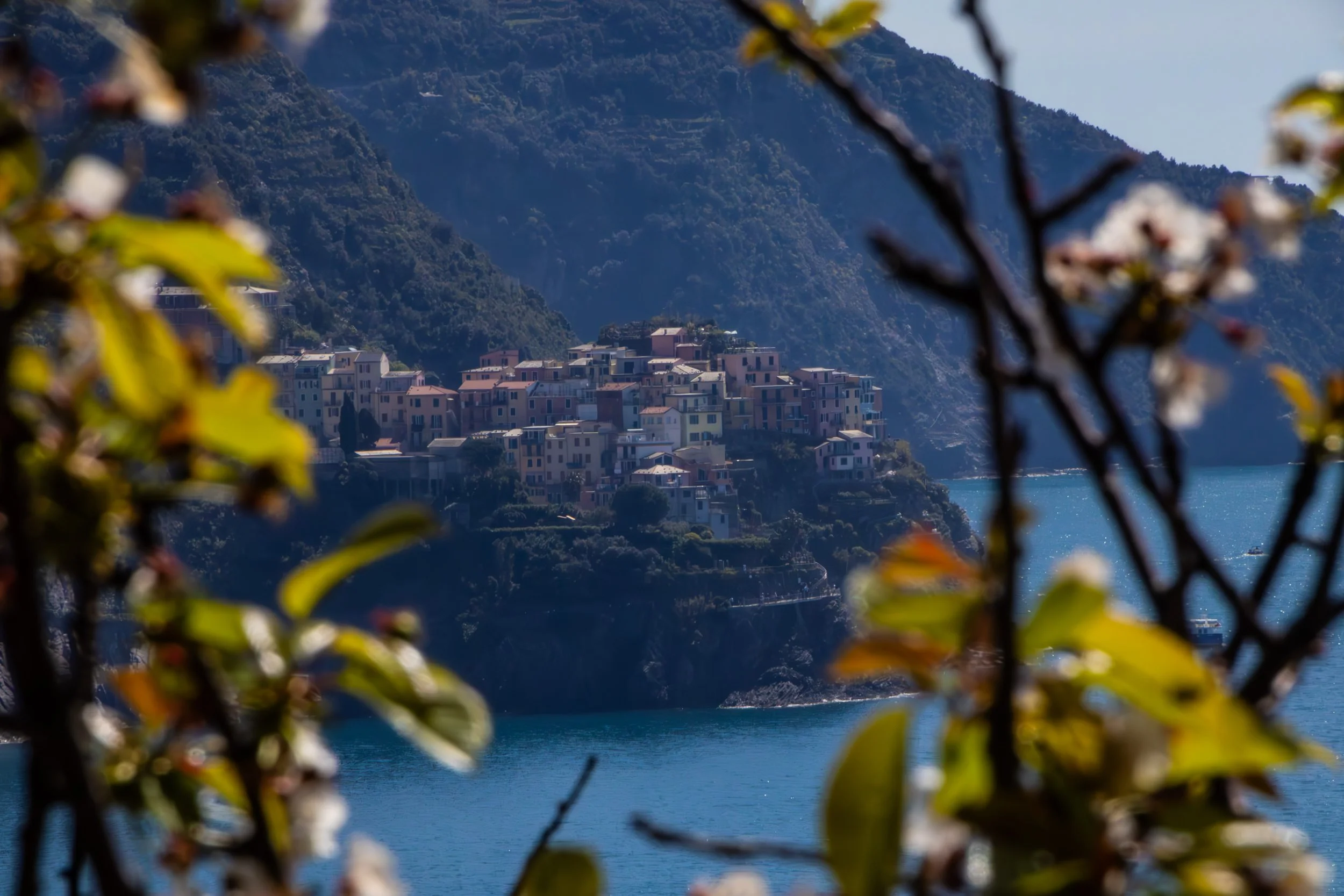
“Cinque Terre” literally translates to 5 lands, and indeed, it is not 1 place, but 5 places. It is a collection of 5 historic towns dotting the rugged, mountainous Mediterranean coastline between La Spezia and Genoa. These towns emerged between 1000 and 1200 AD, and—in their prime—were able to flourish because they combined fishing, boat building, agriculture, and maritime trade. You’ll hear them referred to just as “fishing villages” but that is only part of the story. Agriculture is also massively important to the appearance of these towns even today. The main staple of these towns, in additional to olives, was wine.
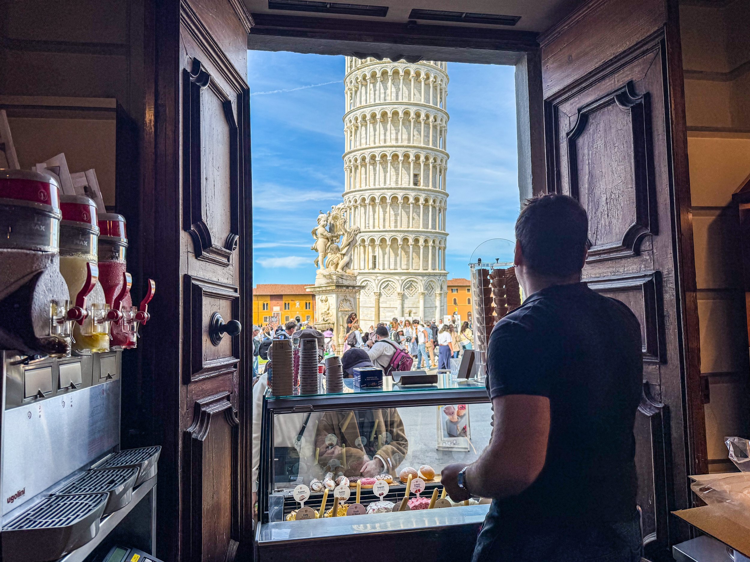
I doubt you will be surprised to learn that the Leaning Tower of Pisa was actually not supposed to lean. In 1173, when work began on this structure, the intention was for it to just be your typical free-standing bell tower. Although I should acknowledge that there was really nothing “typical” about this in the 1100s; Italy was leaps and bounds ahead of (most of) the rest of the world, which is part of what makes these sites so incredible. Anyway, construction took about 200 years, including an almost 100-year-long pause due to wars and political instability. It was officially finished in 1372.
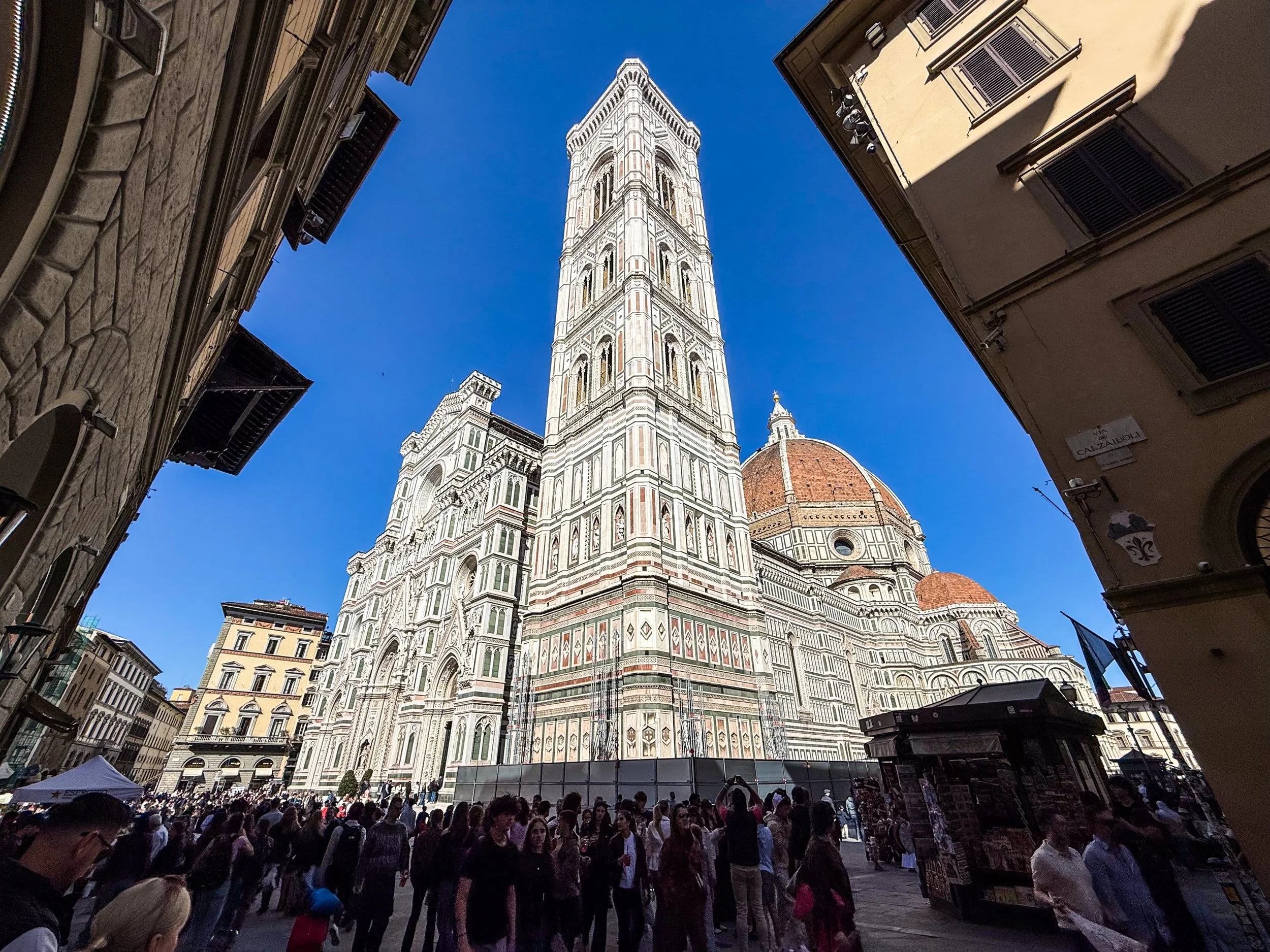
Although Florence was founded under the Romans in 59 BC, its meteoric rise did not begin until about ~1,000 AD. The intervening years saw Florence weather Gothic invasions, Byzantine rule, Lombard control, Frankish conquest under Charlemagne. A thousand years of the same struggle for incremental gains that most every city in the world was experiencing, until Florence’s petri dish yielded something entirely unique. Going into the 1400s, Florence had a unique combination of enormous private wealth, political competition, educated merchants, civic pride, and intense rivalry among wealthy families. You might assume that they the powers that be would opt to duke out their competitions in war, business, and industry (and there was certainly some of this), but the Florentine elite chose a new arena for competition: the arts. You may have heard of the Medici? This was one of those wealthy families that is famously supported some of the artists that would establish Florence as a cultural juggernaut and kick-start the Renaissance. They even have their own Netflix show now.
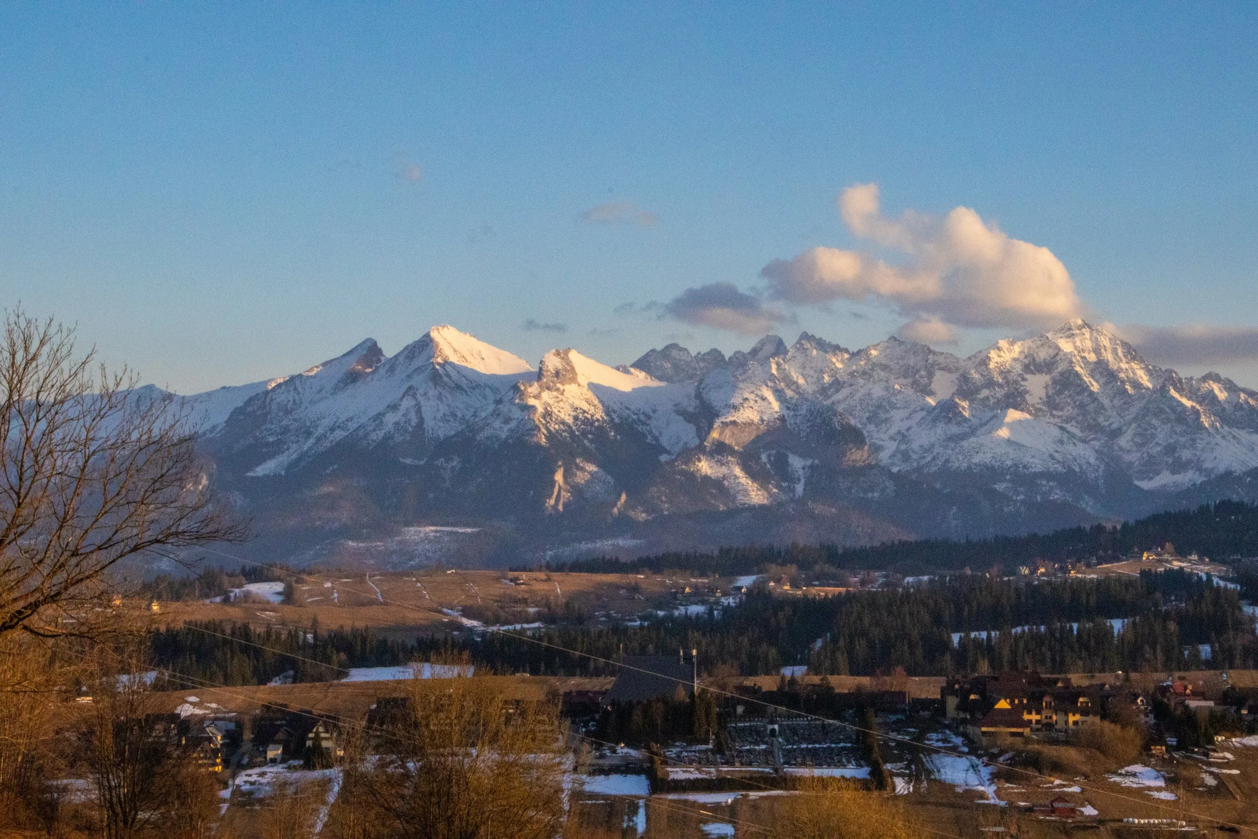
Poland’s reputation is for being an overwhelmingly flat country, and that is mostly true, but its far southern border, which it shares with Slovakia, is marked by a particularly jagged section of the Carpathians known as the Tatra Mountains. Although they are much smaller than other European mountain ranges—such as the Alps, Pyrenees, and Caucasus—they are extremely dense, rugged, and beautiful. In fact, they are SO beautiful that—although they only stretch about 57 km (35 miles)—the Polish and Slovakian sides receive a combined ~8.5 million visitors per year, skewed toward the Polish side. That makes them the most intensely visited mountain landscape per square kilometer in Europe. And yet, I’d never even heard of them before this trip!
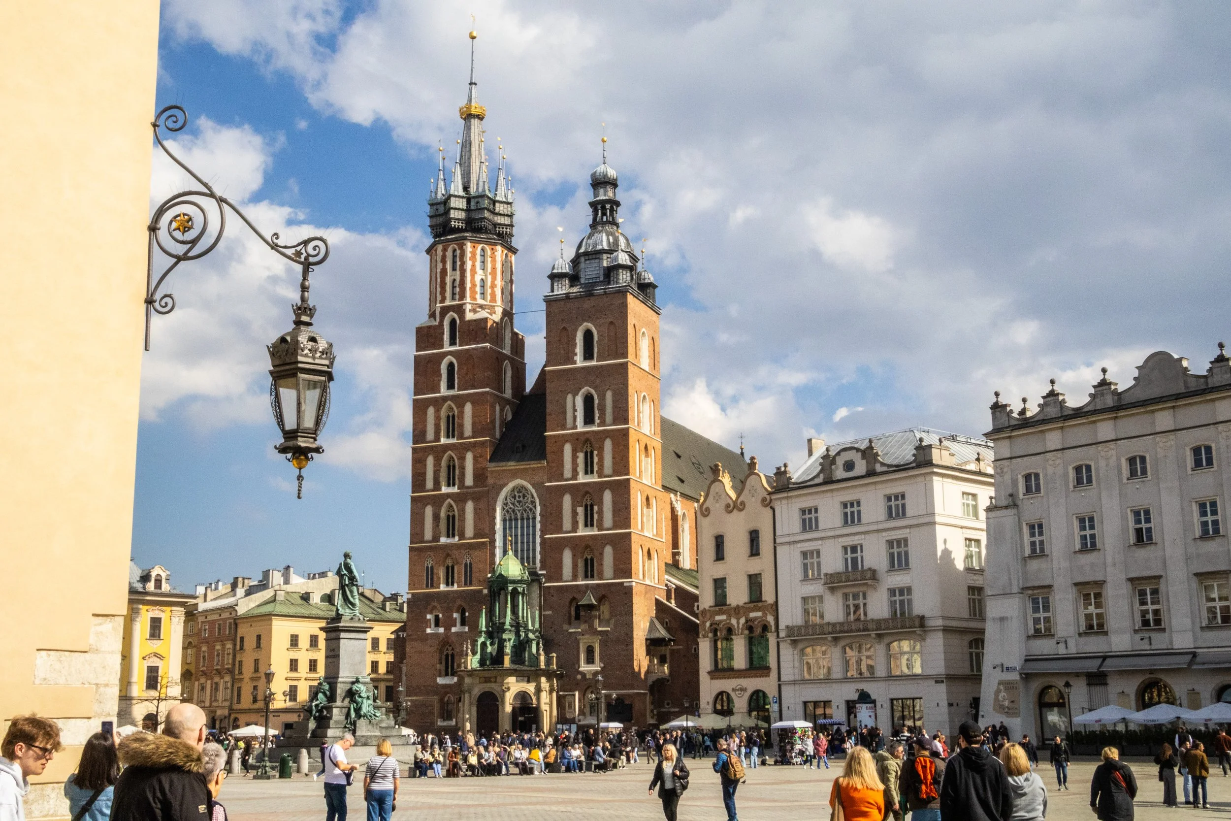
It’s a new country for Peter’s Big Adventure! Welcome to Poland 🇵🇱
Our journey in Poland starts in Krakow. This is a city that I knew first from the WWII history books, and later as a desirable and beautiful European destination that I’d be well-advised to bump up to the top of my priority list of future trips. Indeed, Krakow is many different things to many different groups of people, and today we’re going to do our best to understand as many of these layers as we can. So let’s get started, eh?
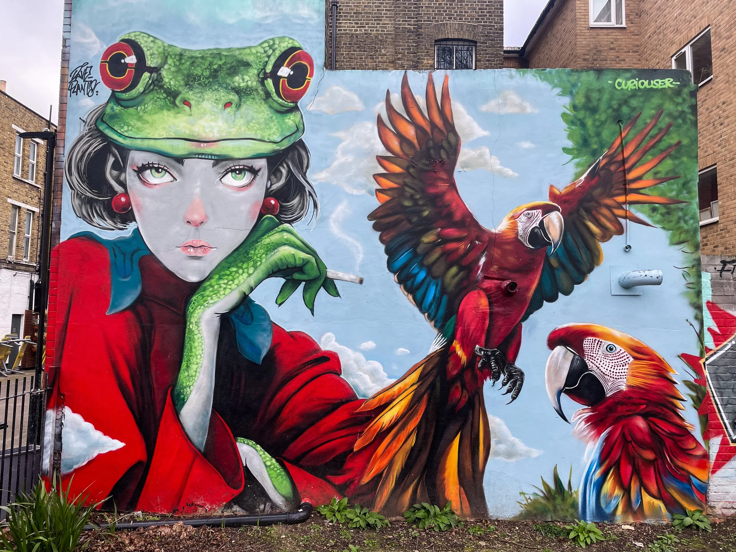
In this article, we’re going to be agnostic with the location within London. Indeed, this article has been sitting around as a ‘draft’ since 2023, and I have just been adding to the gallery every time I walk by a mural in my day-to-day life. So, I stumbled onto all of these randomly, and accordingly, they are really from a random collection of places. I think the London neighborhoods covered here include Camberwell, Stoke Newington, Little Portugal, Bow, Bethnal Green, Walthamstow, Peckham, Hackney, Finsbury Park, Waterloo, Nunhead, Stockwell, Fitzrovia, Clapham, Earl’s Court, Soho, Notting Hill, Streatham… and probably more!
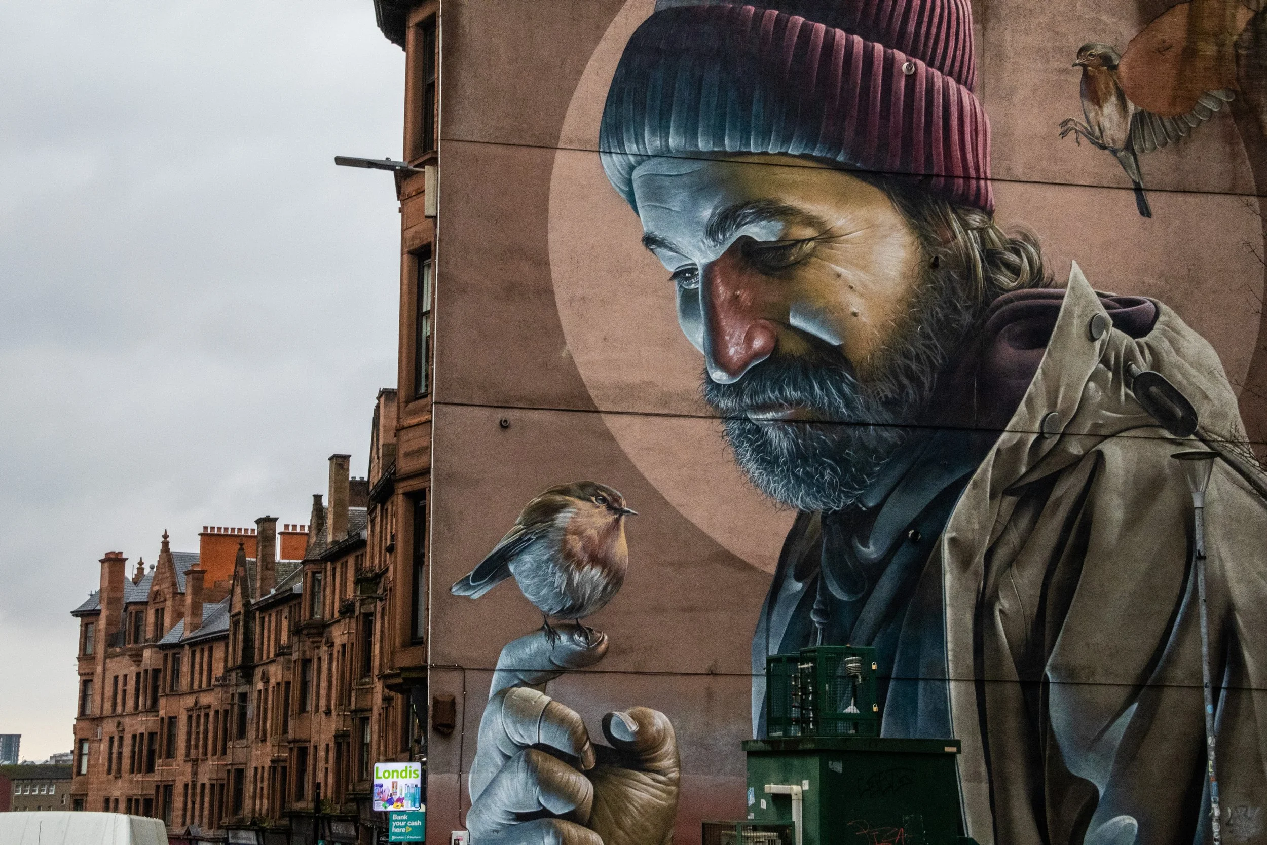
It turns out that Glasgow has a reputation for murals! The one at the top of the gallery below is, perhaps, the most famous of them all. It was done by an Australian-born street artist named Sam Bates, better known under the moniker Smug. He’s offered little information on the intended symbolism of the mural, but because the subject is holding a robin and appears to have some sort of halo—both imagery that were/are commonly associated with St Mungo—the mural has been widely interpreted as a modern St Mungo. The mural’s close proximity to Glasgow Cathedral, which is the resting place of St Mungo, serves to reinforce this.
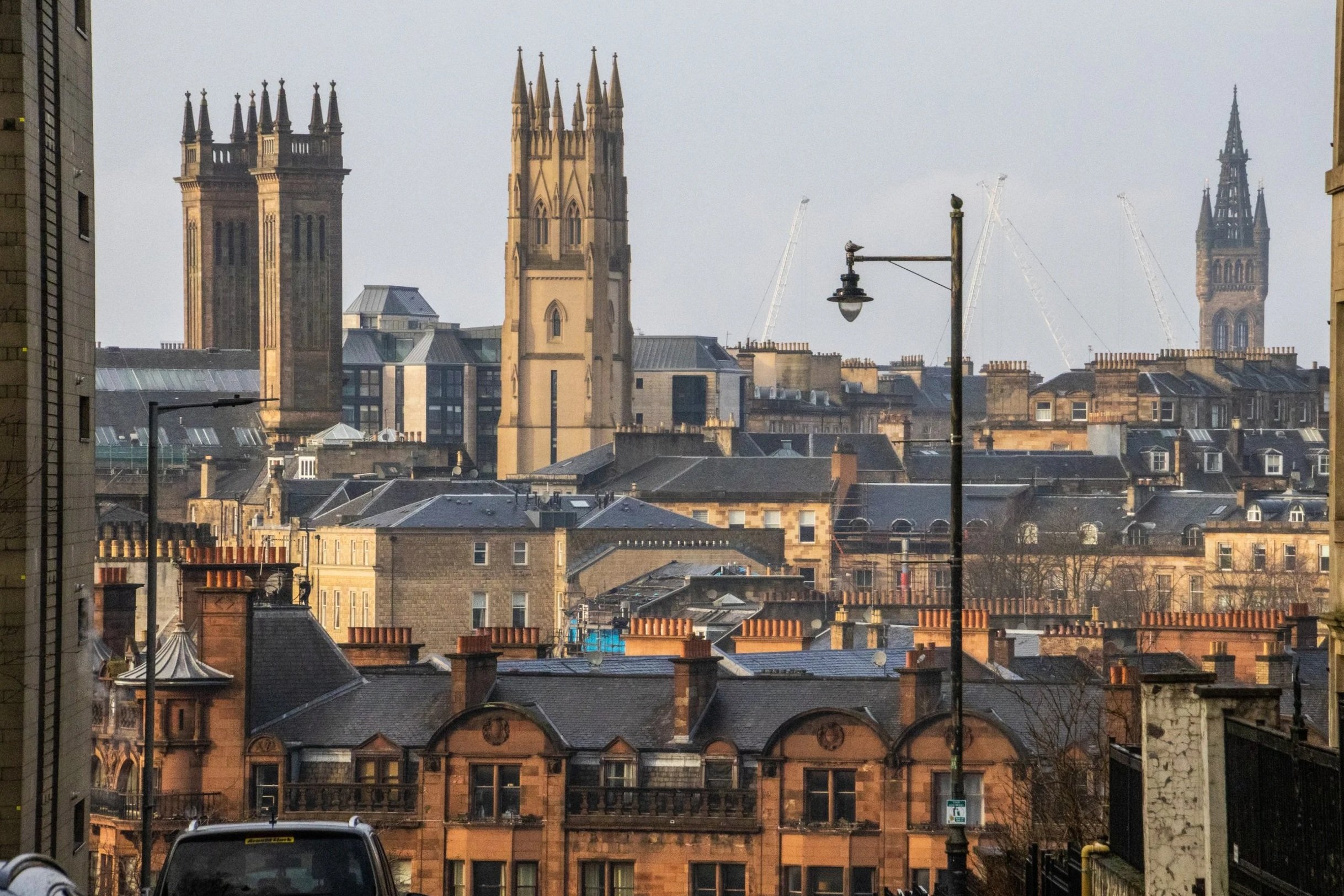
When you think of Scotland, I’m betting you don’t immediately think of Glasgow. You probably think beautiful scenes in the Scottish Highlands, or the charming cobblestone streets of Edinburgh. Indeed, this is the image that Scotland likes to show to the outside world, but the largest city in Scotland is actually not Edinburgh; it’s Glasgow! With a metro area population of ~1.8 million, the joke goes that this is where Scots actually live. It could be said that Edinburgh and Glasgow are two sides of the same coin. They are the largest two cities in Scotland, and they are literally right next to each other at only 70-80km (45-50 miles). Edinburgh is smaller, but it is the administrative, governmental, diplomatic, academic, and financial hub of Scotland. It’s well-connected, it’s expensive, and it’s posh. Glasgow, on the other hand, is none of these things.
You’re gonna love it. 😉
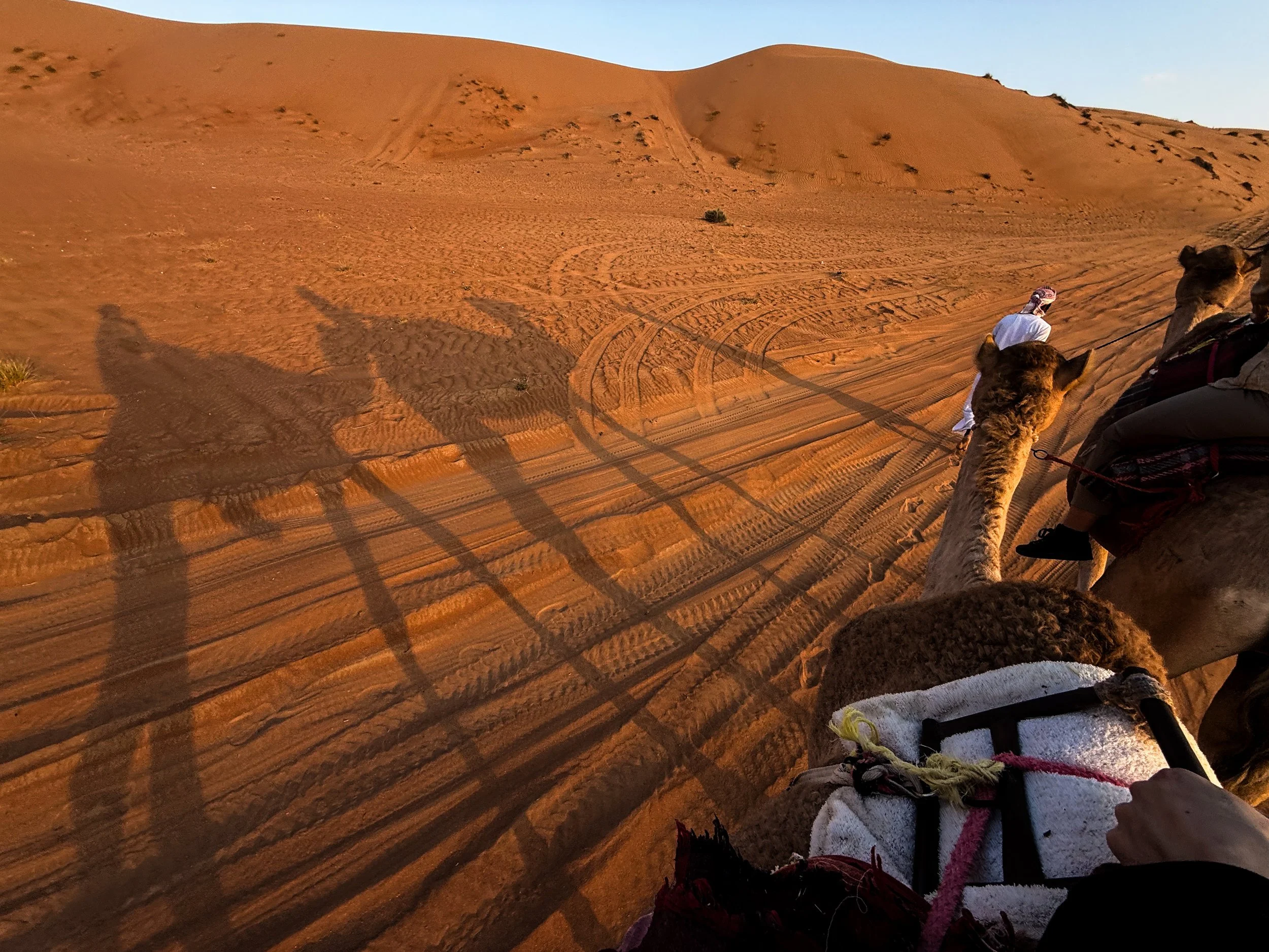
From Saudi to the UAE, to Yemen, to Oman, there are all lots of sub-regions of the Arabian Desert, which have emerged over time based on a combination of local tradition, geographical features, and scientific classification. The geography of this particular corner of the desert is largely dominated by long, parallel dunes (also called longitudinal dunes). A single dune can stretch from 5–20+ km (3–12+ miles) in length. And, in terms of height, they can reach 100 meters high (330 feet). To put that into perspective, that could be roughly equivalent to a 30-storey building!
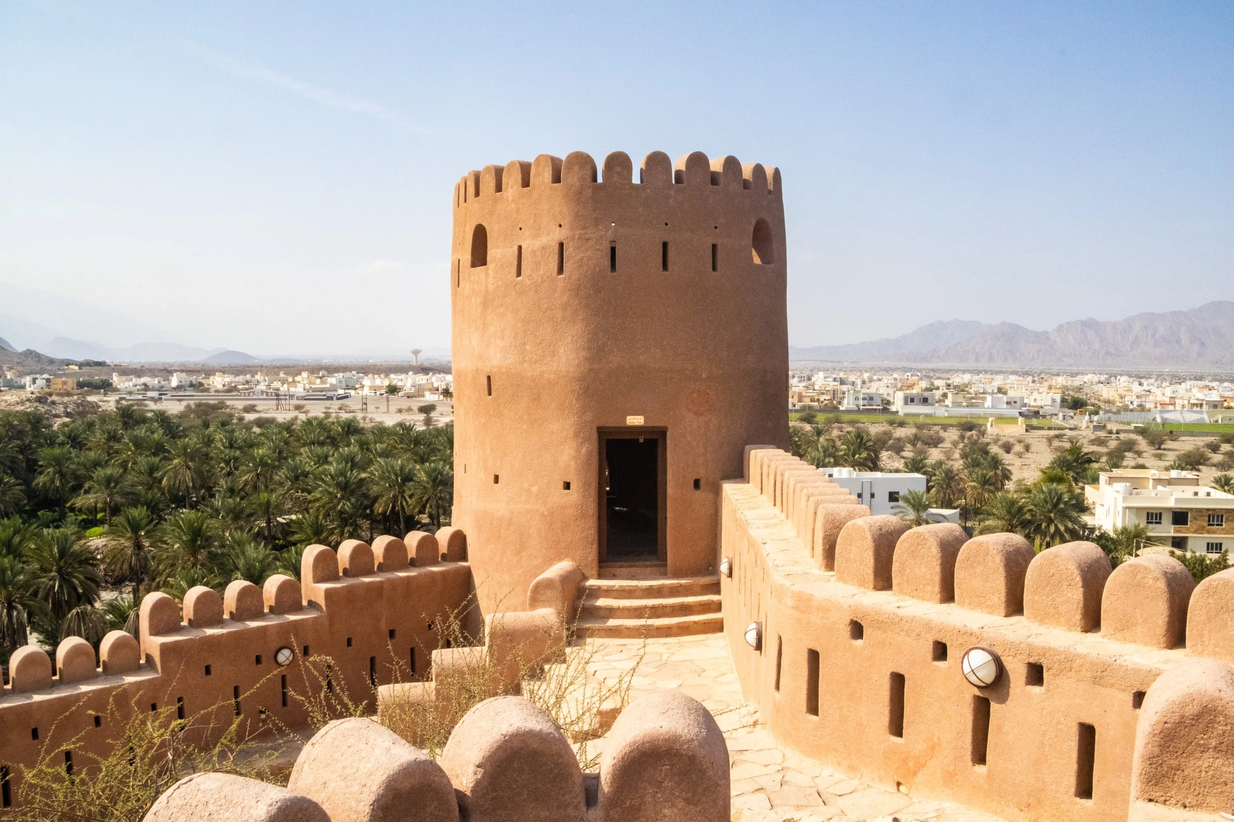
The theme of today is old Arabian fortresses scattered throughout Oman’s Al Hajar mountains. Oman has a lot of these old relics, and we’re going to be visiting 3 of them. We’ll start with Nakhal Fortress, move on to Bahla Fortress, and finish with Nizwa Fortress, which is actually part of a very cool little town bearing the same name. In the past two articles, there was a LOT of information about Oman and the geopolitical neighborhood it calls home. Admittedly, during these articles I was still getting my feet under me in this new country. But this is where we’re going shift gears from educational exploration to something a bit more fun.
So, go use the bathroom now because it’s about 1 hour from Muscat to Nakhal, and we’re not going to stop until we get there. 👀
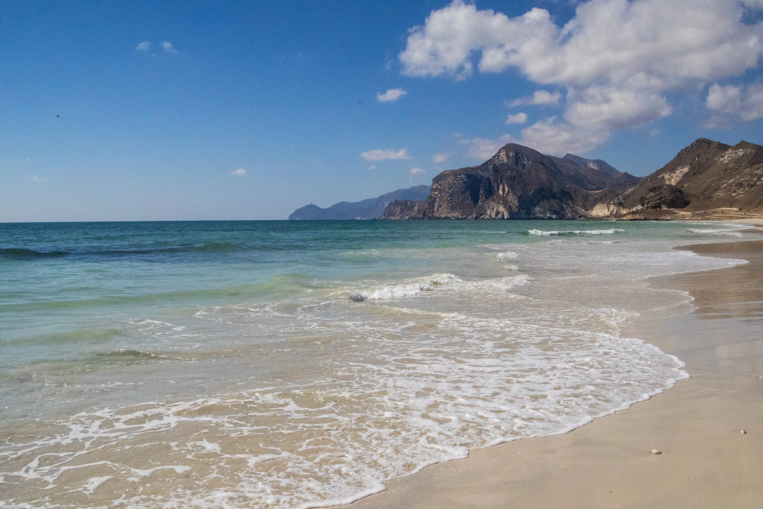
The first time I learned about Dhofar was actually in a BBC nature documentary! Although they are pretty obscure in the wider world, within Arabia the Dhofar mountains are quite famous for the incredible transformation they undergo each year during the monsoon season. During the “Khareef” (the local name for the monsoon season), this whole place transforms from a desert into a massive, green oasis! It happens from June to early September, peaking in July and August and, in addition to being misty and wet (already very unusual within the region), Dhofar also becomes much colder than the rest of the Gulf. There even seasonal waterfalls that pop up all over the mountainous landscape! During this time, there is a huge influx of tourist (mostly from Saudi Arabia and the UAE) that come in to enjoy the greenery and cool temperatures. There is even a Khareef Festival that happens during this time. UNFORTUNATELY, we’re not visiting during the Khareef. This visit happened in mid-December, so Dhofar will be in peak-desert mode.
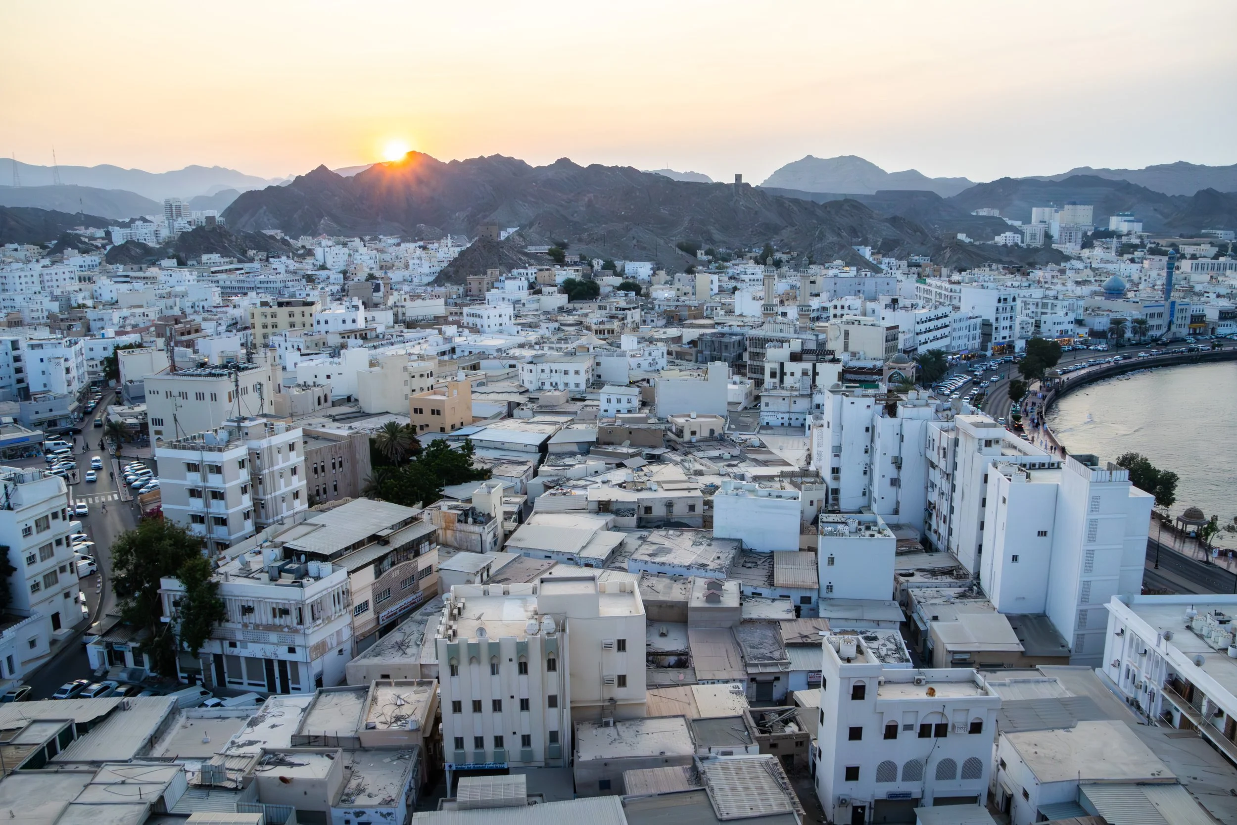
Bourdain said it best: “The Sultanate of Oman defies expectations”. It occupies a very tricky slice of the map indeed, a smaller nation holding its own against all odds in some extremely treacherous geopolitical waters. Its neighbors are the war-torn, perpetually-collapsing Yemen, the conservative and ruthless Kingdom of Saudi Arabia, the opulent, high-flying United Arab Emirates (UAE), and Iran, which needs no introduction. It also shares responsibility with Iran for the Strait of Hormuz; maybe you’ve heard of it? Literally the entire world has had their eyes glued to this strategic global choke point on the world’s oil supply for the past few months… things are TENSE. And right in the middle of this pressure cooker sits Oman: safe, moderate, reserved, modest, welcoming, and beautiful.
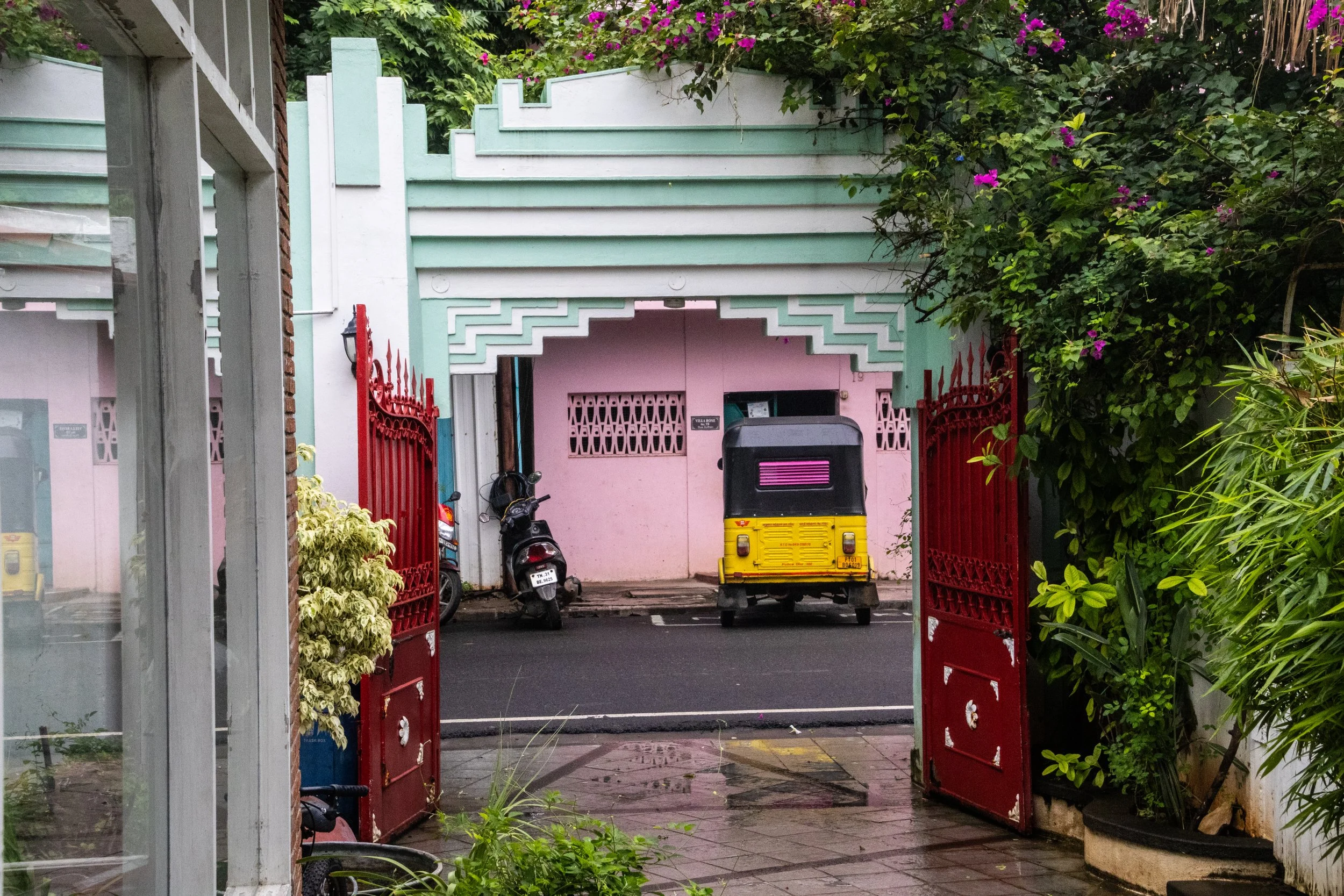
My fascination with Pondicherry began many years ago when I saw it in the movie Life of Pi. It’s an incredible film, and while most of it takes place at sea, the beginning of the film, as well as the narration throughout, is all set in this idyllic French colonial town in India. Of course I was curious about this place, so I looked it up, and there it was: Pondicherry! It had been sitting on a quiet part of South Indian coast this whole time, but there weren’t many major cities around it so my eyes had never lingered on this particular part of the map. I remember thinking that this far-flung place seemed a bit surreal… it looked like France… but it was in India? I knew very little about South India at the time, and I’d probably never go there… but the way it was represented in the film was absolutely intoxicating!
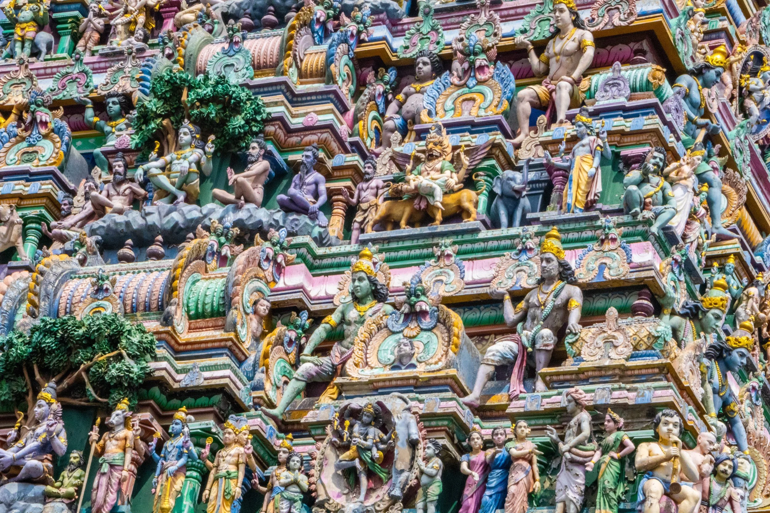
With a metro area population of roughly ~14.5 million people, Chennai is currently the 4th largest city in India, behind only Delhi, Mumbai, and Kolkata. It’s also the capital of the Indian state of Tamil Nadu, which is the formal administrative division corresponding to the Tamil cultural identity. Tamil culture is unique because it is one of the most ancient surviving cultures not only in India, but in the whole world. Its roots can be traced back to ~300 BCE and the Tamil language—one of the world’s oldest living languages—has more than 2,000 years of recorded literature. The Tamil-verse includes multiple different religions (such as Hinduism, Islam, and Christianity), so religion’s typical role as a cultural unifier does not apply here. In its place, the language itself has taken on a unique level of significance.
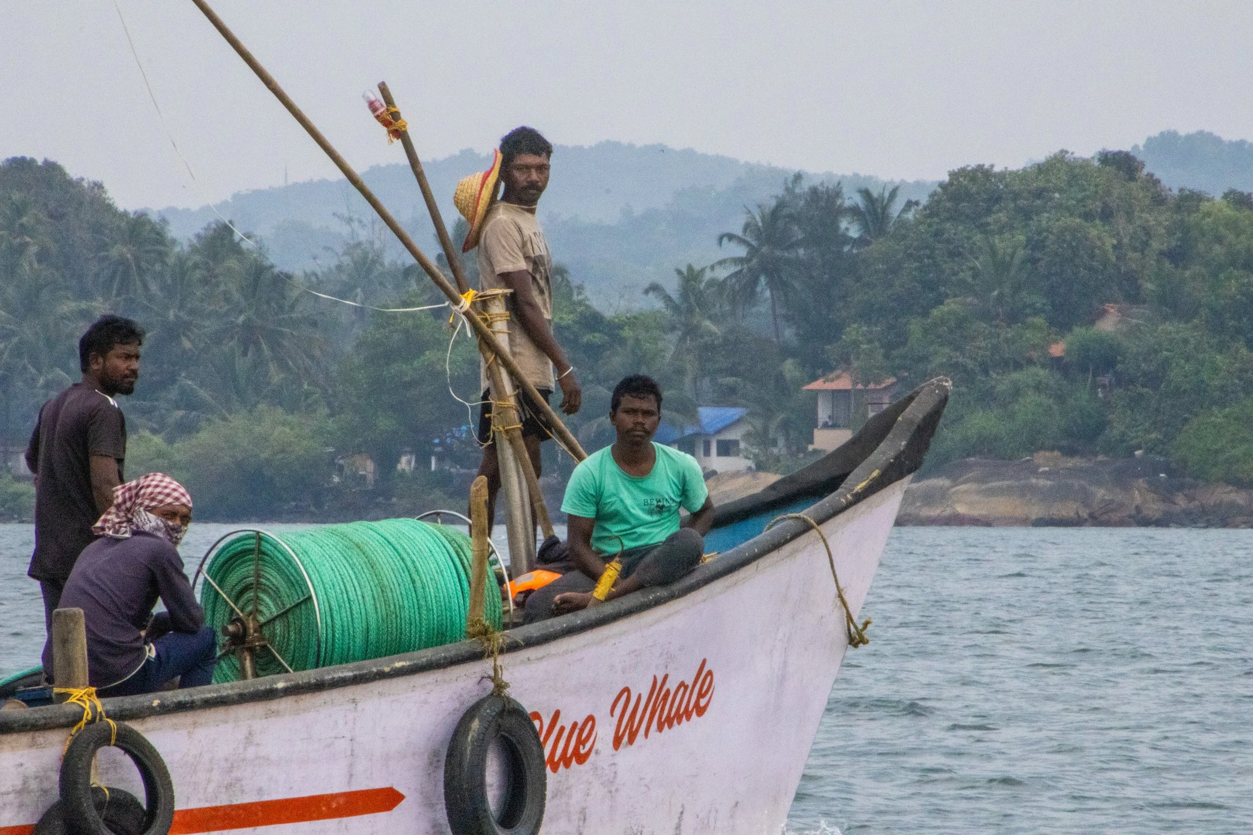
So, what exactly is Goa? Because it’s so tiny, I was surprised to learn that it is actually a stand-alone state in India, on the same administrative level as Uttar Pradesh, Rajasthan, or Maharashtra! Indeed, it is the smallest state in India, and its modern-day borders correspond to the legacy boundaries of Portugal’s once-upon-a-time colony on the Indian Subcontinent.
We mostly associate India’s colonial period with Great Britain, but France and Portugal both had small carve-outs in South India too. When the British finally left India shortly after WWII, the newly independent Indian government had expected Portugal to pull out of Goa as well, but Salazar (dictator of Portugal at the time) had other ideas. Long story short, India reclaimed Goa from Portugal via military force in 1961. The story of Goan identity as it relates to India and Portugal is quite complex, so I won’t delve into it fully here; hopefully in a future article. But I will tell you that Portuguese culture is still part of Goa’s DNA. It’s even got a large catholic population, which is quite out of place in India.
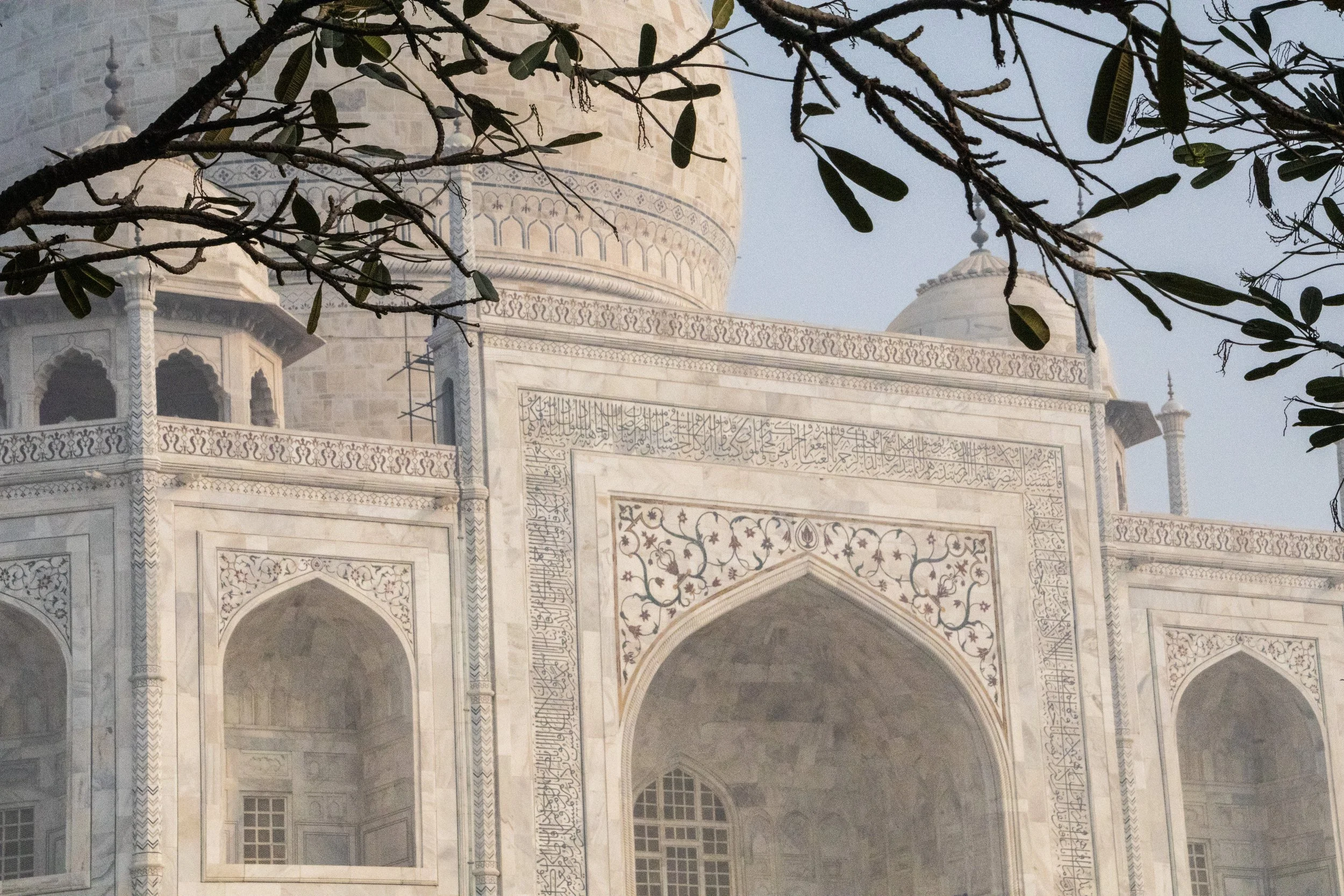
When I first began traveling, my operating assumption was that pretty much everything was a “once in a lifetime experience”. Because, for most people, they are! “Next time” was absolutely never guaranteed. That was definitely the case when I visited the Taj Mahal for the first time in 2015. It’s only just now that I am starting to have the experience of going back to places I’ve already visited. Initially, I was resistant to this, but I’m starting to realize that life is a bit longer than I’d originally thought when I was in my early 20s… I have enough time to do things twice. Or, hell, maybe even 3 or 4 times if I’m lucky! But don’t worry—we’re going to be back to breaking new ground after this article. 😉
I wouldn’t be writing this article at all if I didn’t have a slightly new dimension I wanted to explore on this topic. Unfortunately, it’s pollution. I touched on this while I was in Delhi, but this little excursion was where the issue really slapped me in the face for the first time.
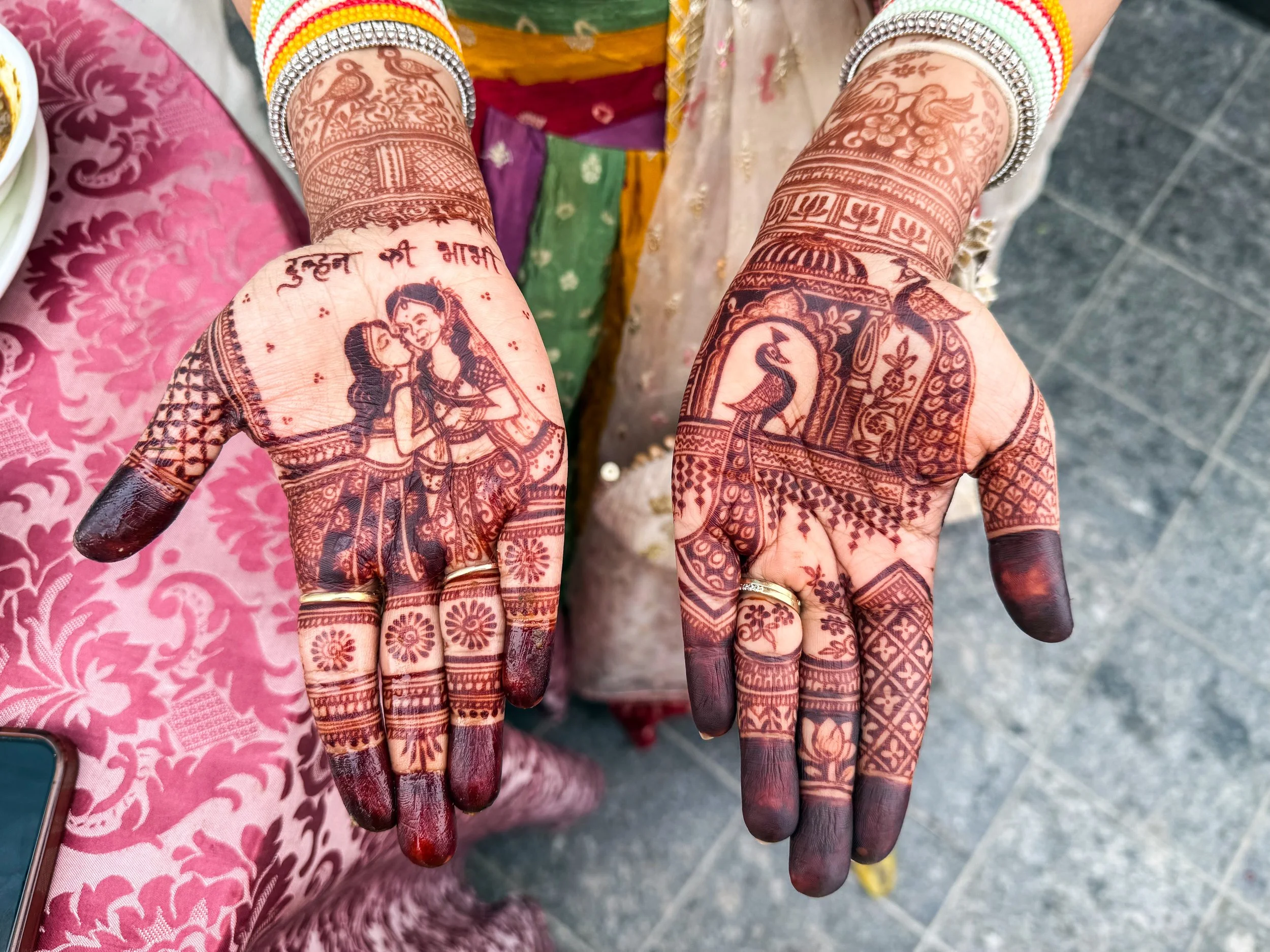
With a metro population of roughly 33 million people… (pause for dramatic affect)… Delhi is the largest city in the largest country on earth. In the overall world rankings, it is 2nd only to Tokyo, but it’s gaining ground fast! In the average Delhi day, there are ~837 births and ~360 deaths, which gives us a natural increase of ~477 people per day. On top of that, there are an additional 200–275 migrants that arrive here per day, mostly from neighboring countries, or rural parts of India. Meanwhile, Tokyo is actually shrinking.
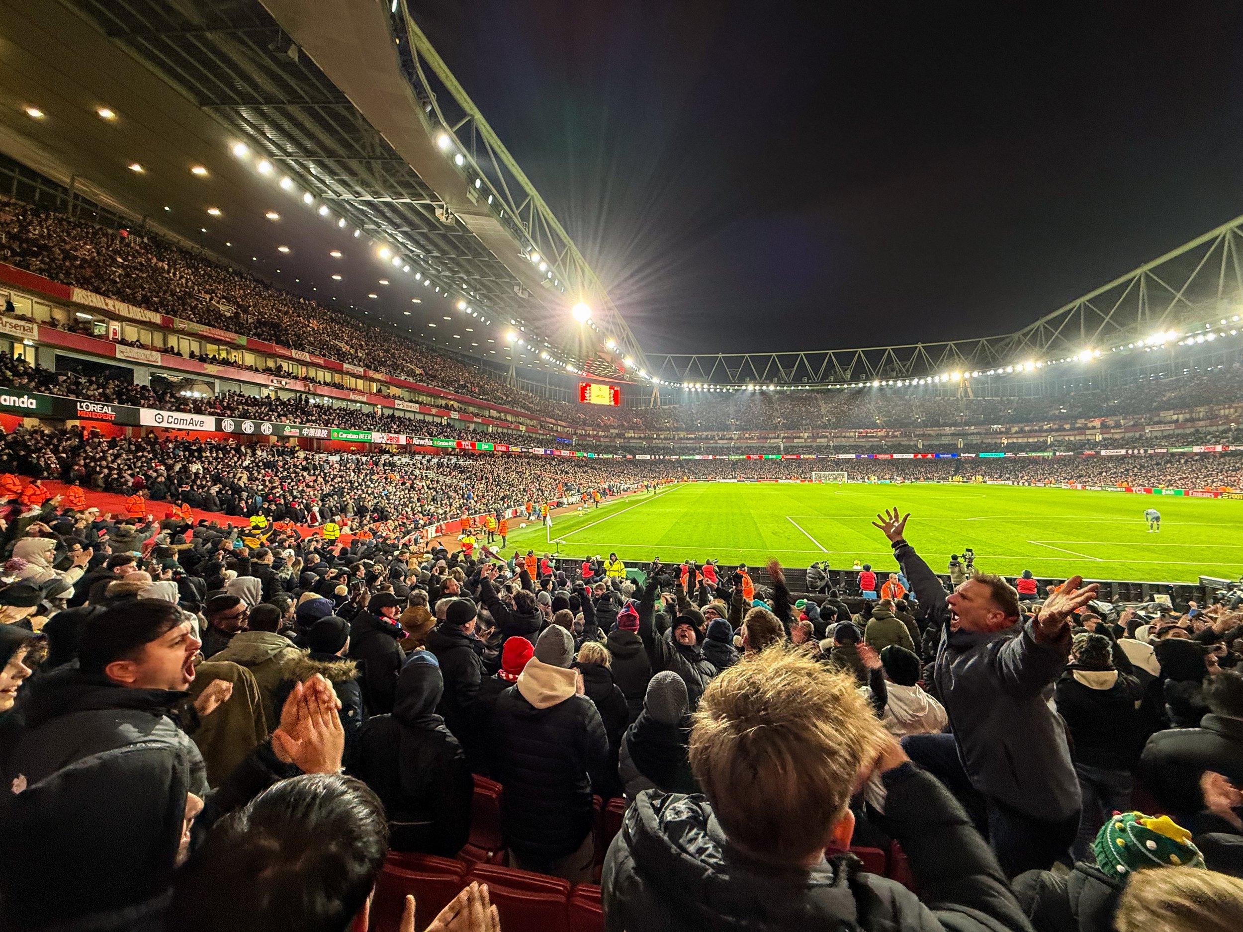
Today we return to football tourism with our quest to visit all the stadiums in the English Premier League. Up to this point we’ve covered Chelsea’s Stamford Bridge, Fulham’s Craven Cottage, West Ham’s London Stadium, Spurs’ Tottenham Hotspur Stadium, and Brighton’s AmEx Stadium. Now, at long last, we’re visiting Arsenal’s Emirates Stadium, which sits in North London, within walking distance of my new flat! We’re going watch the EFL Cup quarter-final against the classic South-London side, Crystal Palace.
So here’s our destination today, along with a couple of nice pictures from the walk over. This match took place on December 23rd, so you will see lots of Christmas imagery & references in the images.
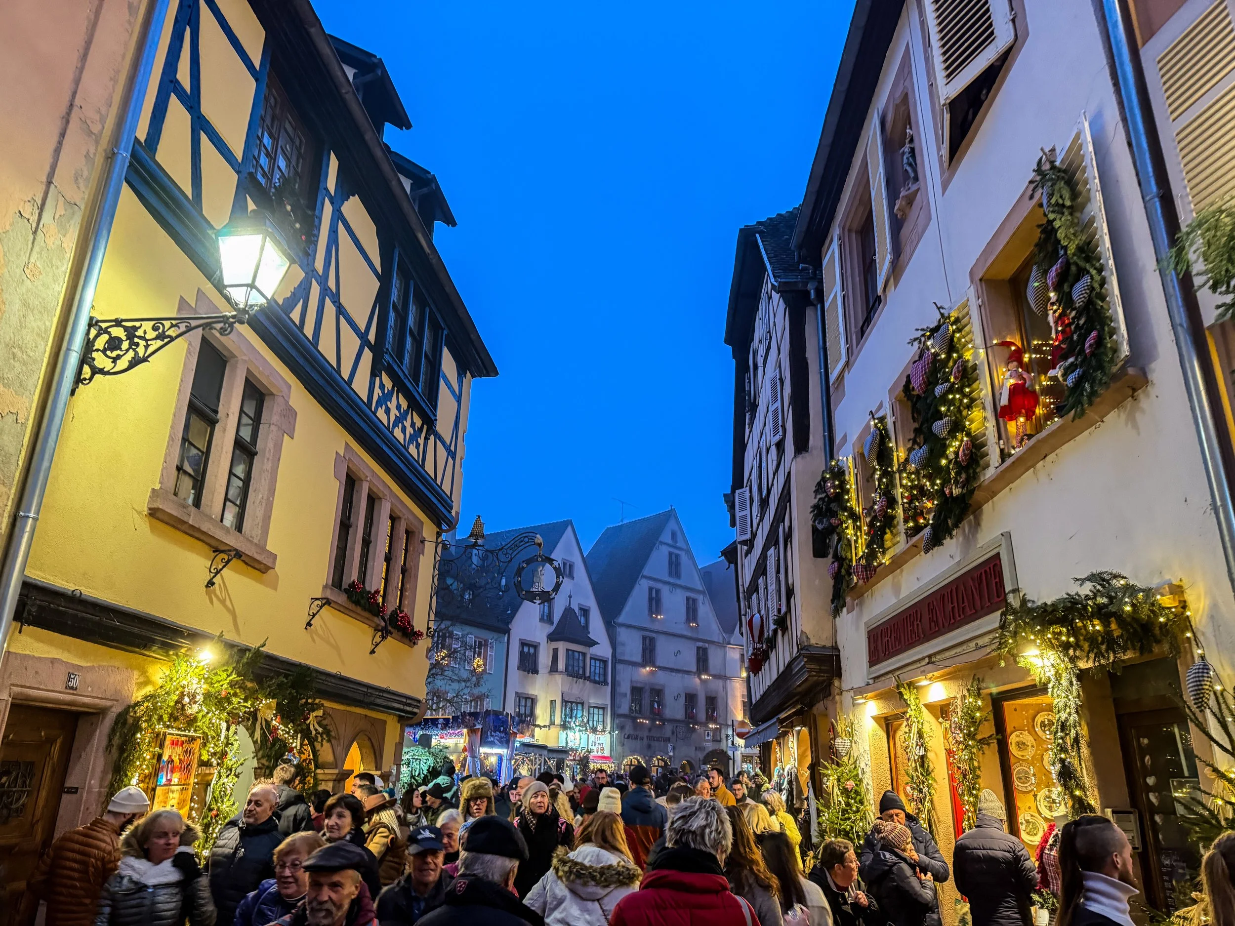
Here’s a fun fact for you: the concept and tradition of the Christmas tree originated right here, in Alsace! The first written records of Christmas Trees anywhere in the world first appear here in 1521, in a small Alsatian village called Sélestat. If you’d imagined there were snowy spruce trees in the Israeli desert for the actual birth of Jesus… I’ve got bad news for you. 😬
Anyway, Sélestat is about a ~20-minute drive from the places we’ll be visiting today! But this is not a historical expedition; we’re going to visit a few more present-day Christmas Markets!
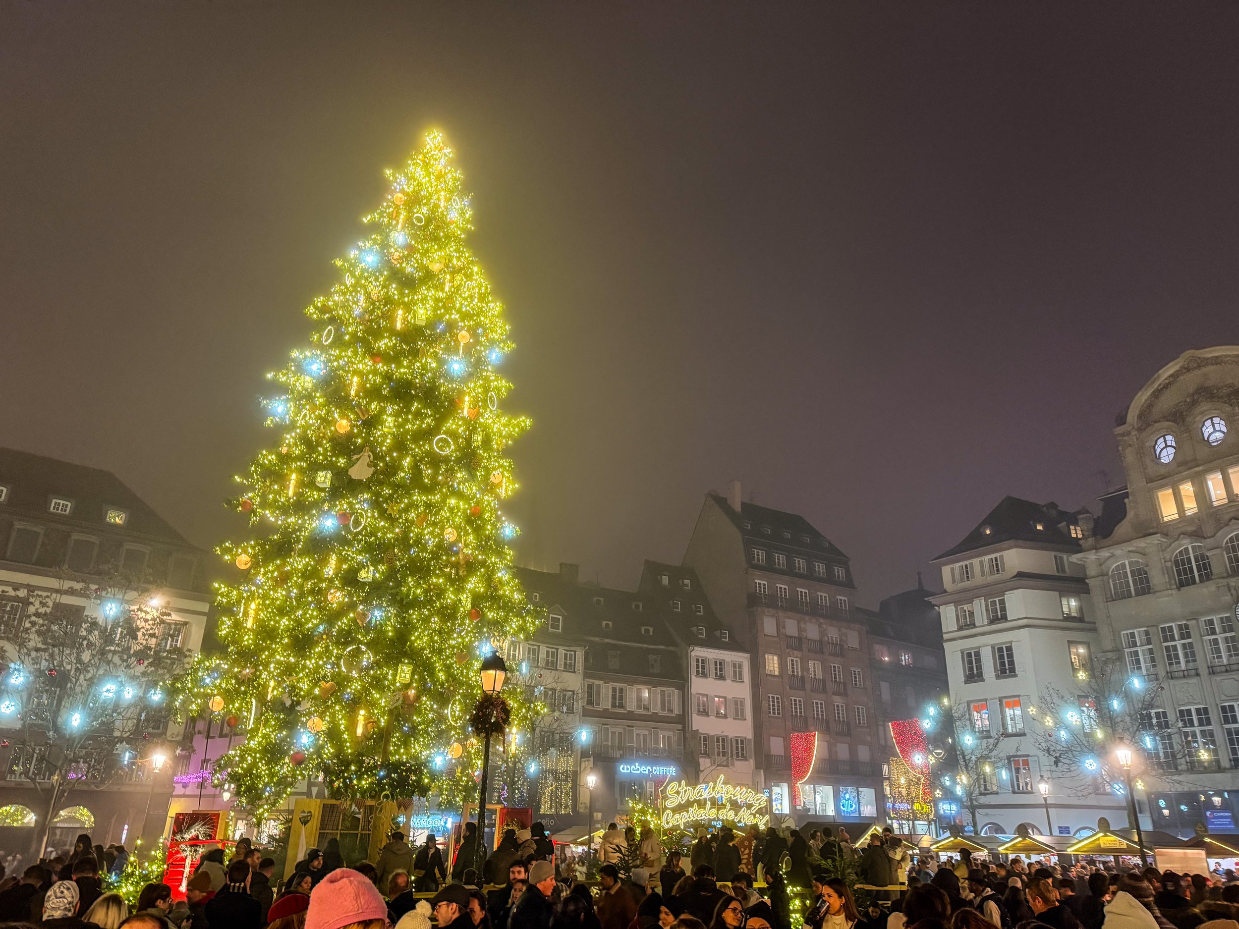
This is (probably) the oldest Christmas Tree anywhere in the world. The first written records of Christmas Trees anywhere in the world first appear here in Alsace in 1521. Those records actually come from a little town called Sélestat which is just south of Strasbourg, but the first records of Strasbourg’s tree follow soon after. At this time, Strasbourg was already the largest city in the region and record keeping was a bit spotty, so I think it’s fair to generally just award the title of “the Birthplace of the Christmas” tree to Alsace in general.
So, this isn’t just a Christmas Tree; this is THE Christmas Tree!

There’s a lot more to Bushwick than I’m going to cover here; it’s known for having a large Latino community, especially Puerto Rican and Dominican, and since the gentrification of Williamsburg, it has also become the new center of indie culture in Brooklyn. But that’s not what this article is about. Today, we’re here to go mural hunting!
We rode the L train to the Jefferson Street station in Bushwick, and basically from the moment I stepped out of the station, I was in mural heaven.
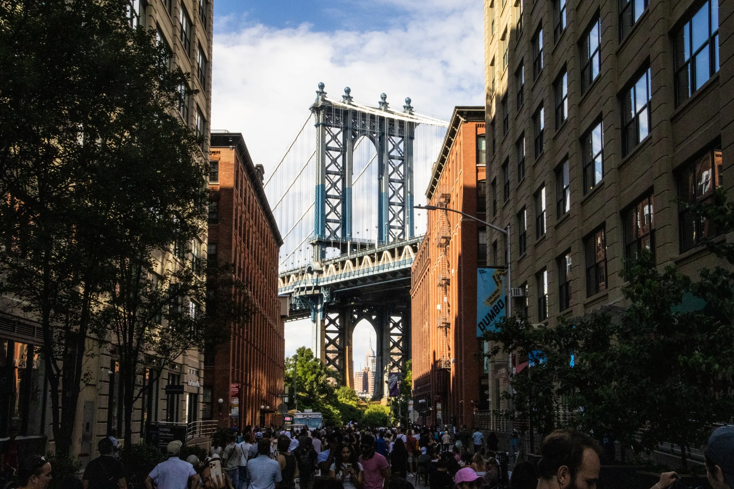
As one of the 5 boroughs of New York City (the others being Manhattan, The Bronx, Staten Island, and Queens), it’s home to some 2.6 million people, which—if it were a stand-alone city—would make it America’s 4th largest city, nearly as large as Chicago! It has a stand-alone GDP of approximately ~$120B, which—for context—is more than the country of Ethiopia.
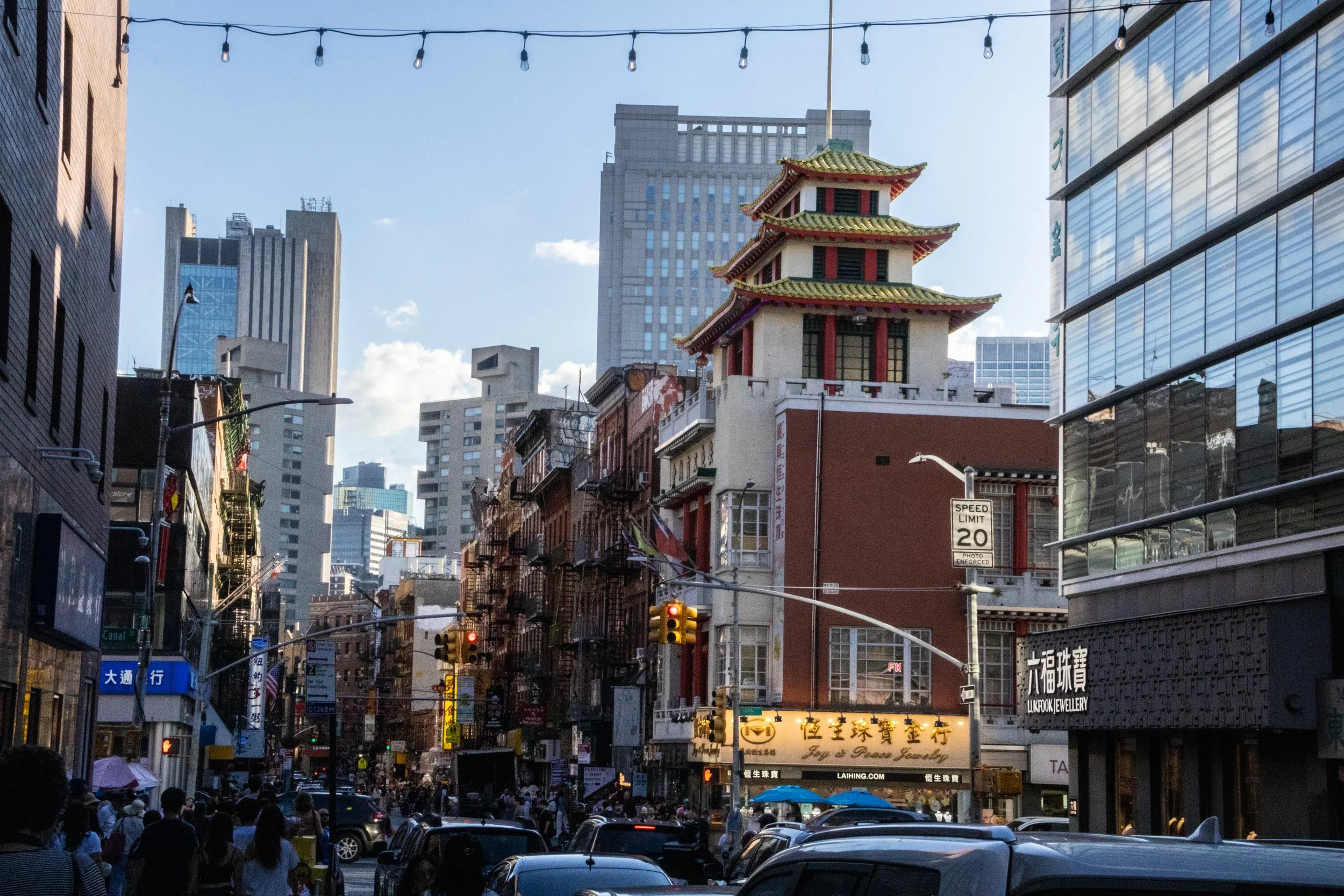
While the ascent of NYC’s Chinatown may have coincided with the shrinkage of Little Italy, giving the impression that the former was “taking over” the latter, the truth is that, by the 1990s, both of them were under equal economic pressure from encroaching gentrification and rising real estate costs. In spite of that Chinatown didn’t start to shrink until the early 2010s. By that point, as had been the case with the Italian immigrants who’d followed a similar path before them to achieve widespread integration into American society, the next generation of this Chinese community soon relocated to other parts of the city, especially Queens and Brooklyn. And just like Italians are now an integral part of the New York identity, this Chinese community is part of the deal now! There are 4th and 5th generation people of Chinese descent walking around New York, which means their families have been here longer even than mine! Cue my recommendation for you to go watch Nora From Queens. Great show.
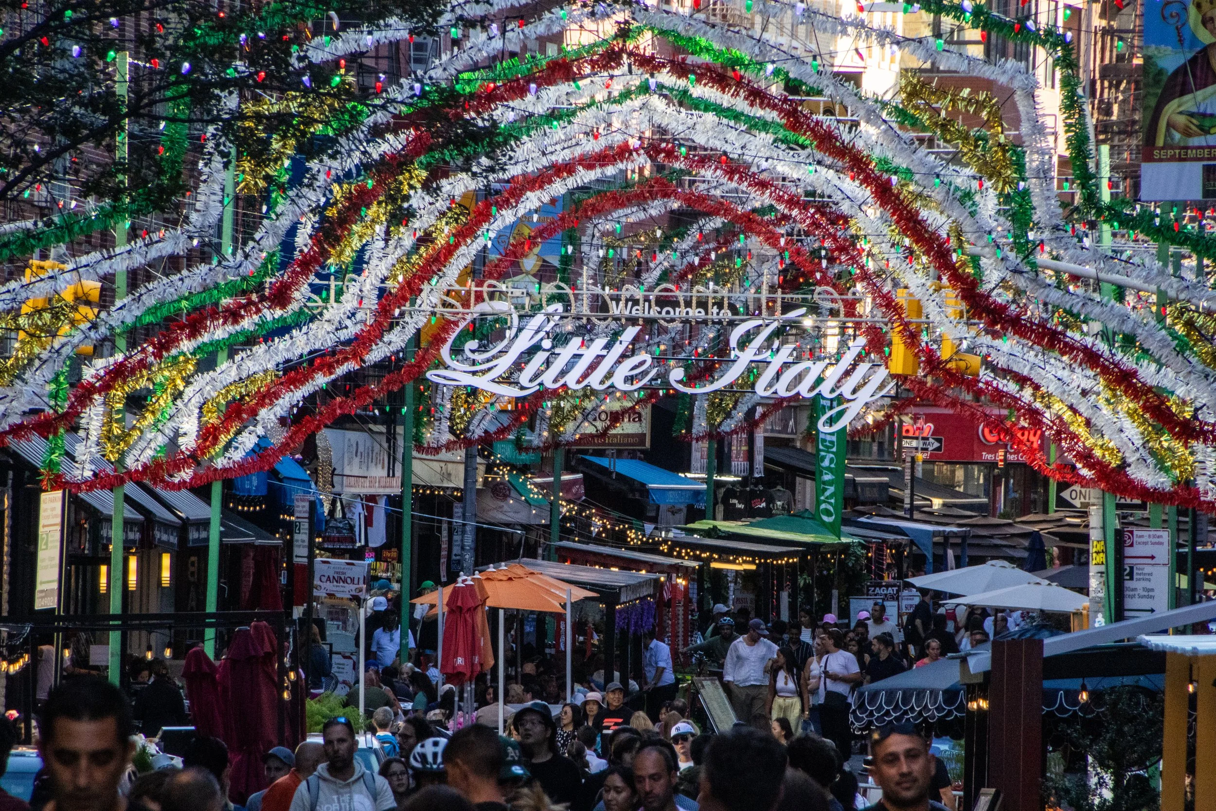
New York City not just one thing; the whole is formed of many thousands of individual threads woven and intertwined together. All of these parallel realities existing on top of each other is a big part of what makes New York so captivating… but some of these threads are more visible to the outside than others. One of New York’s most visible threads is its status as ground-zero for Italian-American culture. Yes, from Frank Sinatra to George Costanza, few immigrant communities in the US managed to balance the simultaneous integration with American society with the maintenance of a shared collective sense of identity like the Italians. Ironically, Italian-American culture has strayed hilariously far from actual Italian culture at this point; the two groups barely even claim each other at this point! But, within the U.S. at least, this shared homeland is a powerful unifier. Indeed, there are about 16 million Americans (~4.8% of the population) that have some level of Italian lineage, including yours truly. 🍕
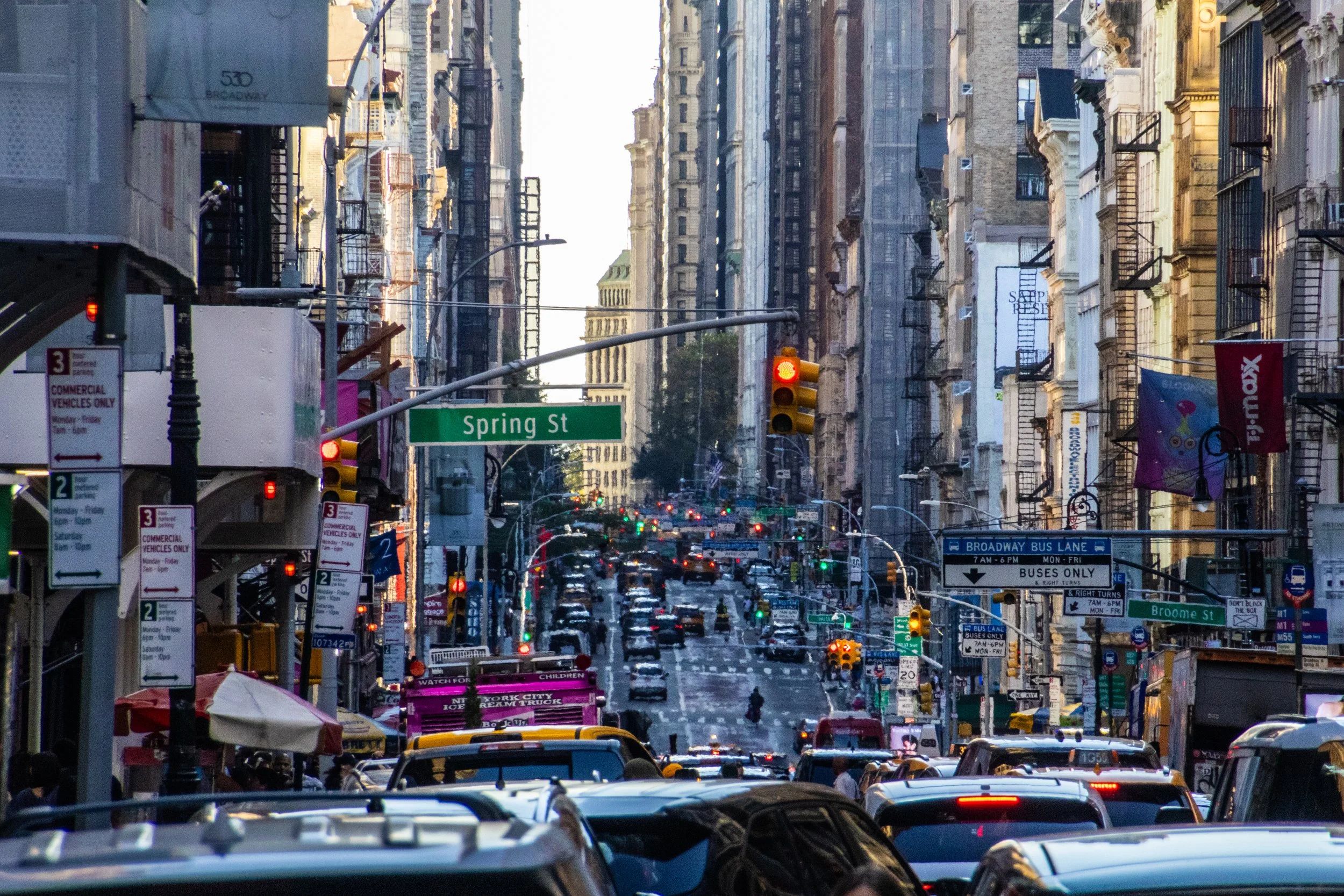
Although the beginnings of the U.S. as we know it today began with British roots, New York City actually began as a Dutch colony called New Amsterdam. It passed into British hands in 1664 and actually served as the capital city of the newly independent United States from 1785 to 1790. So it has been vitally important since the very beginning. As of 2023, the city alone (its metro area, that is) had a stand-alone GDP of $2.30 trillion, making it the most valuable city in the world. In fact, if treated as an independent country, New York City would rank within the top 10 largest economies in the world, ranking above Italy, Canada, and Australia, to name a few. For a domestic point of comparison, the next largest economy in the United States is Los Angeles with an approximate GDP of $1.1 trillion.
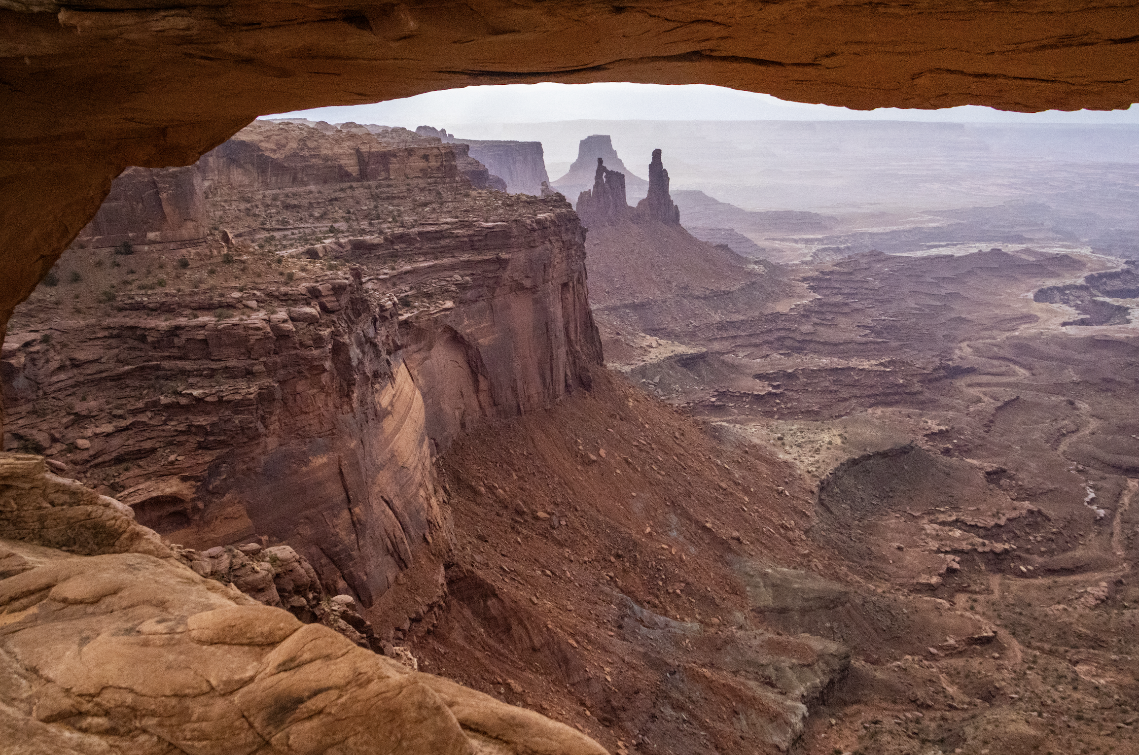
Finally, we arrive at Canyonlands National Park, which is the largest and most remote place we will visit on this trip by far. A couple hours southwest of Moab and Arches, Canyonlands spans an area of more than 300,000 acres. It is not a place that can be seen fully in a single day… but we’re going to do our best. Indeed, this particular trip will be most confined to the northern regions of the park, but I want to underscore that there is a LOT more of this landscape that we won’t see today.
As you will see, Canyonlands is a VAST area of canyons carved by mighty rivers that still flow through them to this day. Thousands of feet above the water, towering mesas look out across seemingly endless canyon-scapes. It offers more than a few STUNNING views.
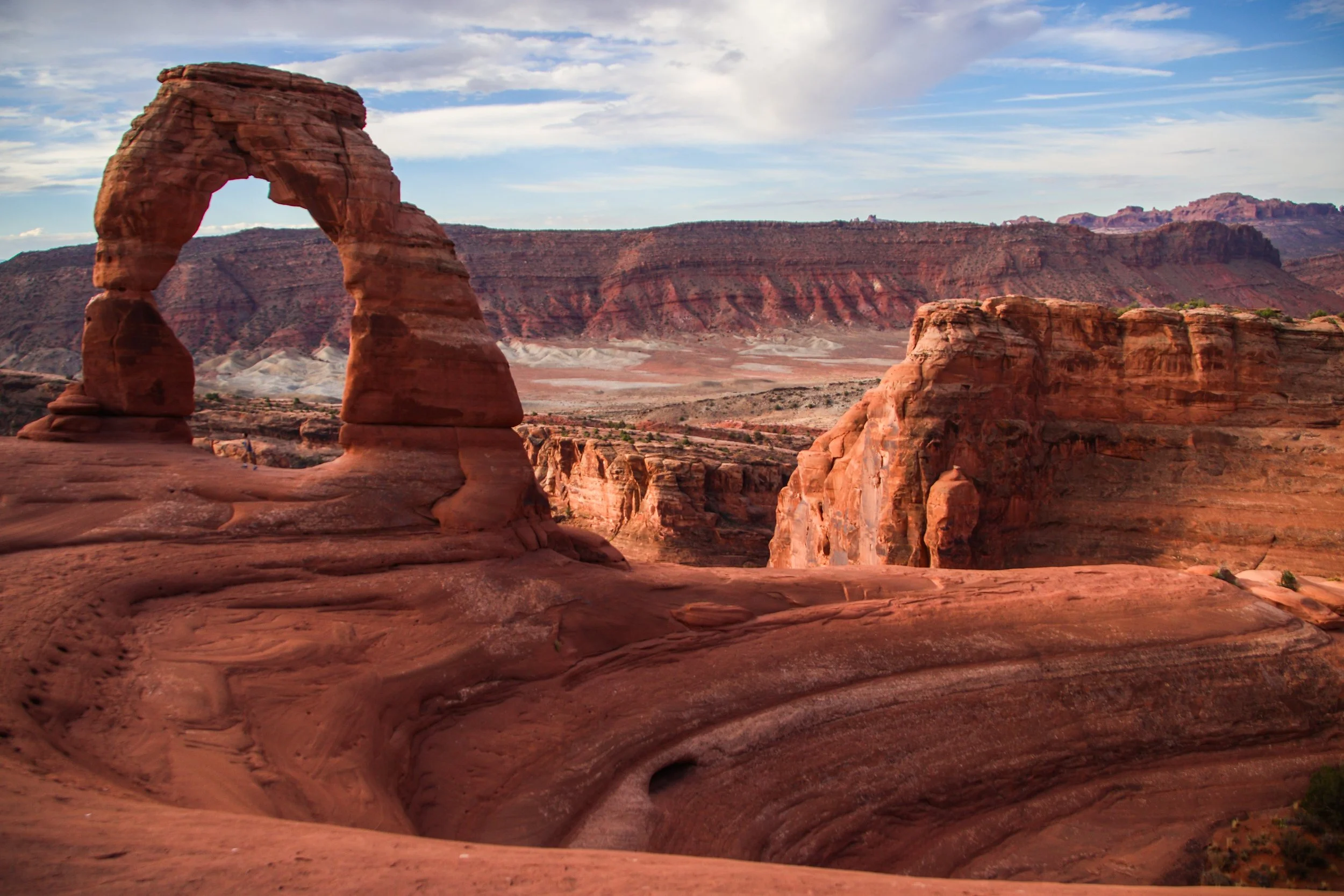
There are lots of famous rock formations in Arches National Park, but the most famous of them all is called “Delicate Arch”. We wanted to get there early in the day and experience sunrise within the park, which meant that we have to get moving at the butt-crack of dawn. In the gentle early morning light, our rental car carried us out of Moab and up a steep switch-back road into the park. Mind you that Moab is already ~4,025 ft (1,227 m) above sea-level. Arches actually gets as high as ~5,653 ft (~1,723 m) above sea-level, and—despite being only ~5 miles (8 km) away from downtown Moab—is usually 5–10°F (~3-6° C) colder. That being said, both Moab and Arches get HOT in the summer. The record high in Moab was 114°F (~46°C), and summer highs frequently exceed in 100°F (38°C) within Arches. So, heat is a hazard here! Consequently, sunrise/sunset exploration tends to be preferred, with many visitors retreating to Moab for a nice air-conditioned siesta in the middle of the day.
There are few cities on earth—certainly none more notable than Barcelona—whose architectural identities have been shaped so profoundly by just 1 person. Sure, other famous architects have left their mark on some of the other great cities of the world over the years, but none that I can think of whose work has so strongly and completely defined the identity of a single city as Antoni Gaudí for Barcelona. You may never have even heard of Gaudí, but if you know anything about Barcelona, chances are good that when you picture this city, you are picturing something that originated in this guy’s imagination.