


Peter's Big Adventure in Chronological Order
This blog evolves through time. Here are the (metaphorical) DVD box sets.
Peter's Big Adventure in Chronological Order
This blog evolves through time. Here are the (metaphorical) DVD box sets.
Seasons of Peter’s Big Adventure 🍂
Season 4 (2023 - Present)
Countries Visited: Austria 🇦🇹 + Canada 🇨🇦 + Denmark 🇩🇰 + England 🏴 + France 🇫🇷 + India 🇮🇳 + Italy 🇮🇹 + Kenya 🇰🇪 + Norway 🇳🇴 + Oman 🇴🇲 + Poland 🇵🇱 + Portugal 🇵🇹 + Scotland 🏴 + Sri Lanka 🇱🇰 + Spain 🇪🇸 + Sweden 🇸🇪 + Türkiye (Turkey) 🇹🇷 + United States 🇺🇸
Season 3 (2019 - 2023)
Countries Visited: Armenia 🇦🇲 + Canada 🇨🇦 + Georgia 🇬🇪 + Mexico 🇲🇽 + United States 🇺🇸
Season 2 (2017 - 2019)
Countries Visited: Algeria 🇩🇿 + Cuba 🇨🇺 + Canada 🇨🇦 + Czechia (Czech Republic) 🇨🇿 + Iceland 🇮🇸 + Italy 🇮🇹 + Malta 🇲🇹 + Netherlands 🇳🇱 + Spain 🇪🇸 + Switzerland 🇨🇭 + Tunisia 🇹🇳 + United States 🇺🇸 + Vatican City 🇻🇦
Season 1 (2014 - 2016)
Countries Visited: Bangladesh 🇧🇩 + Myanmar (Burma) 🇲🇲 + Cambodia 🇰🇭 + Hong Kong 🇭🇰 + India 🇮🇳 + Indonesia 🇮🇩 + Italy 🇮🇹 + Malaysia 🇲🇾 + Singapore 🇸🇬 + Thailand 🇹🇭 + Türkiye (Turkey) 🇹🇷 + Vietnam 🇻🇳
Season 4
AIRING NOW
Season 4
AIRING NOW
Major Series in Season 4 (so far) 📎
Moving To & Living In: London 🇬🇧 + Paris 🇫🇷
Scandinavian Hat-Trick: 🇸🇪 + 🇩🇰 + 🇳🇴
Spring in Lisboa + Hiking Madeira 🇵🇹
Exploring Spanish Basque Country 🇪🇸
Return to India: Rajasthan, Goa, & more 🇮🇳
US Adventures: Utah, Colorado, NYC 🇺🇸
Sub-Saharan Africa: Kenya 🇰🇪 & Tanzania 🇹🇿
Autumn in Vienna, Austria 🇦🇹
Roadtripping Oman 🇴🇲
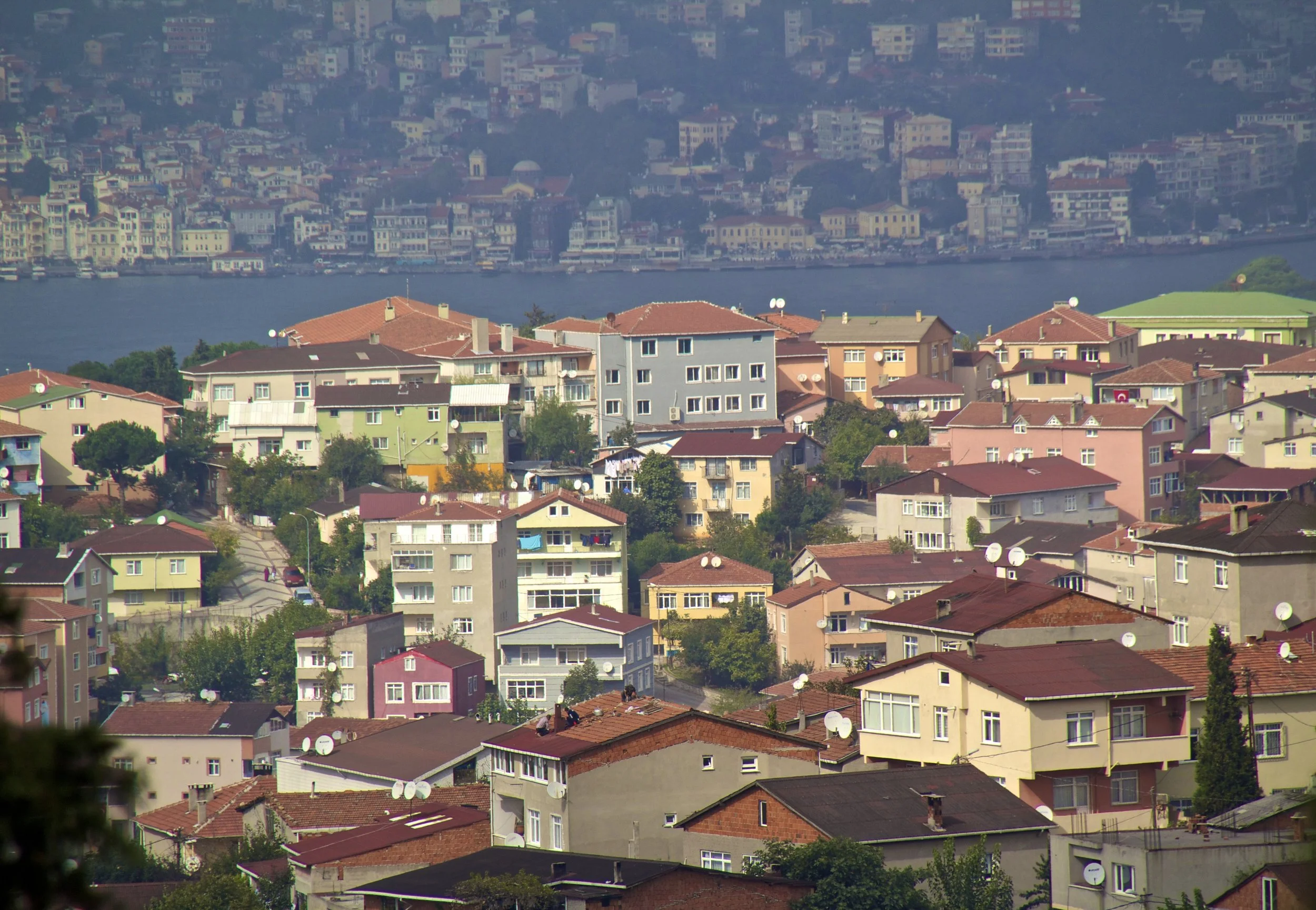
Wandering Around Istanbul, Türkiye 🇹🇷
Assorted European Soccer (Football) Matches ⚽️
As Always, Lots of Street Art 🎨
Most recent season 4 Articles ⭐️
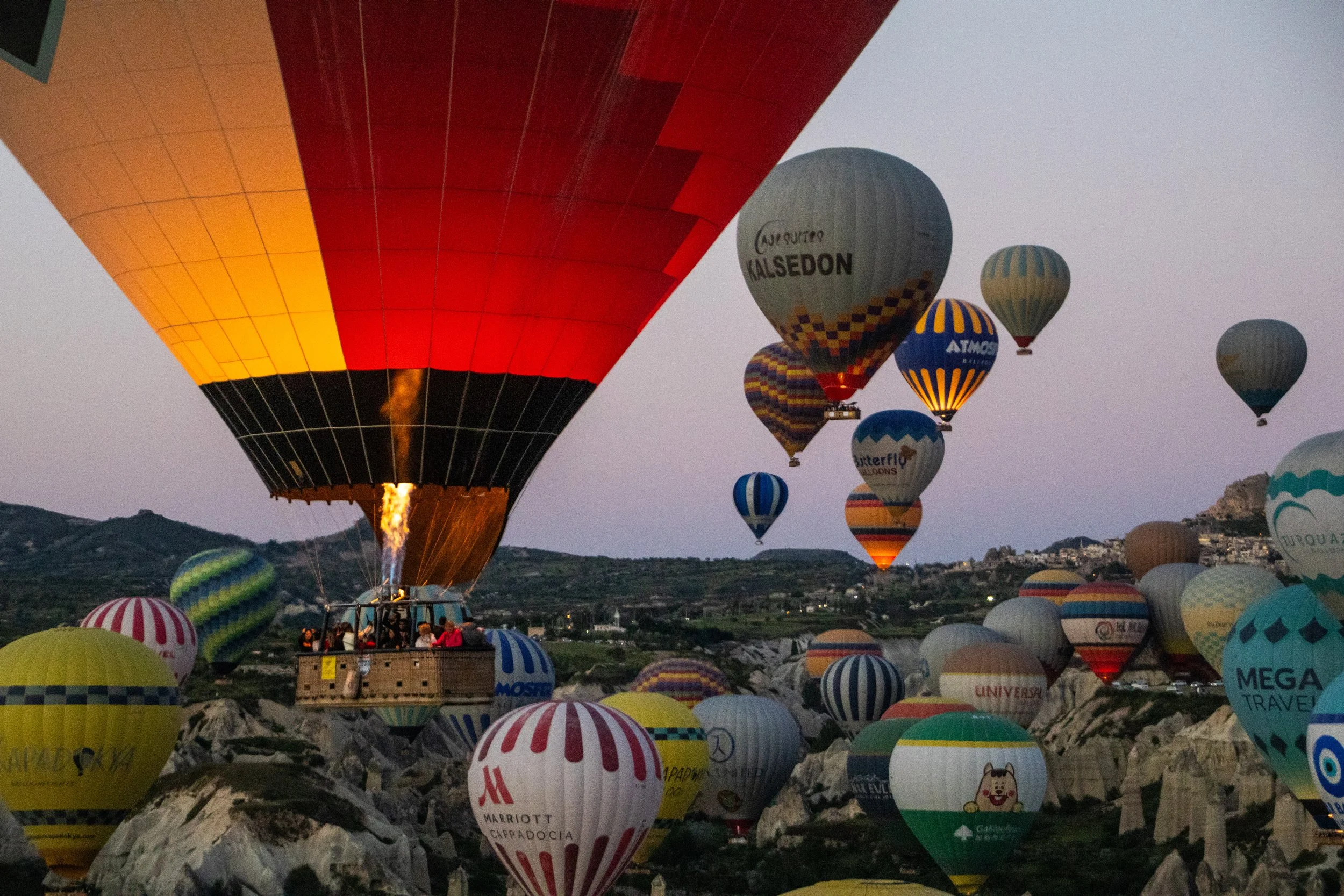
Here’s how hot air balloons work: heated air is less dense than cool air, so an injection of hot air will make the balloon rise, and letting hot air out will make the balloon descend. So, above the basket, there’s a massive burner that shoots flames vertically up into the balloon. And, at the top of the balloon, there is a small hole that the driver can open and close to let out hot air when they want to go down. Add all that up… and I wasn’t feeling too good about this. BUT, in 2025, an estimated 750,000 people did hot air balloon rides in Cappadocia, and every single one of them was fine. So, it was time to face my fears on this one.
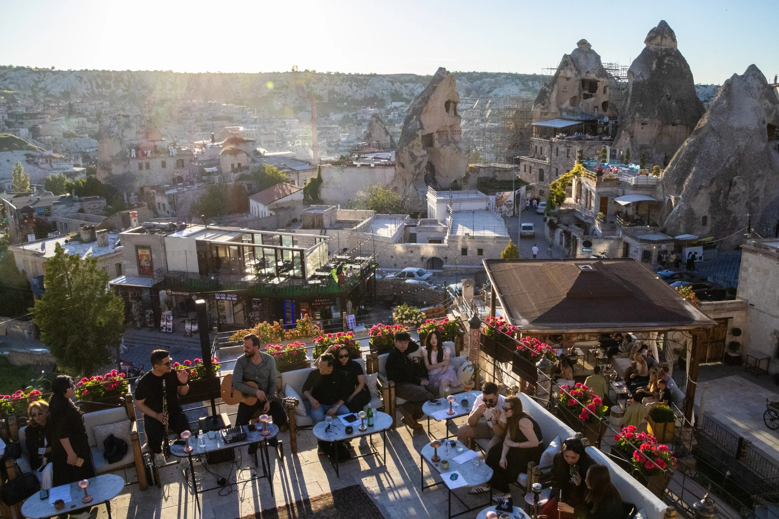
I realized in writing this article that I was a bit fuzzy on what the word “Anatolian” actually means. I’ll admit it! So, here’s a quick clarification: while the region known as “Anatolia” has basically the same boundaries as modern day Türkiye, the name “Türkiye” is derived from Turkish ethnic and cultural identity. Anatolia had been a hotbed of civilization for eons before the Turks showed up. To give a few examples, people groups such as the Hittites, Luwians, Phrygians, Lydians, Romans—and, approaching groups more relevant to the 21st century now—Persians, Greeks, Armenians, and Kurds ALL fall under the “Anatolian” umbrella, in part or in full. That’s why you’ll hear historians say things like “ancient Anatolian civilizations” rather than “ancient Turkish civilizations.” The Turks are the new kids on the block.
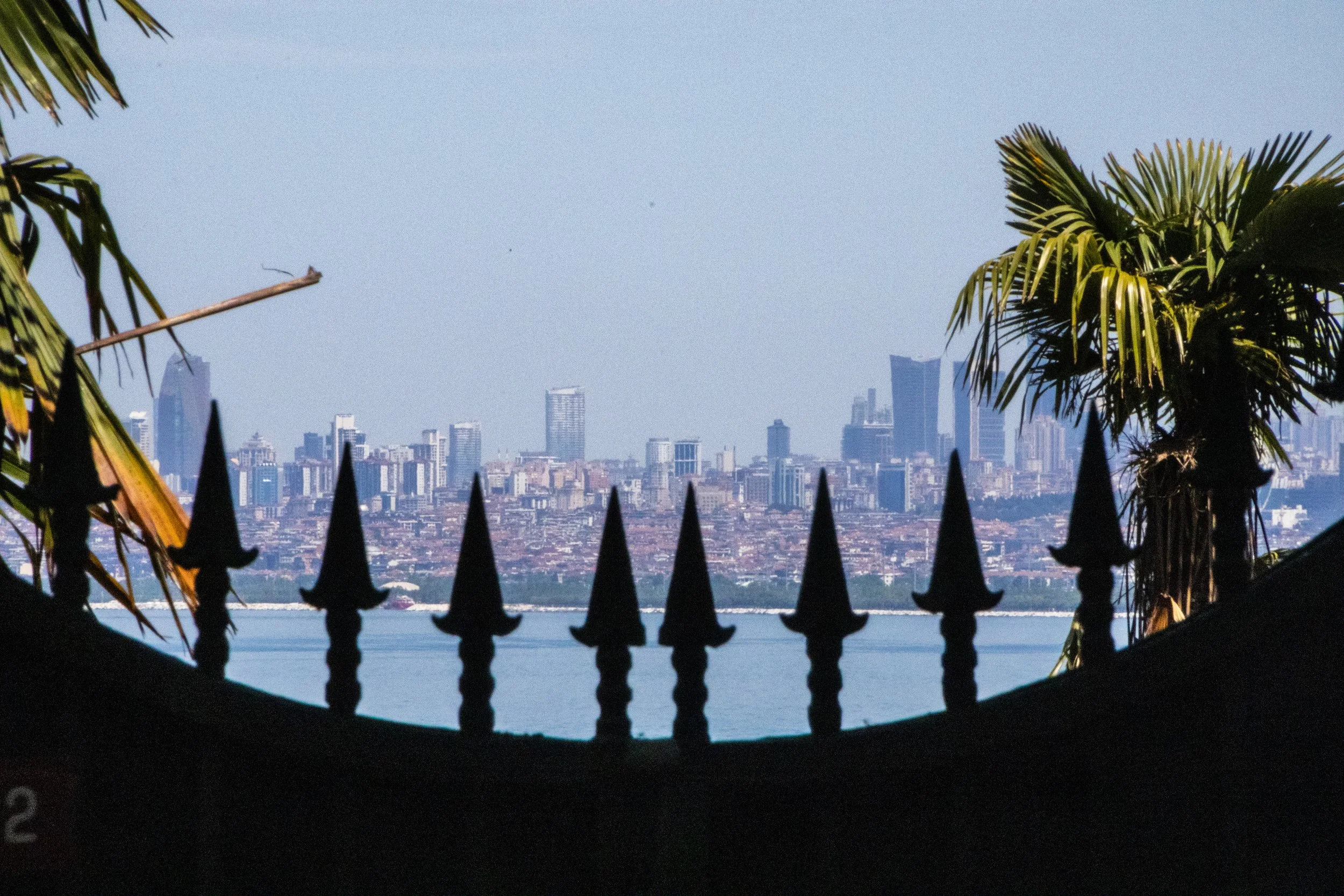
Istanbul has a chain of islands just off the coast that contain full-on neighborhoods. The Princes’ Islands are a chain of 9 islands just off the coast of Istanbul in the Sea of Marmara, but only 4 of them have substantial populations: Büyükada, Heybeliada, Burgazada and Kınalıada. Combined, they constitute the Adalar district of Istanbul. This is an interesting area to explore not only for the scenery, but because these islands embody and preserve the diversity of Istanbul in some fascinating ways.
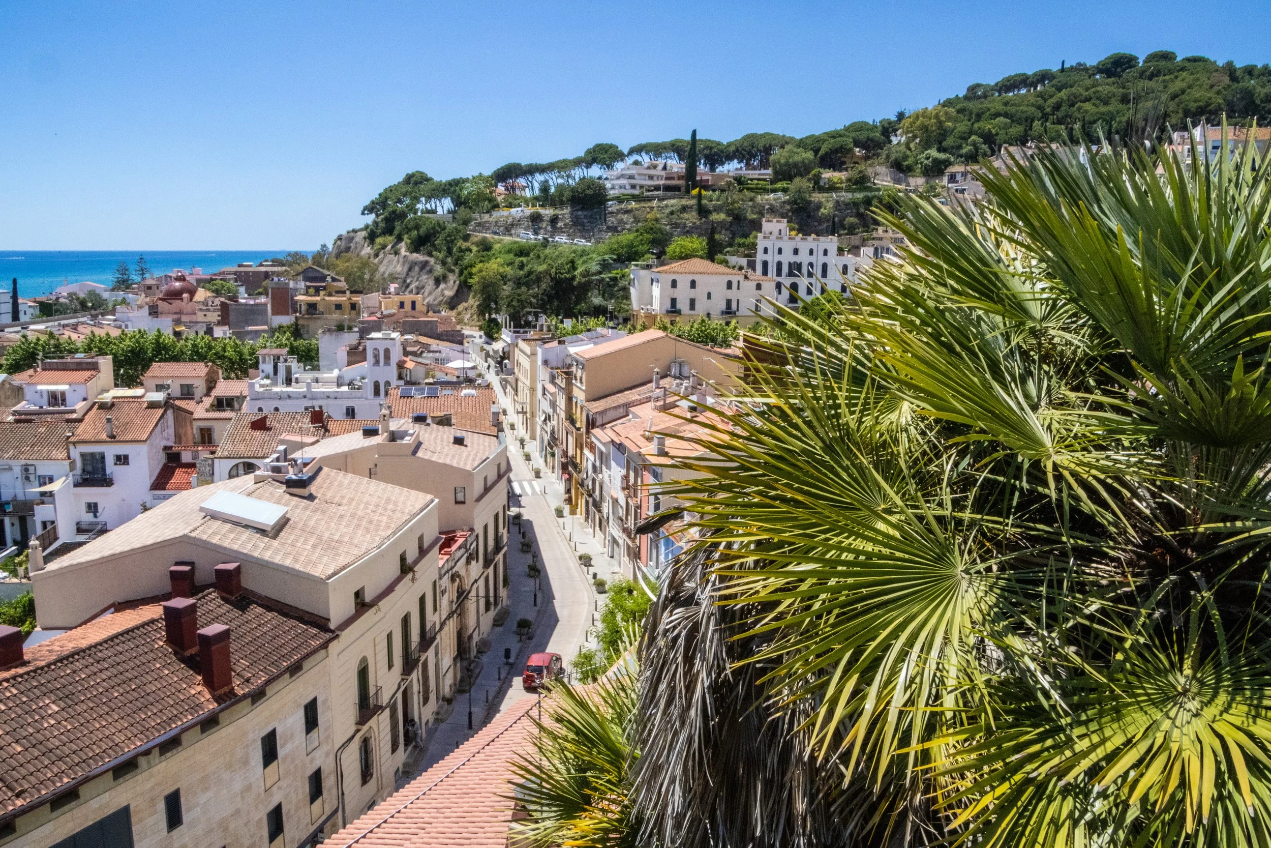
As chance would have it, on a quick errand into town, we’d spotted an old brick tower protruding through the trees off in the distance. We were standing on a ridge when we spotted it, and this was on the ridge opposite us, with a valley in between. THIS, we decided, WAS THE DESTINATION FOR OUR QUEST.
Honestly, if we never found our way up to this tower, that would be fine. But it gave us something to orient ourselves toward. The journey is what counts, right?
Well, the journey did not disappoint!
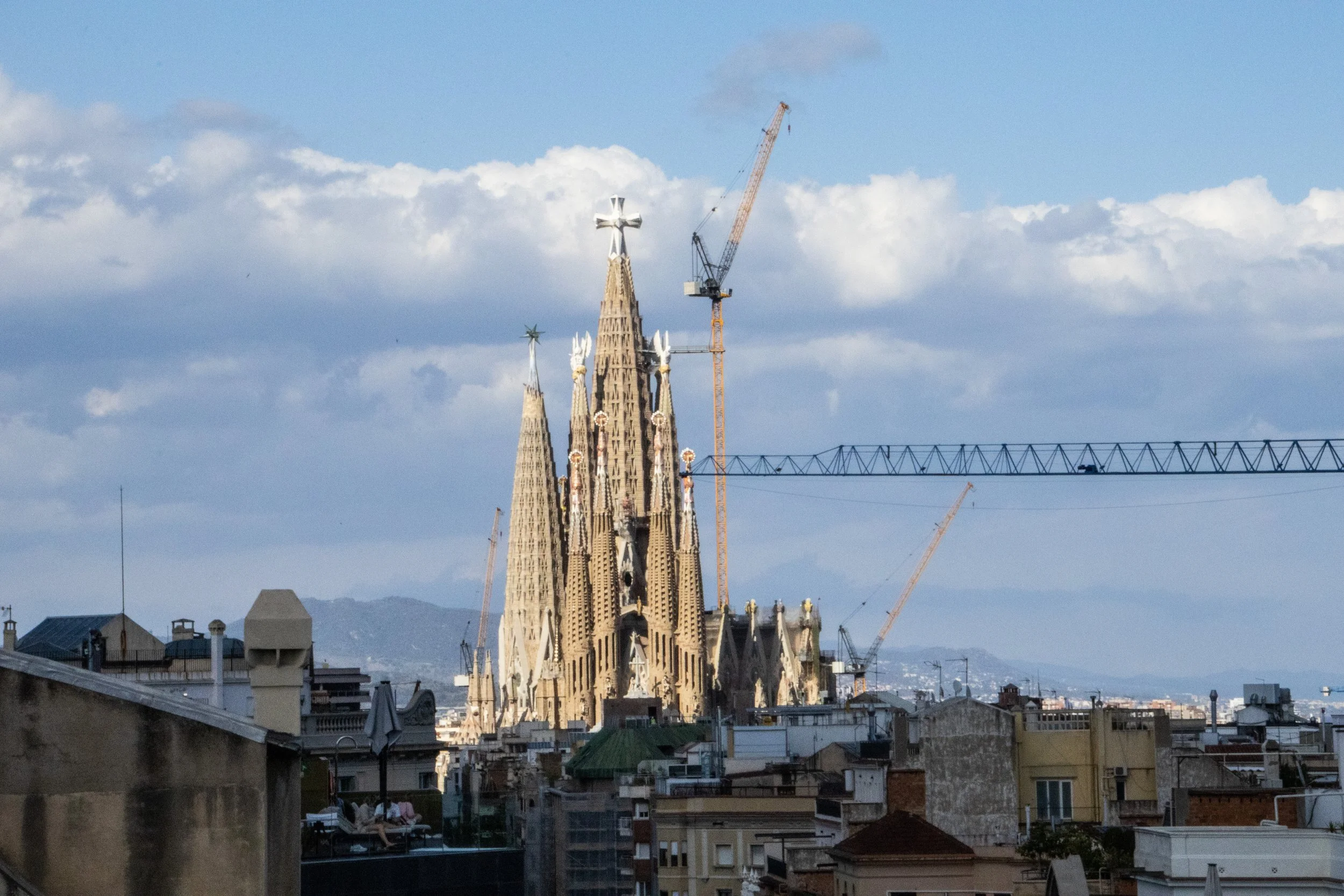
There are few cities on earth—certainly none more notable than Barcelona—whose architectural identities have been shaped so profoundly by just 1 person. Sure, other famous architects have left their mark on some of the other great cities of the world over the years, but none that I can think of whose work has so strongly and completely defined the identity of a single city as Antoni Gaudí for Barcelona. You may never have even heard of Gaudí, but if you know anything about Barcelona, chances are good that when you picture this city, you are picturing something that originated in this guy’s imagination.
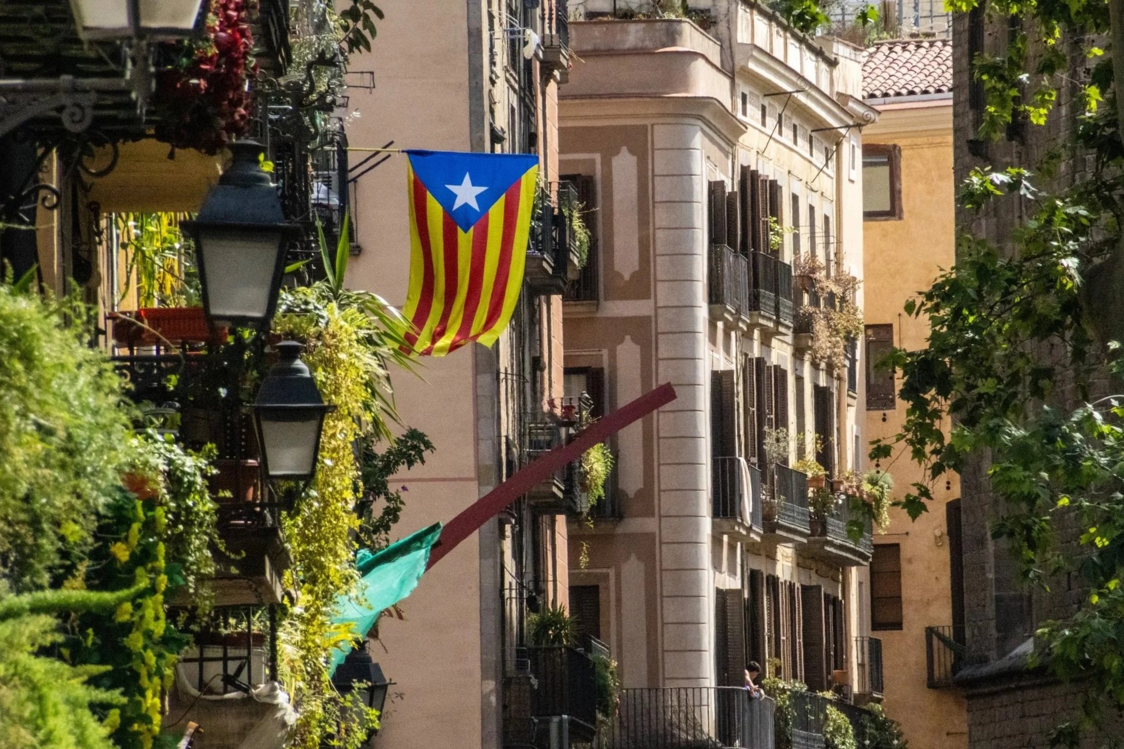
With a metro area population of ~ 5.5 million people, Barcelona is the 2nd largest city in Spain, behind only Madrid. By basically every quantifiable metric— population, economy, political power, etc.—Madrid is the larger city. But when it comes to travel, especially international travel, this relationship reverses. Barcelona is far-and-away the favorite destination for international tourists visiting Spain. And, when you consider the fact that Barcelona also covers a much smaller land area than Madrid, the concentration of international tourists becomes much more intense. Barcelona has indeed struggled to accommodate the levels of tourism it is now receiving, but it’s easy to see why the whole world is so interested in coming here! Sandwiched between the Collserola mountains and the Mediterranean Sea, Barcelona is an absolutely idyllic city. And once you’re in the middle of it, it’s incredible how quickly the Catalan identity eclipses that of Spain.
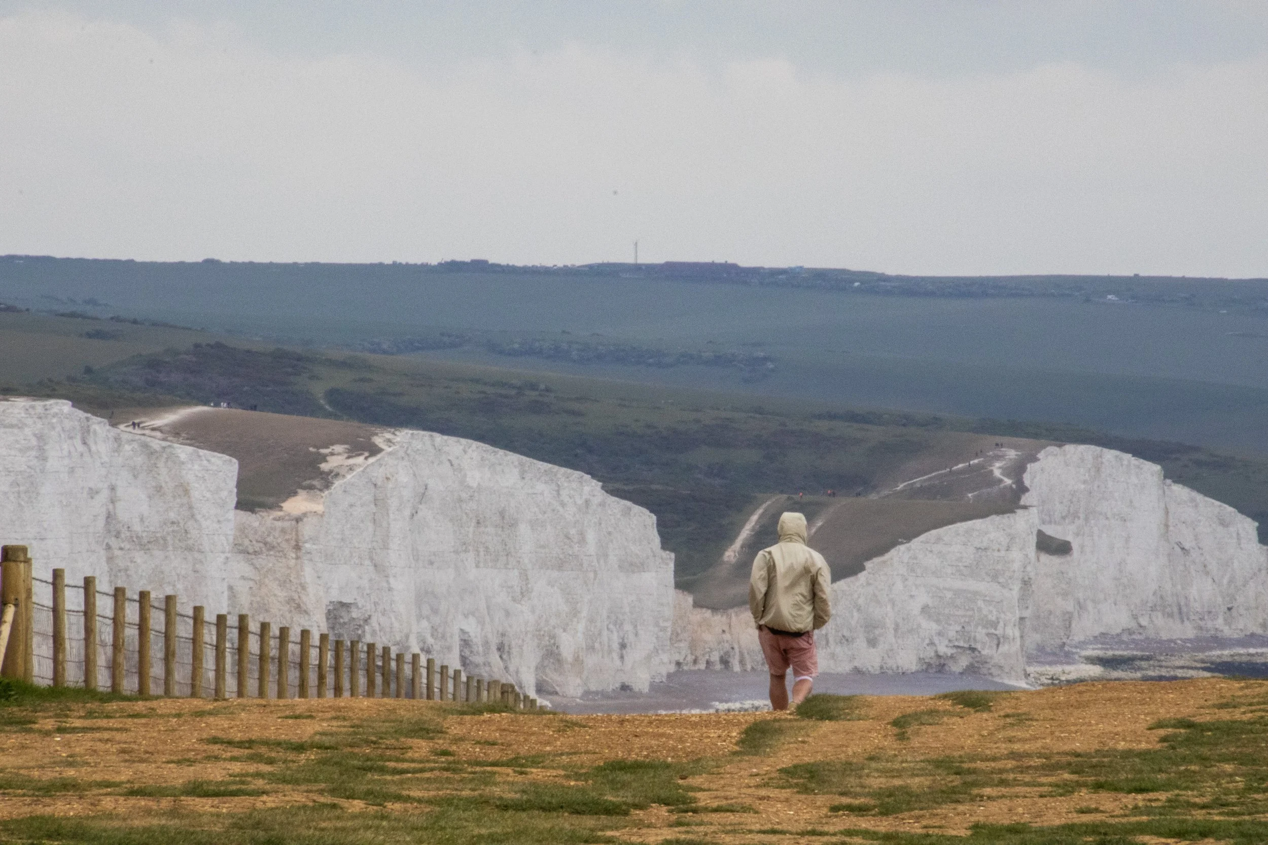
So, the “Sisters” are a series of massive hills that have each essentially been sliced down the middle by natural erosive processes to reveal massive, sheer cliffs that stretch along the English coastline like a series of rolling waves. To make the scene all the more striking, these cliffs are entirely white. Perhaps you’ve heard of the “White Cliffs of Dover”? This is part of the same system of cliffs, which is called the “South Downs”, but Seven Sisters is arguably even more iconic because the entire stretch has been kept completely natural and undeveloped. The white color comes from the fact that the earth here is made of an extraordinarily pure form of limestone: chalk! Indeed, the earth here contains about 98–99% calcium carbonate, with very little clay or sand, making them appear dazzlingly white! They stay so white because they are in a constant cycle of erosion, where after some time the outer layers of chalk crumble away revealing fresh, white chalk.
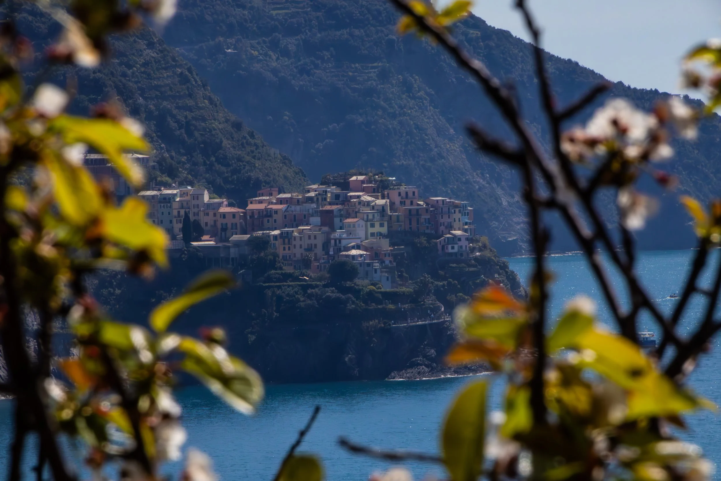
“Cinque Terre” literally translates to 5 lands, and indeed, it is not 1 place, but 5 places. It is a collection of 5 historic towns dotting the rugged, mountainous Mediterranean coastline between La Spezia and Genoa. These towns emerged between 1000 and 1200 AD, and—in their prime—were able to flourish because they combined fishing, boat building, agriculture, and maritime trade. You’ll hear them referred to just as “fishing villages” but that is only part of the story. Agriculture is also massively important to the appearance of these towns even today. The main staple of these towns, in additional to olives, was wine.
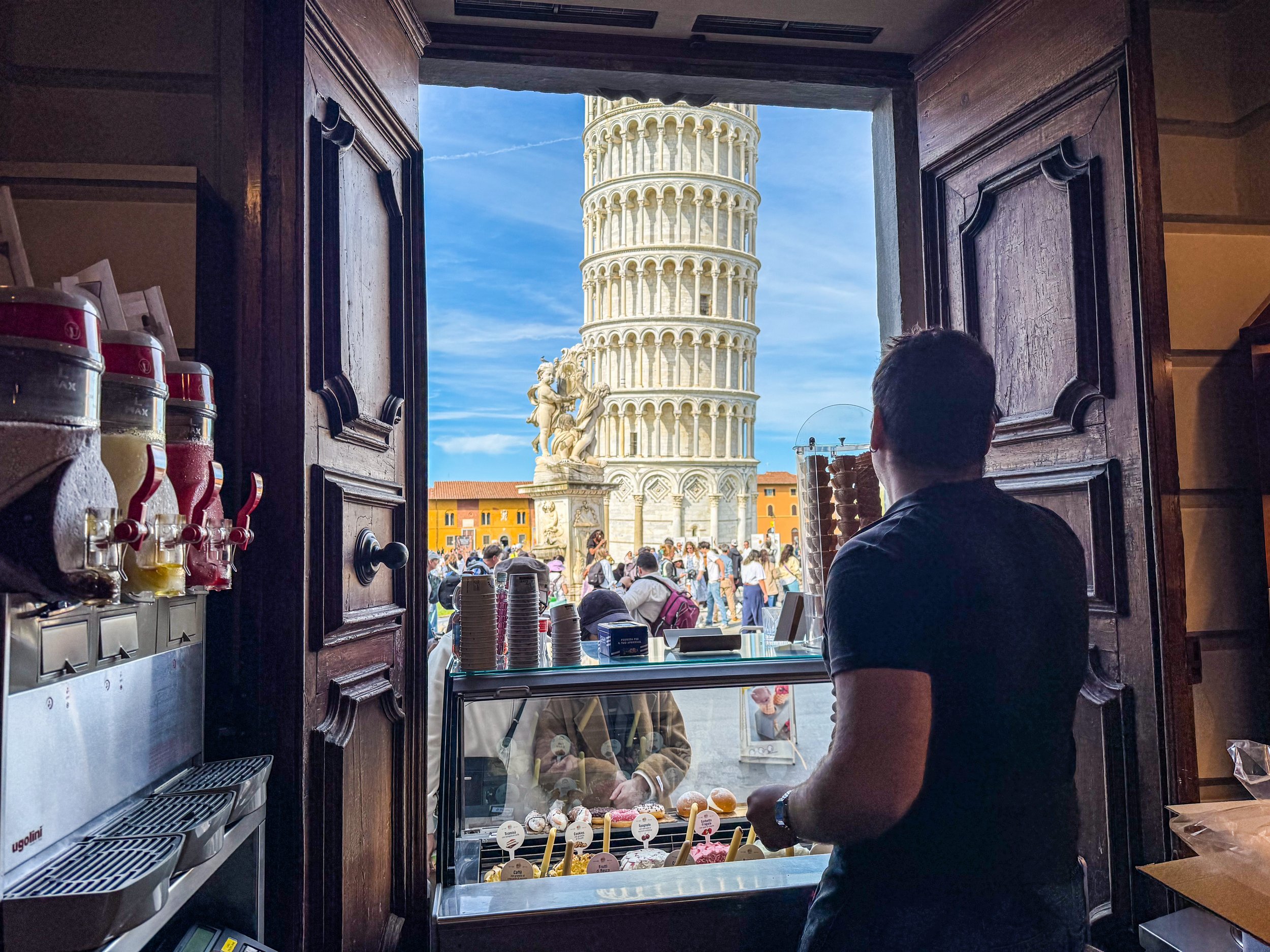
I doubt you will be surprised to learn that the Leaning Tower of Pisa was actually not supposed to lean. In 1173, when work began on this structure, the intention was for it to just be your typical free-standing bell tower. Although I should acknowledge that there was really nothing “typical” about this in the 1100s; Italy was leaps and bounds ahead of (most of) the rest of the world, which is part of what makes these sites so incredible. Anyway, construction took about 200 years, including an almost 100-year-long pause due to wars and political instability. It was officially finished in 1372.
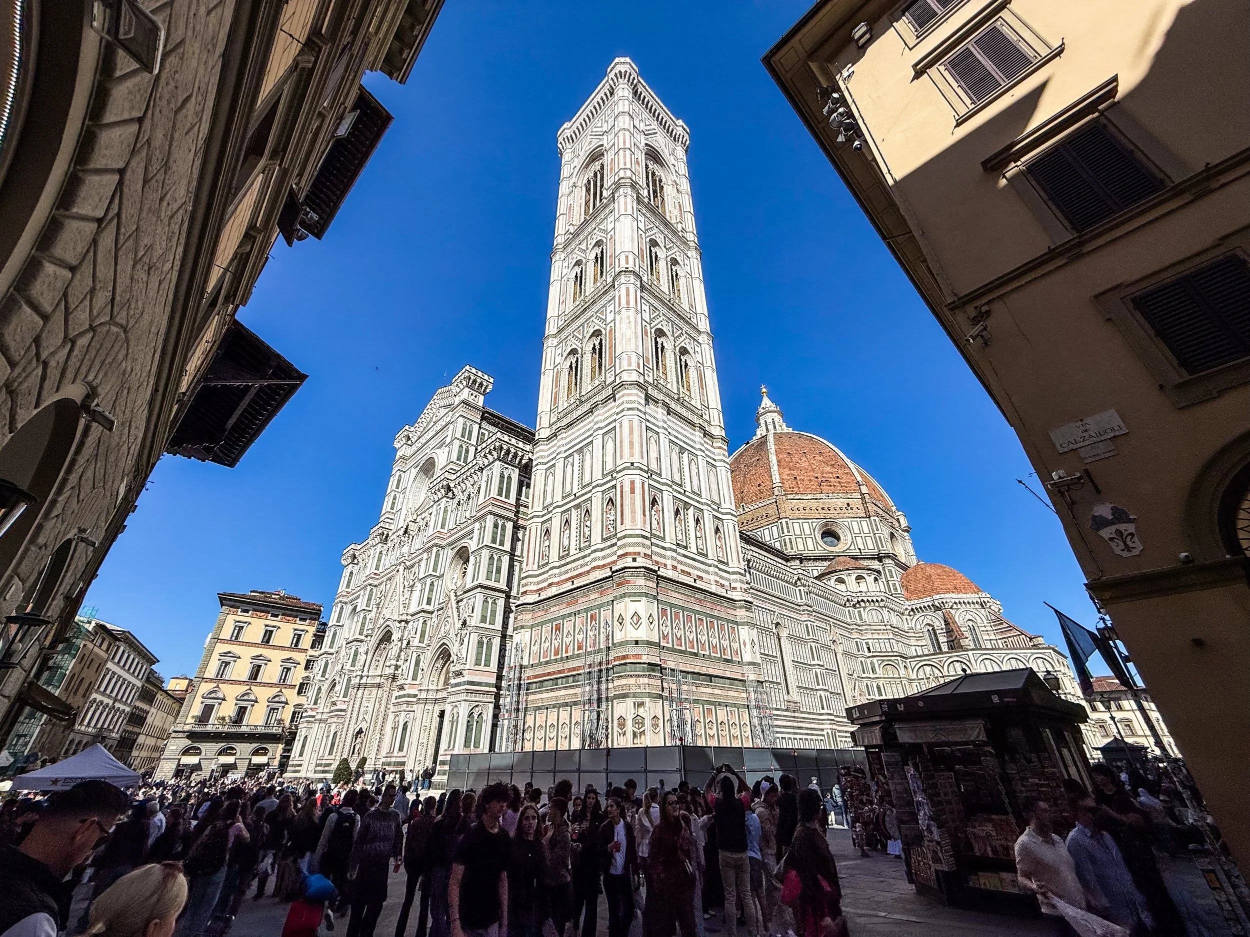
Although Florence was founded under the Romans in 59 BC, its meteoric rise did not begin until about ~1,000 AD. The intervening years saw Florence weather Gothic invasions, Byzantine rule, Lombard control, Frankish conquest under Charlemagne. A thousand years of the same struggle for incremental gains that most every city in the world was experiencing, until Florence’s petri dish yielded something entirely unique. Going into the 1400s, Florence had a unique combination of enormous private wealth, political competition, educated merchants, civic pride, and intense rivalry among wealthy families. You might assume that they the powers that be would opt to duke out their competitions in war, business, and industry (and there was certainly some of this), but the Florentine elite chose a new arena for competition: the arts. You may have heard of the Medici? This was one of those wealthy families that is famously supported some of the artists that would establish Florence as a cultural juggernaut and kick-start the Renaissance. They even have their own Netflix show now.
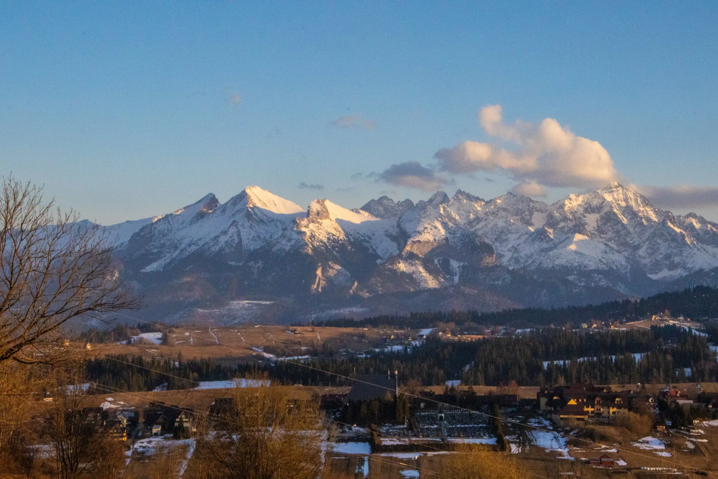
Poland’s reputation is for being an overwhelmingly flat country, and that is mostly true, but its far southern border, which it shares with Slovakia, is marked by a particularly jagged section of the Carpathians known as the Tatra Mountains. Although they are much smaller than other European mountain ranges—such as the Alps, Pyrenees, and Caucasus—they are extremely dense, rugged, and beautiful. In fact, they are SO beautiful that—although they only stretch about 57 km (35 miles)—the Polish and Slovakian sides receive a combined ~8.5 million visitors per year, skewed toward the Polish side. That makes them the most intensely visited mountain landscape per square kilometer in Europe. And yet, I’d never even heard of them before this trip!
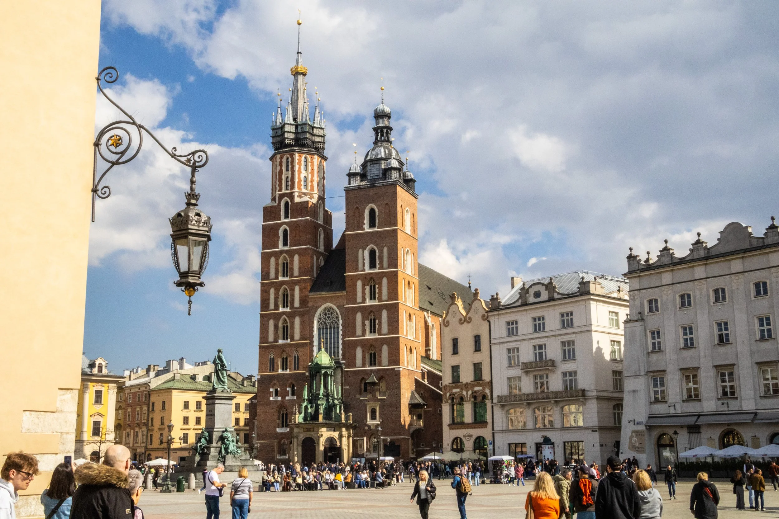
It’s a new country for Peter’s Big Adventure! Welcome to Poland 🇵🇱
Our journey in Poland starts in Krakow. This is a city that I knew first from the WWII history books, and later as a desirable and beautiful European destination that I’d be well-advised to bump up to the top of my priority list of future trips. Indeed, Krakow is many different things to many different groups of people, and today we’re going to do our best to understand as many of these layers as we can. So let’s get started, eh?
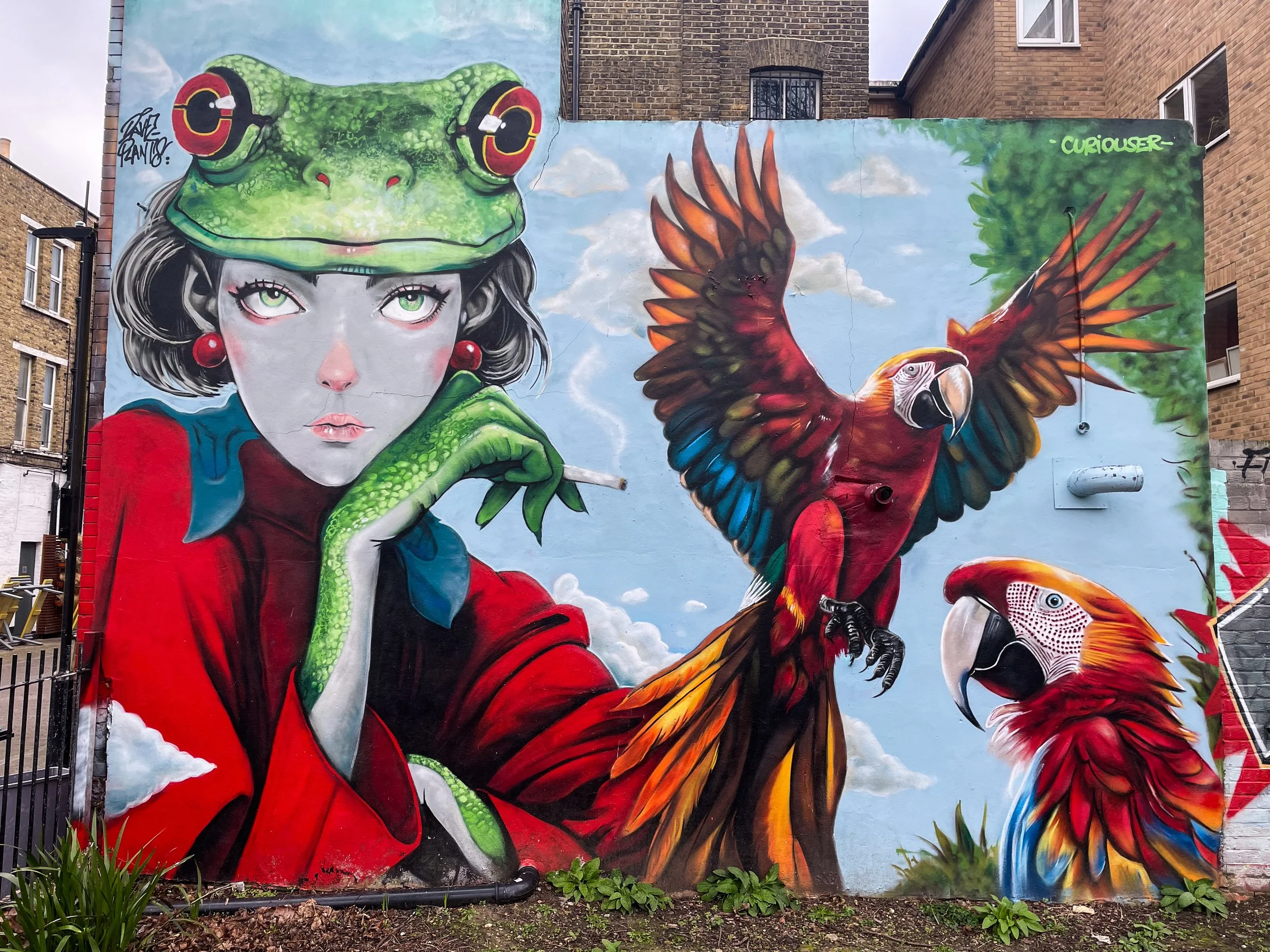
In this article, we’re going to be agnostic with the location within London. Indeed, this article has been sitting around as a ‘draft’ since 2023, and I have just been adding to the gallery every time I walk by a mural in my day-to-day life. So, I stumbled onto all of these randomly, and accordingly, they are really from a random collection of places. I think the London neighborhoods covered here include Camberwell, Stoke Newington, Little Portugal, Bow, Bethnal Green, Walthamstow, Peckham, Hackney, Finsbury Park, Waterloo, Nunhead, Stockwell, Fitzrovia, Clapham, Earl’s Court, Soho, Notting Hill, Streatham… and probably more!
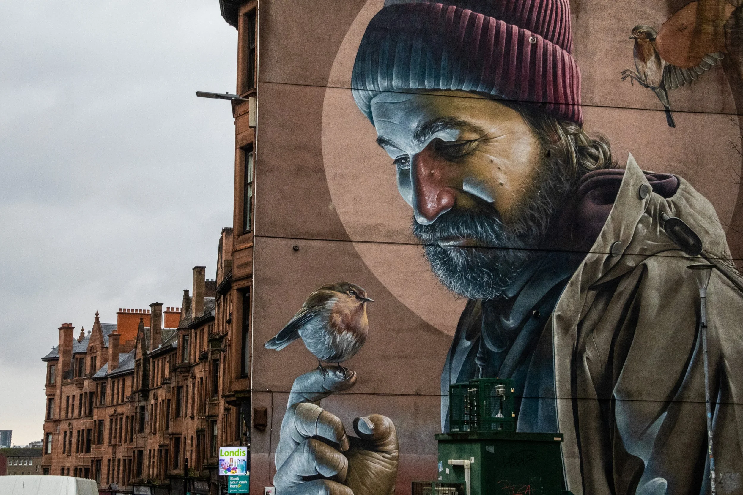
It turns out that Glasgow has a reputation for murals! The one at the top of the gallery below is, perhaps, the most famous of them all. It was done by an Australian-born street artist named Sam Bates, better known under the moniker Smug. He’s offered little information on the intended symbolism of the mural, but because the subject is holding a robin and appears to have some sort of halo—both imagery that were/are commonly associated with St Mungo—the mural has been widely interpreted as a modern St Mungo. The mural’s close proximity to Glasgow Cathedral, which is the resting place of St Mungo, serves to reinforce this.
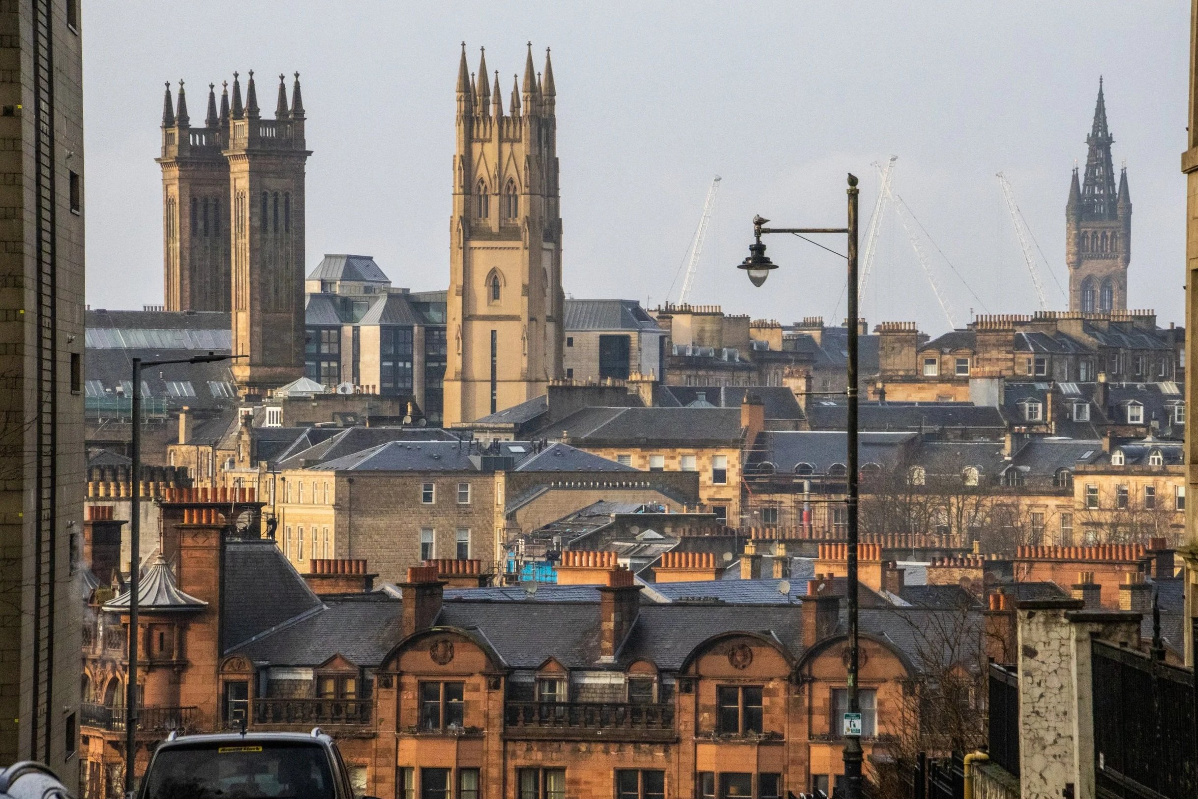
When you think of Scotland, I’m betting you don’t immediately think of Glasgow. You probably think beautiful scenes in the Scottish Highlands, or the charming cobblestone streets of Edinburgh. Indeed, this is the image that Scotland likes to show to the outside world, but the largest city in Scotland is actually not Edinburgh; it’s Glasgow! With a metro area population of ~1.8 million, the joke goes that this is where Scots actually live. It could be said that Edinburgh and Glasgow are two sides of the same coin. They are the largest two cities in Scotland, and they are literally right next to each other at only 70-80km (45-50 miles). Edinburgh is smaller, but it is the administrative, governmental, diplomatic, academic, and financial hub of Scotland. It’s well-connected, it’s expensive, and it’s posh. Glasgow, on the other hand, is none of these things.
You’re gonna love it. 😉
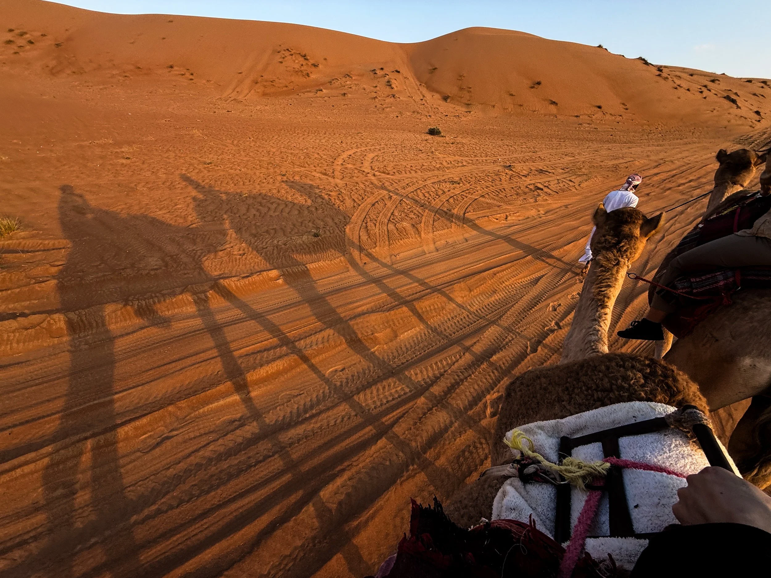
From Saudi to the UAE, to Yemen, to Oman, there are all lots of sub-regions of the Arabian Desert, which have emerged over time based on a combination of local tradition, geographical features, and scientific classification. The geography of this particular corner of the desert is largely dominated by long, parallel dunes (also called longitudinal dunes). A single dune can stretch from 5–20+ km (3–12+ miles) in length. And, in terms of height, they can reach 100 meters high (330 feet). To put that into perspective, that could be roughly equivalent to a 30-storey building!
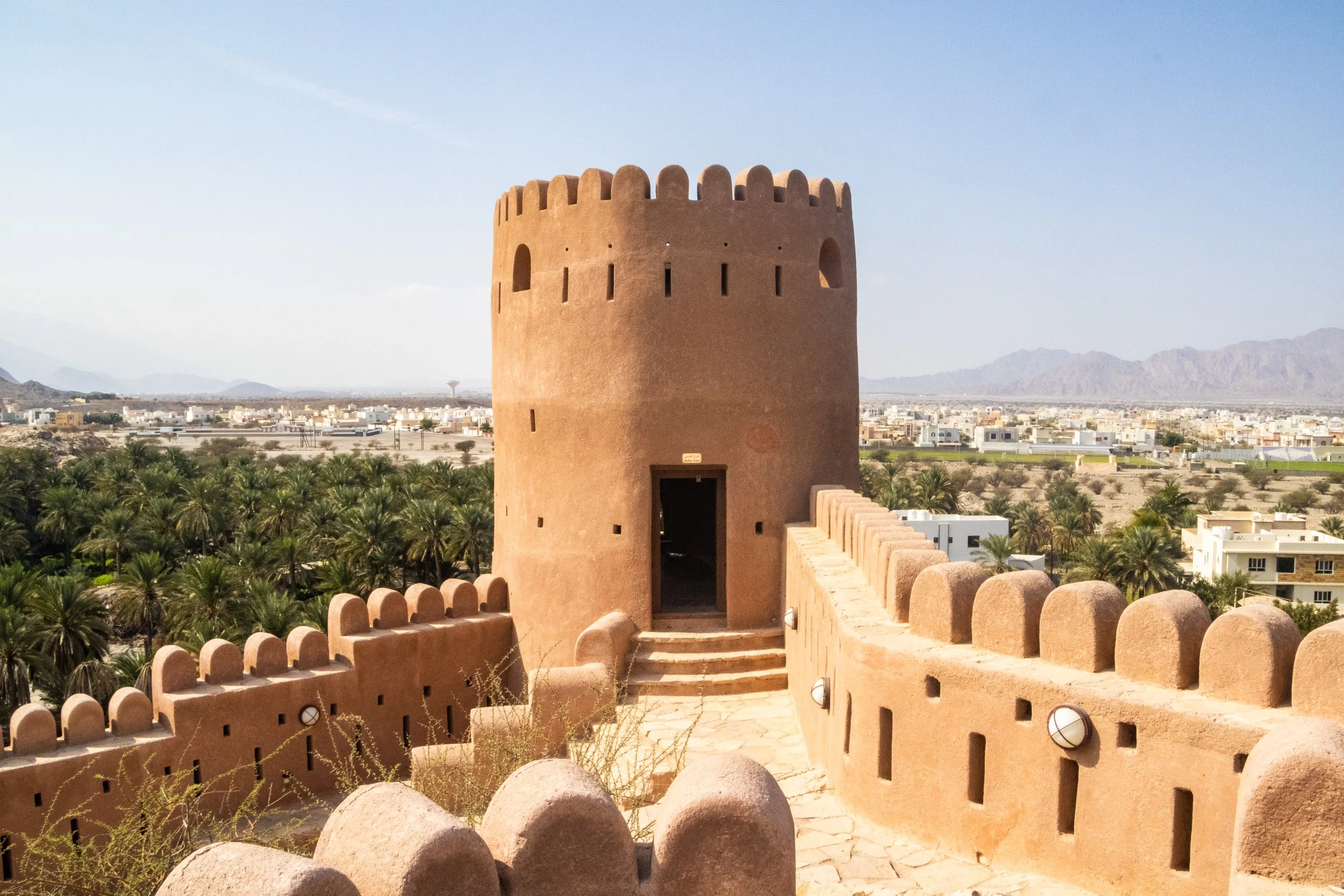
The theme of today is old Arabian fortresses scattered throughout Oman’s Al Hajar mountains. Oman has a lot of these old relics, and we’re going to be visiting 3 of them. We’ll start with Nakhal Fortress, move on to Bahla Fortress, and finish with Nizwa Fortress, which is actually part of a very cool little town bearing the same name. In the past two articles, there was a LOT of information about Oman and the geopolitical neighborhood it calls home. Admittedly, during these articles I was still getting my feet under me in this new country. But this is where we’re going shift gears from educational exploration to something a bit more fun.
So, go use the bathroom now because it’s about 1 hour from Muscat to Nakhal, and we’re not going to stop until we get there. 👀
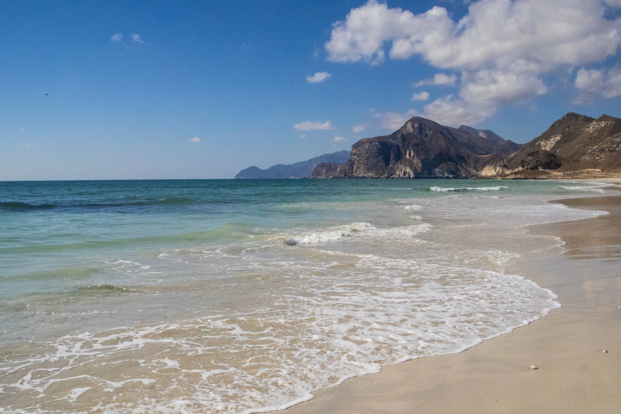
The first time I learned about Dhofar was actually in a BBC nature documentary! Although they are pretty obscure in the wider world, within Arabia the Dhofar mountains are quite famous for the incredible transformation they undergo each year during the monsoon season. During the “Khareef” (the local name for the monsoon season), this whole place transforms from a desert into a massive, green oasis! It happens from June to early September, peaking in July and August and, in addition to being misty and wet (already very unusual within the region), Dhofar also becomes much colder than the rest of the Gulf. There even seasonal waterfalls that pop up all over the mountainous landscape! During this time, there is a huge influx of tourist (mostly from Saudi Arabia and the UAE) that come in to enjoy the greenery and cool temperatures. There is even a Khareef Festival that happens during this time. UNFORTUNATELY, we’re not visiting during the Khareef. This visit happened in mid-December, so Dhofar will be in peak-desert mode.
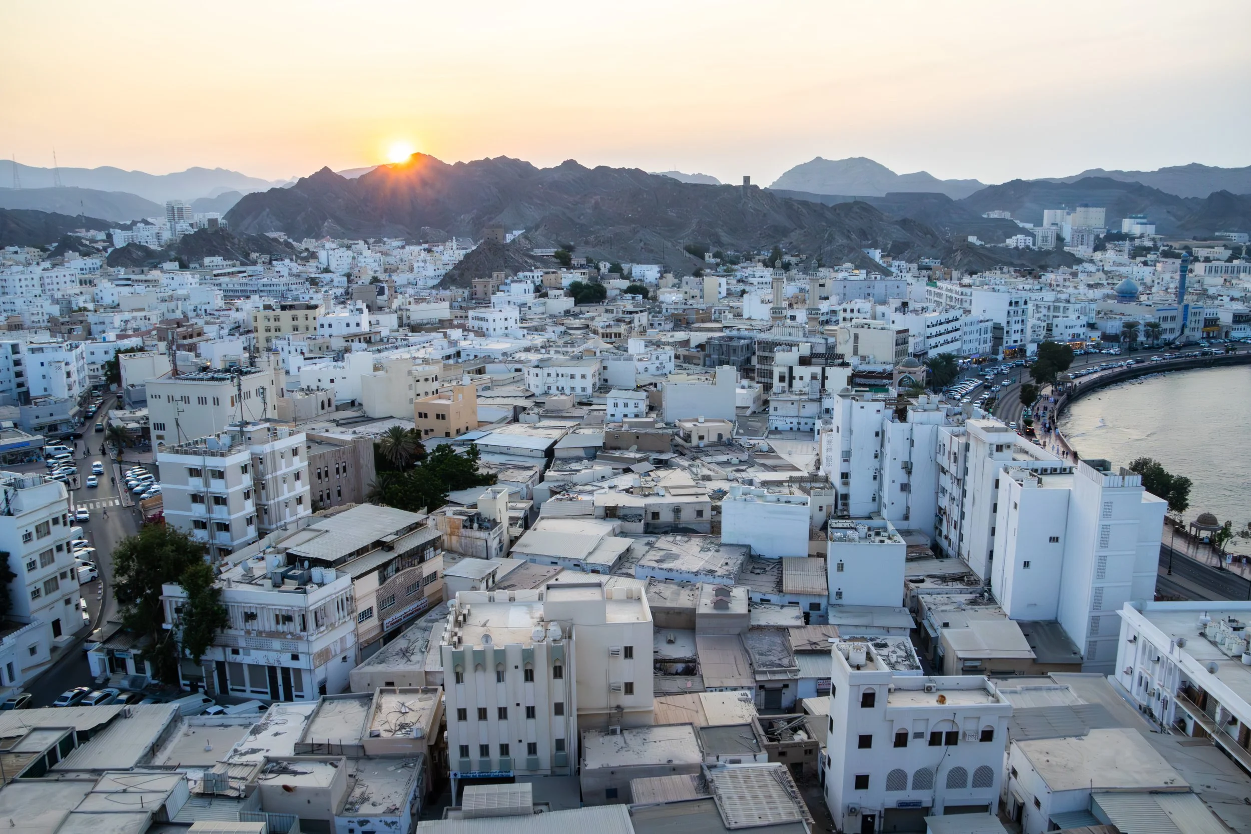
Bourdain said it best: “The Sultanate of Oman defies expectations”. It occupies a very tricky slice of the map indeed, a smaller nation holding its own against all odds in some extremely treacherous geopolitical waters. Its neighbors are the war-torn, perpetually-collapsing Yemen, the conservative and ruthless Kingdom of Saudi Arabia, the opulent, high-flying United Arab Emirates (UAE), and Iran, which needs no introduction. It also shares responsibility with Iran for the Strait of Hormuz; maybe you’ve heard of it? Literally the entire world has had their eyes glued to this strategic global choke point on the world’s oil supply for the past few months… things are TENSE. And right in the middle of this pressure cooker sits Oman: safe, moderate, reserved, modest, welcoming, and beautiful.
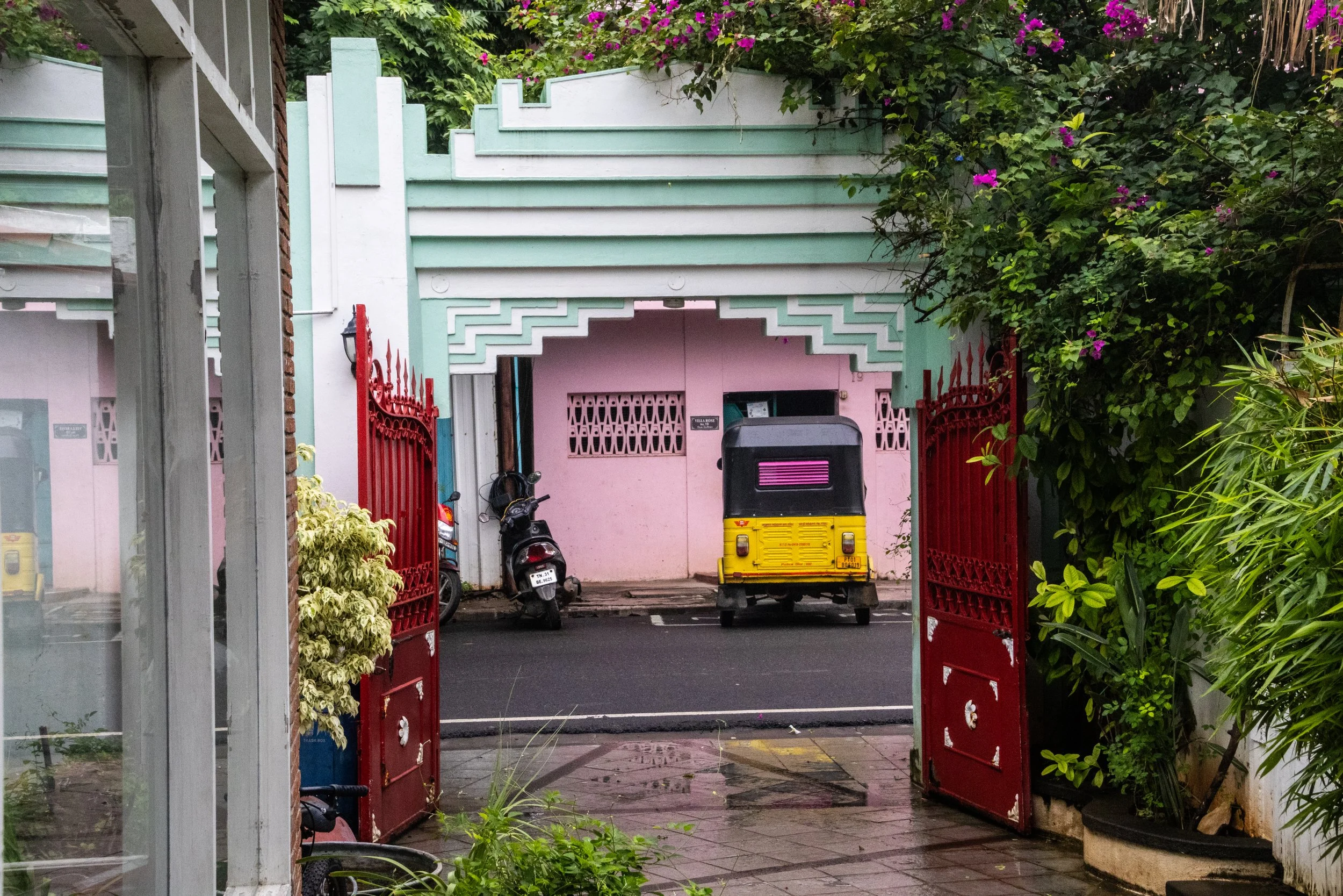
My fascination with Pondicherry began many years ago when I saw it in the movie Life of Pi. It’s an incredible film, and while most of it takes place at sea, the beginning of the film, as well as the narration throughout, is all set in this idyllic French colonial town in India. Of course I was curious about this place, so I looked it up, and there it was: Pondicherry! It had been sitting on a quiet part of South Indian coast this whole time, but there weren’t many major cities around it so my eyes had never lingered on this particular part of the map. I remember thinking that this far-flung place seemed a bit surreal… it looked like France… but it was in India? I knew very little about South India at the time, and I’d probably never go there… but the way it was represented in the film was absolutely intoxicating!
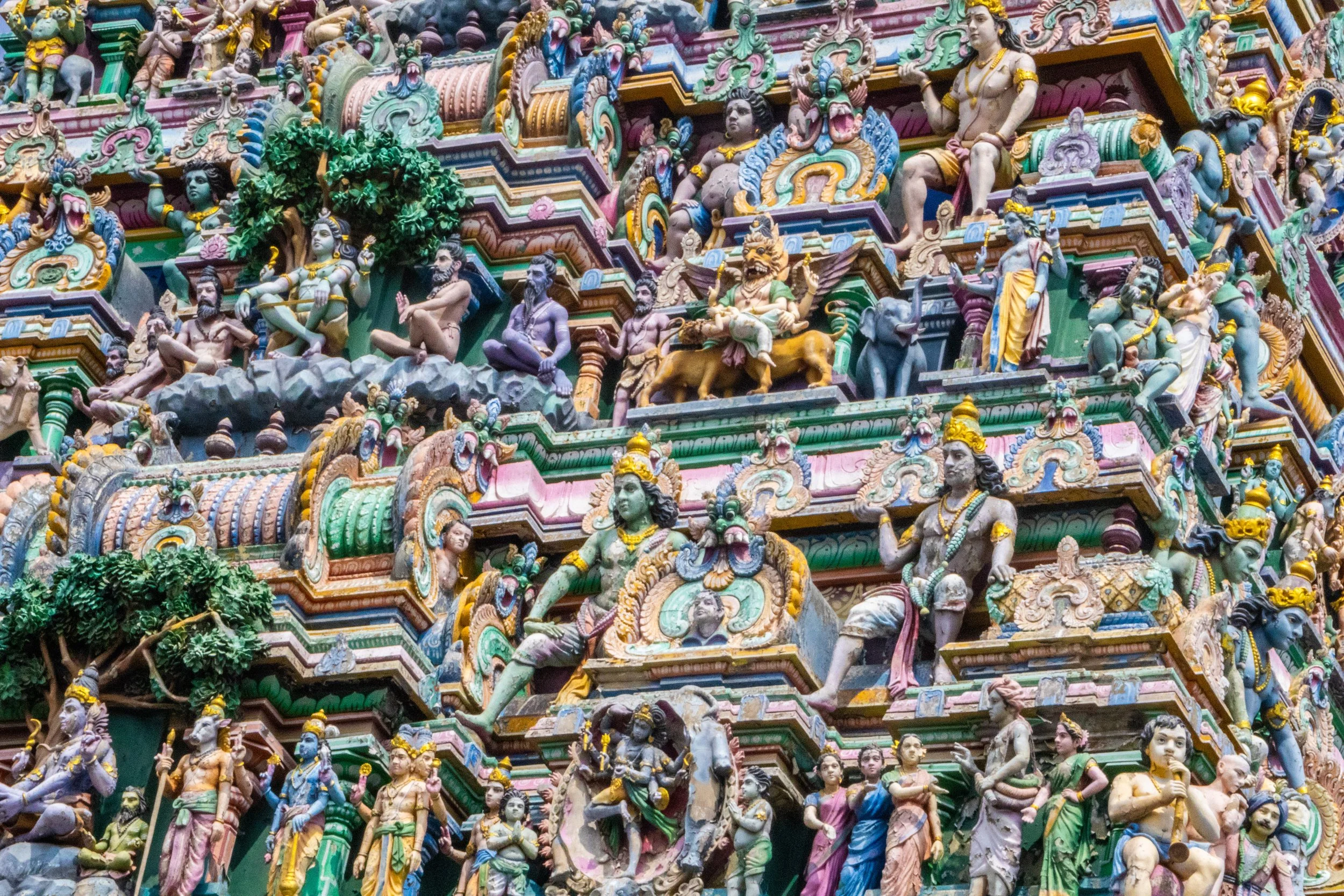
With a metro area population of roughly ~14.5 million people, Chennai is currently the 4th largest city in India, behind only Delhi, Mumbai, and Kolkata. It’s also the capital of the Indian state of Tamil Nadu, which is the formal administrative division corresponding to the Tamil cultural identity. Tamil culture is unique because it is one of the most ancient surviving cultures not only in India, but in the whole world. Its roots can be traced back to ~300 BCE and the Tamil language—one of the world’s oldest living languages—has more than 2,000 years of recorded literature. The Tamil-verse includes multiple different religions (such as Hinduism, Islam, and Christianity), so religion’s typical role as a cultural unifier does not apply here. In its place, the language itself has taken on a unique level of significance.
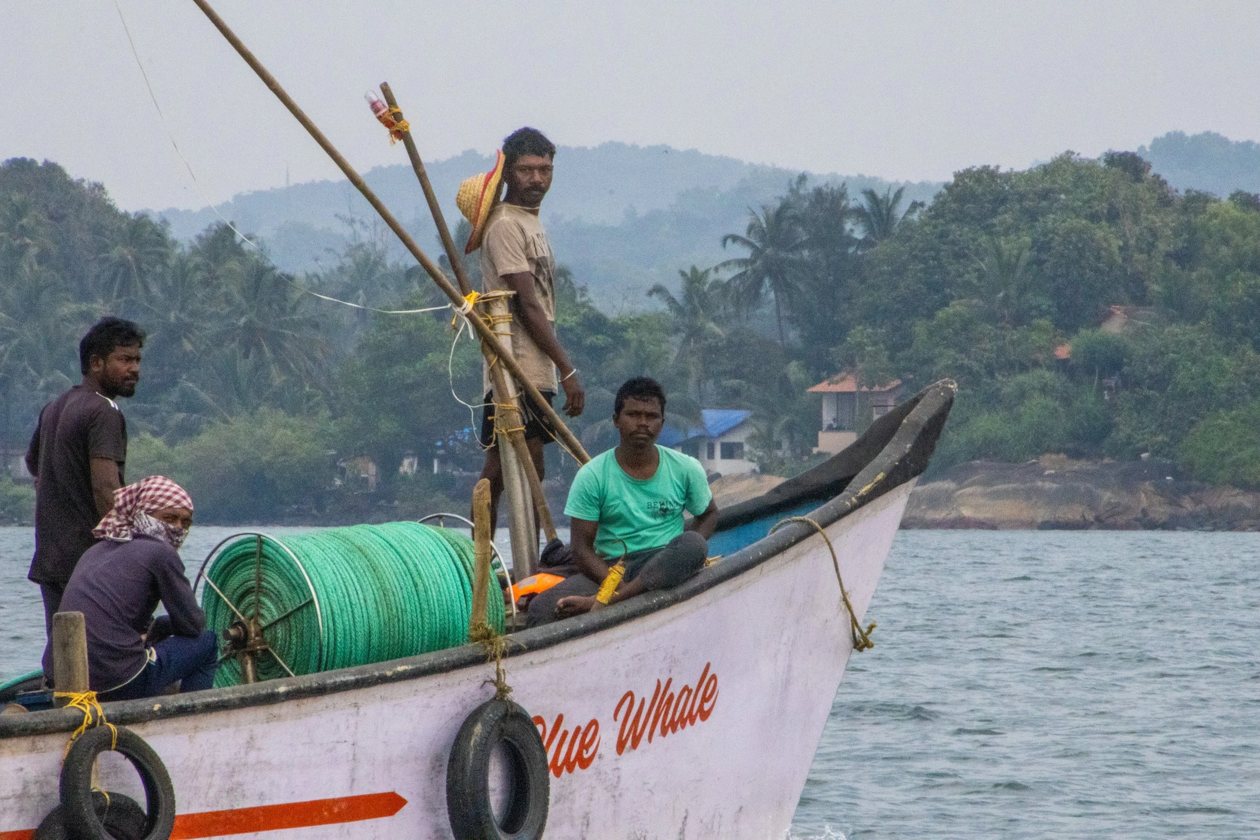
So, what exactly is Goa? Because it’s so tiny, I was surprised to learn that it is actually a stand-alone state in India, on the same administrative level as Uttar Pradesh, Rajasthan, or Maharashtra! Indeed, it is the smallest state in India, and its modern-day borders correspond to the legacy boundaries of Portugal’s once-upon-a-time colony on the Indian Subcontinent.
We mostly associate India’s colonial period with Great Britain, but France and Portugal both had small carve-outs in South India too. When the British finally left India shortly after WWII, the newly independent Indian government had expected Portugal to pull out of Goa as well, but Salazar (dictator of Portugal at the time) had other ideas. Long story short, India reclaimed Goa from Portugal via military force in 1961. The story of Goan identity as it relates to India and Portugal is quite complex, so I won’t delve into it fully here; hopefully in a future article. But I will tell you that Portuguese culture is still part of Goa’s DNA. It’s even got a large catholic population, which is quite out of place in India.
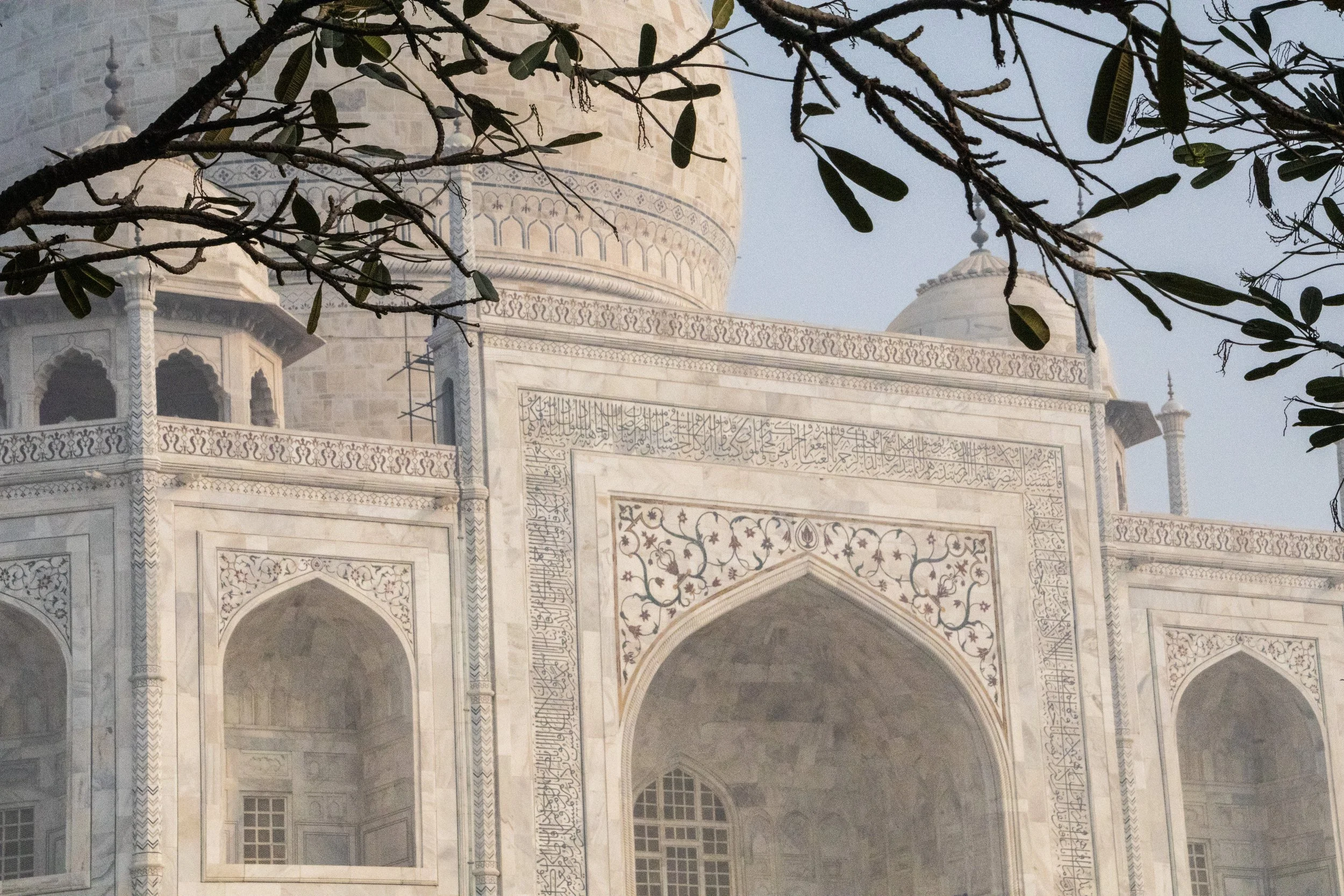
When I first began traveling, my operating assumption was that pretty much everything was a “once in a lifetime experience”. Because, for most people, they are! “Next time” was absolutely never guaranteed. That was definitely the case when I visited the Taj Mahal for the first time in 2015. It’s only just now that I am starting to have the experience of going back to places I’ve already visited. Initially, I was resistant to this, but I’m starting to realize that life is a bit longer than I’d originally thought when I was in my early 20s… I have enough time to do things twice. Or, hell, maybe even 3 or 4 times if I’m lucky! But don’t worry—we’re going to be back to breaking new ground after this article. 😉
I wouldn’t be writing this article at all if I didn’t have a slightly new dimension I wanted to explore on this topic. Unfortunately, it’s pollution. I touched on this while I was in Delhi, but this little excursion was where the issue really slapped me in the face for the first time.
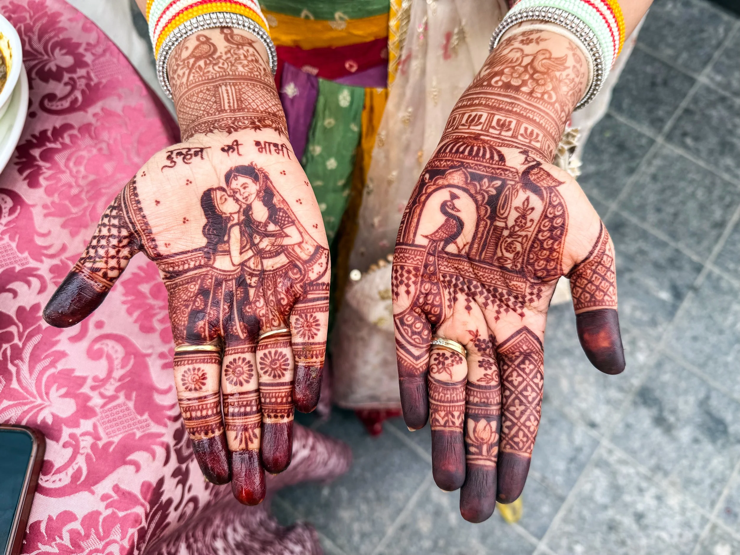
With a metro population of roughly 33 million people… (pause for dramatic affect)… Delhi is the largest city in the largest country on earth. In the overall world rankings, it is 2nd only to Tokyo, but it’s gaining ground fast! In the average Delhi day, there are ~837 births and ~360 deaths, which gives us a natural increase of ~477 people per day. On top of that, there are an additional 200–275 migrants that arrive here per day, mostly from neighboring countries, or rural parts of India. Meanwhile, Tokyo is actually shrinking.
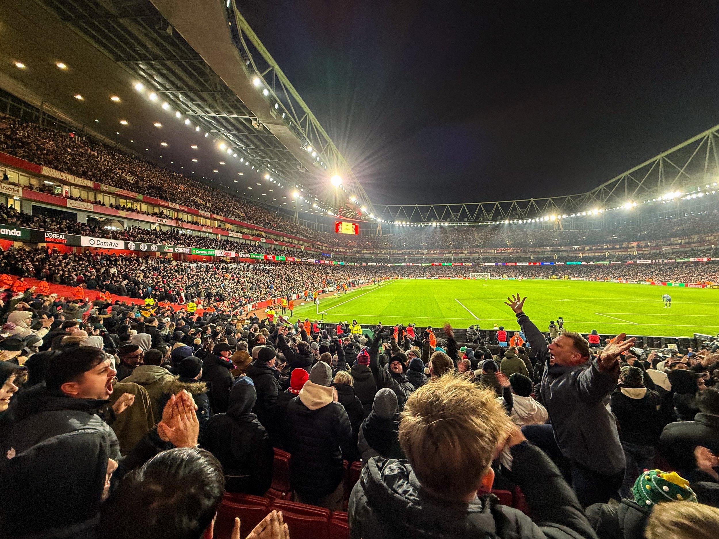
Today we return to football tourism with our quest to visit all the stadiums in the English Premier League. Up to this point we’ve covered Chelsea’s Stamford Bridge, Fulham’s Craven Cottage, West Ham’s London Stadium, Spurs’ Tottenham Hotspur Stadium, and Brighton’s AmEx Stadium. Now, at long last, we’re visiting Arsenal’s Emirates Stadium, which sits in North London, within walking distance of my new flat! We’re going watch the EFL Cup quarter-final against the classic South-London side, Crystal Palace.
So here’s our destination today, along with a couple of nice pictures from the walk over. This match took place on December 23rd, so you will see lots of Christmas imagery & references in the images.
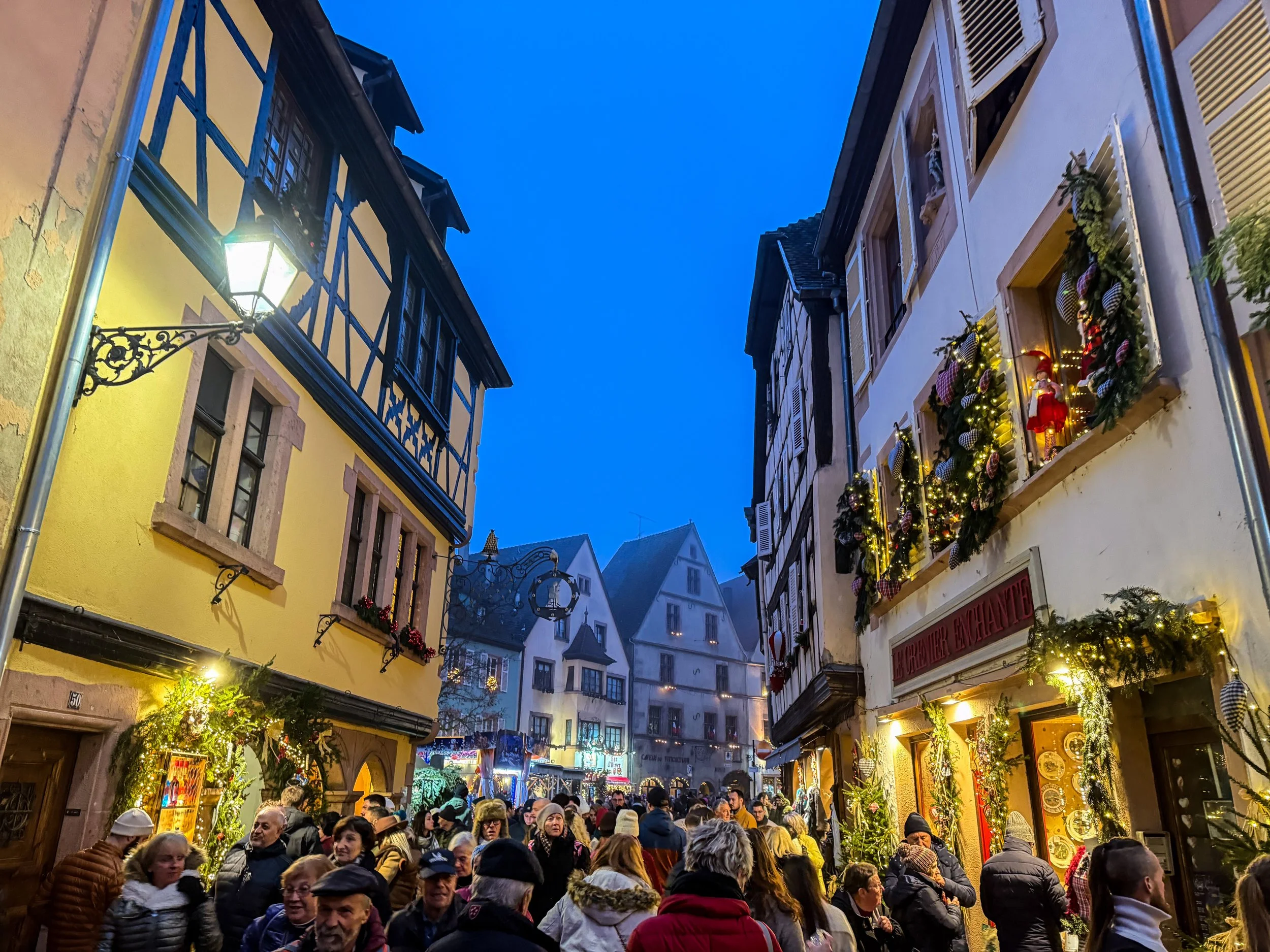
Here’s a fun fact for you: the concept and tradition of the Christmas tree originated right here, in Alsace! The first written records of Christmas Trees anywhere in the world first appear here in 1521, in a small Alsatian village called Sélestat. If you’d imagined there were snowy spruce trees in the Israeli desert for the actual birth of Jesus… I’ve got bad news for you. 😬
Anyway, Sélestat is about a ~20-minute drive from the places we’ll be visiting today! But this is not a historical expedition; we’re going to visit a few more present-day Christmas Markets!
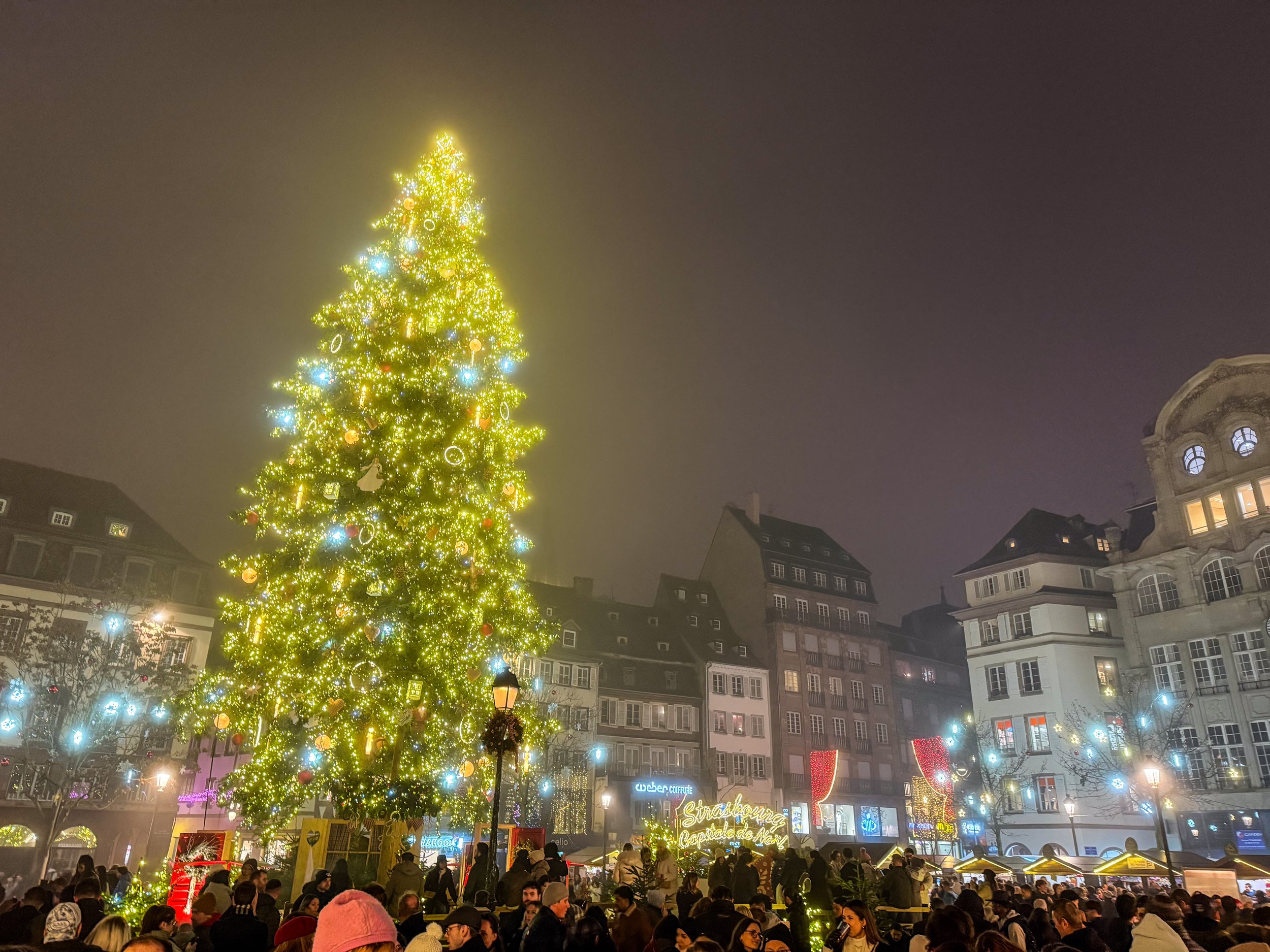
This is (probably) the oldest Christmas Tree anywhere in the world. The first written records of Christmas Trees anywhere in the world first appear here in Alsace in 1521. Those records actually come from a little town called Sélestat which is just south of Strasbourg, but the first records of Strasbourg’s tree follow soon after. At this time, Strasbourg was already the largest city in the region and record keeping was a bit spotty, so I think it’s fair to generally just award the title of “the Birthplace of the Christmas” tree to Alsace in general.
So, this isn’t just a Christmas Tree; this is THE Christmas Tree!

There’s a lot more to Bushwick than I’m going to cover here; it’s known for having a large Latino community, especially Puerto Rican and Dominican, and since the gentrification of Williamsburg, it has also become the new center of indie culture in Brooklyn. But that’s not what this article is about. Today, we’re here to go mural hunting!
We rode the L train to the Jefferson Street station in Bushwick, and basically from the moment I stepped out of the station, I was in mural heaven.
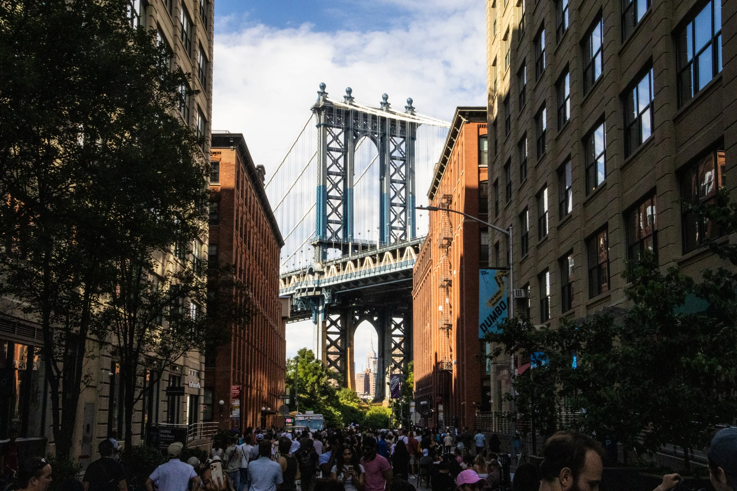
As one of the 5 boroughs of New York City (the others being Manhattan, The Bronx, Staten Island, and Queens), it’s home to some 2.6 million people, which—if it were a stand-alone city—would make it America’s 4th largest city, nearly as large as Chicago! It has a stand-alone GDP of approximately ~$120B, which—for context—is more than the country of Ethiopia.
Season 3
Aired 2020 - 2023
Season 3
Aired 2020 - 2023
Major Series in Season 3 📎
Adventures in Armenia 🇦🇲
Deep Dive into Georgia 🇬🇪
Adventures In & Around Mexico City 🇲🇽
Assorted Adventures in Los Angeles 🇺🇸
Deep South: Mississippi Delta 🇺🇸
Bay Area: SF, Napa, Point Reyes 🇺🇸
Heading West: Seattle & Denver 🇺🇸
British Columbia Deep Dive 🇨🇦
PDX + Central Oregon 🇺🇸
Lots of Street Art 🎨
Featured Articles From Season 3 ⭐️
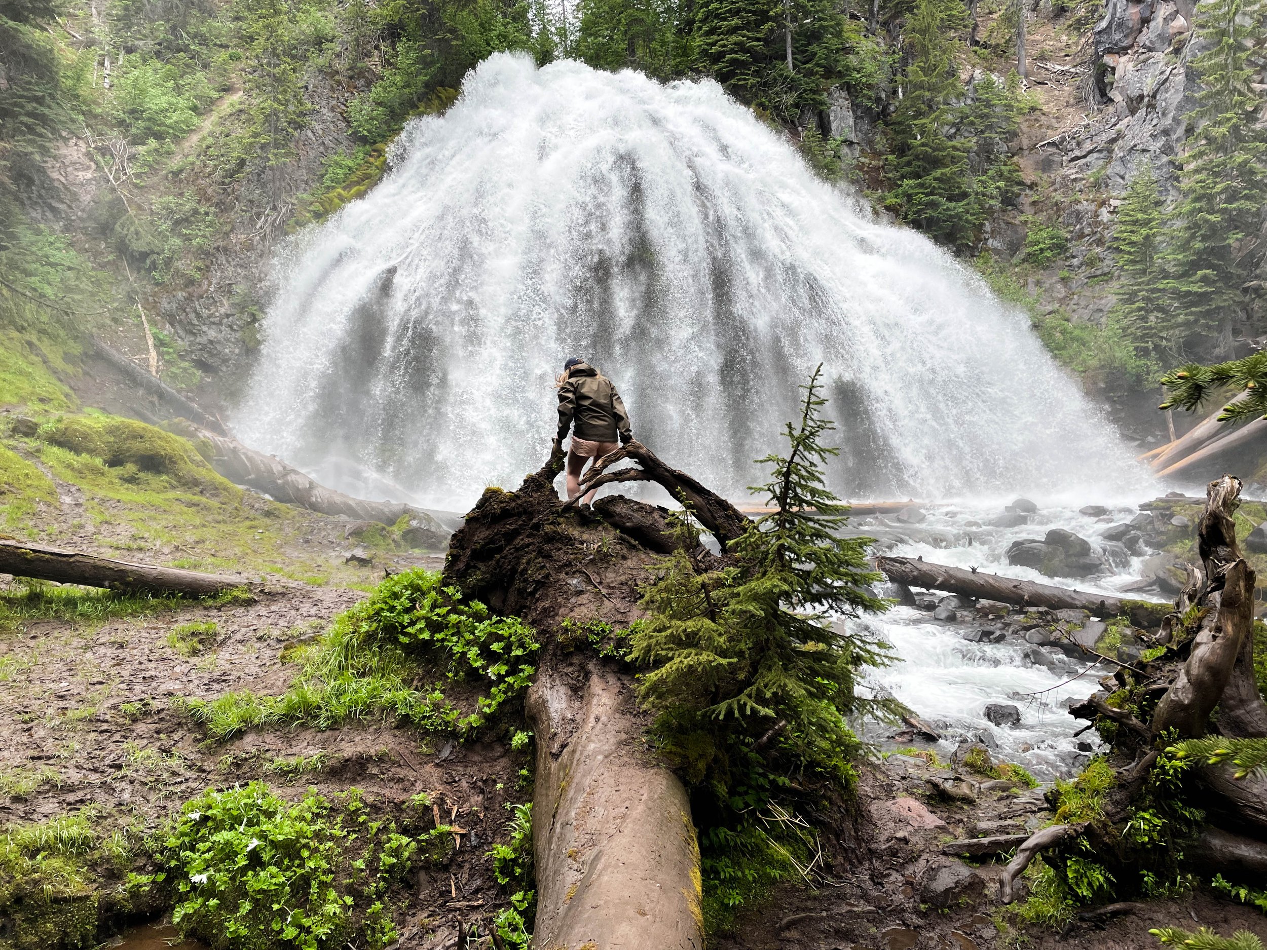
Chush Falls (pronounced “shoosh”) is actually nestled right up against the Sisters Mountains and Broken Top. The drive to get to this trailhead was about an hour from Tam McArthur Rim, all over gravel roads. Oh, and it was absolutely STUNNING. Honestly, even if you don’t do this hike, the drive is still well worth the effort. This was already bringing me closer to these mountains than I had yet been. Looking up at the snowy slopes, I could see every little rock and wisp of cloud clearly and was able to even capture some of this with my camera. And, miraculously, the weather really was clearer over here.

This many mountains is just insane to me. Prior to this trip, this was not what I pictured when I thought of Oregon. This was downright RUGGED! And it was gorgeous. The three mountains in closest proximity to Black Butte, and to one another are the Three Sisters for which this area is named: Middle Sister, North Sister, and South Sister. All three of these mountains are sleeping volcanoes. The North and Middle Sister last erupted ~14,000 years ago and scientists think it’s unlikely that they’ll ever erupt again. However, the South Sister erupted as recently as 2,000 years ago, and could feasibly erupt again. There have been sporadic reports of volcanic rumblings deep within South Sister since 1866, and there have been a couple of minor scares since the late 1980s. Nothing has ever happened, but there is a big pot of magma a few miles beneath the peak of South Sister. Did I mention that South Sister is also the easiest of these mountains to climb? Sign me up for that!! 😵
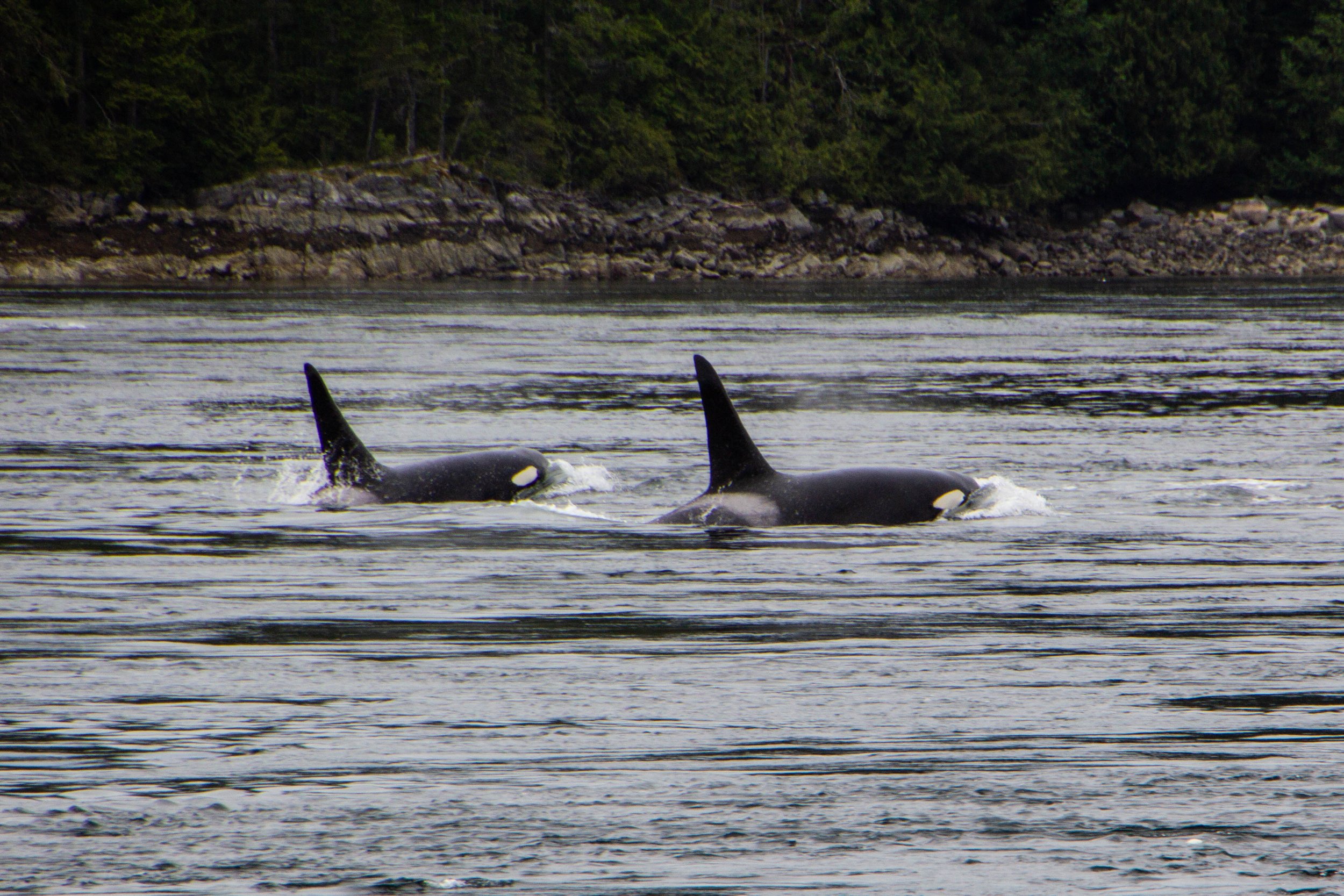
Orcas, or Killer Whales, were something of a feared creature in the olden days. Apparently, back in the 1800s when this part of the world was first being explored by Europeans, their technical/scientific classification was actually “Monster.” Hilarious as this might seem, it does make some sense. Black whales with sharp teeth and shark fins? Yeah, that would have definitely felt somewhat monstrous to me if I was an early sailor of these waters. The conventional wisdom of the day was that, if you fell in the water, you needed to get out ASAP so an Orca wouldn’t eat you. If you hadn’t already guessed this, there is, in fact, no record of an Orca ever eating a human. But this was still a legitimate fear as recently as the 1960s when they actually mounted a machine gun on a coastal bluff known as Chatham Point with the aim of shooting as many Orcas as possible. 🤯 Somehow, for the time when this gun was actively scouring the seas, the Orcas stayed clear of this area and there were no casualties. So Orca/human tensions have never escalated to be anything more than a cold war. And it was not long after this that human sentiments toward Orcas began to change for the better.

Cortes Island is perfect. I am not speaking figuratively. Literally perfect. Every little detail of this island was so effortlessly interesting, unique, and authentic… I don’t know that I have ever seen a place quite like it. It felt like I was living in a chapter of a book. It was like the entire place was straight out of a Wes Anderson movie. Think Moonrise Kingdom, but on an island off the coast of British Columbia, and mostly populated by adults. I could make a cool Pacific-Northwest-meets-Martha’s-Vineyard Pinterest board inspired by this place. Every property was tastefully weathered and clearly maintained with a personal, practical touch. There were no houses that screamed “VACATION RENTAL” here. Every single one of them looked like they were the active, primary residence of an eccentric gardener.

Avatar Grove is well-named; it really does feel like something out of Avatar. Or maybe Jurassic Park. It is a tangled, mossy labyrinth of ancient, knotted trees rising out of an infinite carpet of prehistoric-looking ferns. Each tree branch is draped with moss, similar to the way Spanish Moss hangs from every tree in Savannah—but in a green, lush, distinctly Pacific Northwest kind of way. Every little detail of this place was fascinating and photogenic. From the mossy, leafy forest floor, to the canopy high above our heads, every inch felt like its own world.

We already talked about how close into the mountains Vancouver is. I have never seen anything like it—at least not for a city as big as this. Northern Vancouver is literally built into the sides of the Cascades, with its streets and buildings sloping up the sides of the mountains as far as physics will allow. So when you start driving northward from Vancouver, you will find yourself in the mountains pretty much instantly. The drive up follows the coastline of a rugged Pacific fjord that comes to a head in the gorgeous little town of Squamish, and from there it’s all mountains. Here’s a map of the trip. It might not look like a huge distance on the map, but’s 2.5 to 3 hour drive to get up there from Vancouver.

Say what you will about Vancouver—there’s no debating that it makes an impression on you. Its iconic glittery, sparkling, glassy skyline set against a backdrop of imposing, snowcapped mountains and moody gray skies is nothing if not striking. But there’s a lot more to this place than whatever this image conjures up for you. Vancouver is an unlikely swirl of old and new, of chic and grit, and of sun and rain. And it will serve as the base camp for our next series of articles.

You can’t actually drive all the way out to Tomales Point. There’s a parking lot and a trailhead next to the historic Pierce Ranch. From there, it’s a 9.4-mile round trip hike to get all the way out to the tip and back. Over the course of this route, there’s a total elevation gain of 1,177 feet. Honestly, it’s a pretty easy hike. I did this when I was fresh off a particularly rough COVID infection, still trying to get my mojo back, so this should give you no pause.

San Francisco is not a flat city. The word “hilly” doesn’t quite cover it. So it should come as no surprise that there are lots of interesting staircases (600+) scattered throughout the city, helping pedestrians scale the city’s steepest nooks and crannies. This much is to be expected. But what I did not expect was that many of these staircases have been turned into hidden works of art. I’ve been to San Francisco a few times, and I have somehow never stumbled across even one of these before. And what you’re about to see isn’t even all of them! We’re going to start in the Richmond District, but then we’re going to head south and spend the rest of this article in the Sunset District.

And we’re back in mainland Seattle from our little trip over to Bainbridge Island! In our first installment, we checked off some of Seattle’s more obvious tourist attractions (i.e. Pioneer Square, Pike Place Market, the view of the Space Needle from Kerry Park, etc.). It was very cool, but TODAY we’re going to peel a few more layers off the onion and get into some of Seattle’s quirky b-list attractions. As a city, Seattle has a stronger and more distinct personality than most. I think this cross-section of less-notable items actually did more to help me get to know this place than the major tourist attraction did. It’s all about details.
SO LEMME HITCHU WITH THE DEETS.

Some places hit you with vibes the second you step out of the airport. The air is different. The energy is different. Even the industrial in-between areas around the airport and the highway have a strong sense of character. Seattle is one of those places. In a happy twist of fate, I unwittingly ended up on the same flight to and from Seattle as one of my buddies in BNA, so I got the express pass into the city riding shotgun in the car that he had rented. Seeing the breathtaking Cascadian landscape unfold before us, I could not stop talking about how cool it all was. The mountainous terrain makes it so you are always either arriving at or leaving from a scenic vista, each of which provides a more gorgeous view than the last. Looking out in any direction, there are always multiple layers of water, city, and evergreen-dominated foothills between you and a background of MUCH larger mountains. And those mountains are always set against an expressive sky, which alternates between a clear, northerly baby-blue color, or a swirling moody mass of clouds.
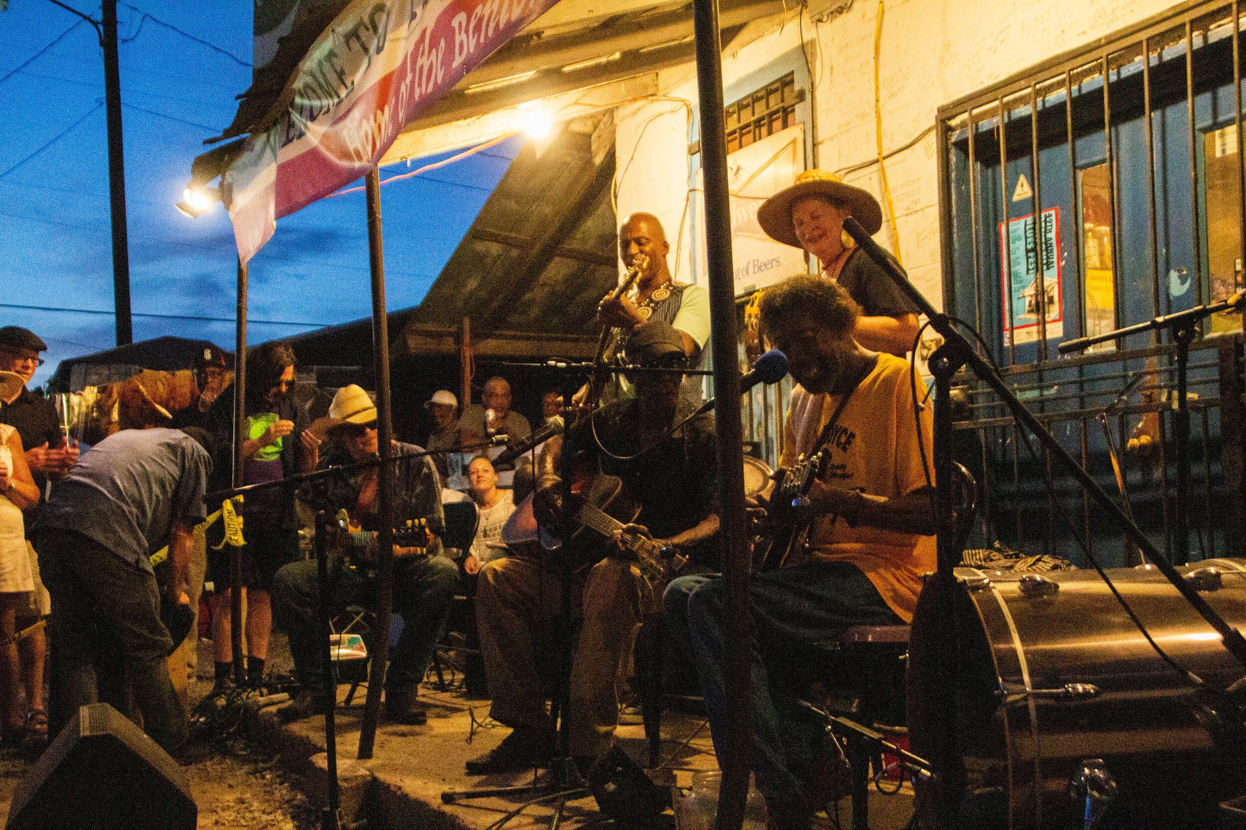
I don’t know what I expected when I showed up in Mississippi. I had some vague aspirations about getting out into the legendary Delta to see pieces of the Blues Trail, but I wasn’t sure how realistic it was to cover all of that ground in the short time I had. I thought it would be cool to visit the Crossroads, but everybody I know that has been there told me it’s literally just an intersection in the middle of nowhere. So I wasn’t sure it was worth the drive. This probably doesn’t sound like the beginning of a great article. I really thought of the Blues mostly in the past tense so I wasn’t expecting to find anything in Mississippi but some history. But OHHHHH MAMA! I have never been more wrong in my LIFE!

The observatory was/is equipped with a 12-inch Zeiss refractor telescope that you can actually go look through. Since 1935, an estimated 7 million people have looked through it to catch a glimpse of the stars, which makes it the most used telescope in history by far. In WWII the planetarium was used to train pilots in celestial navigation. Later, in the 1960s, it would be used for that same purpose as a part of the NASA space program. In 2002 this place underwent a major renovation mostly focused on its visitor-facing amenities. Now there’s a café, a gift shop, and a movie theater. I’m sorry to tell you we’re not going into much of this stuff today though. We’re here to catch the sunset!

It was our first full day in Mexico City, and we were sitting in a coffee shop somewhere along the boundary line between Condesa and Roma trying to figure out what we should do with the rest of the time we had. I’m not great at planning my travels in advance, so these sorts of on-the-go brainstorms happen in just about every new city I visit. I wondered aloud if there was any Lucha Libre wrestling to be found here. “I mean, this is the literal center of everything Mexican, so it’s gotta be here somewhere, right?”
At that exact moment, we heard somebody say “Excuse me.” It was the man sitting next to us. He had overheard us talking. In perfect English, he proceeded to tell us everything we could have ever wanted to know about Lucha Libre wrestling in Mexico City. “It’s so fun! I go like every week!” he said emphatically.

Teotihuacán is one of the most historically, culturally, and architecturally significant cities in the pre-Columbian Americas. At its height, it was the largest city in both North and South America, with a population of 125,000 people (estimated). That might not seem like much today, but by Mesoamerican standards, that’s like Tokyo or New York. This wasn’t just a place—it was THE place. But here’s what makes it so fascinating…
The origins of Teotihuacán are utterly mysterious. The backstory behind its founders is totally unknown. And it’s not just unknown to us now, in 2020. Apparently the Aztecs discovered the ruins of this city and also didn’t know exactly where it came from or what the story was. Isn’t that INSANE? The AZTECS discovered this when it was already ruins!

Let’s start with size. Mexico City is really, really big. In fact, Mexico City proper has almost 9 million people and Mexico City metro is home to a whopping 21 million people, which just a few million less than Beijing. This makes it the largest population center on the entire continent of North America—bigger even than New York, LA, Chicago, Toronto, etc. It also puts Mexico City comfortably in the top 10 largest cities in the world.

Literal paradise.
Ushguli is a small cluster of towns that sits right on the Georgia-Russia border in the mountainous northerly region of Svaneti. It’s remote, difficult to access, and it’s got a population of less than 250 people. And yet, a quick Google image search for Georgia (the country of Georgia) will often return images of Ushguli even above images of the capital city. Clearly there is something special about this place.

Svaneti is the highest inhabited region of the Caucasus mountain chain. The whole region is studded with snow-capped 3,000–5,000 meter (~10,000–16,500 foot) peaks and sprinkled with small glaciers. In fact, the highest mountain in Georgia, Mount Shkhara, is located here in Svaneti, which stands at 5,201 meters (17,059 feet) tall. But in between all these mountains and glaciers are some of Georgia’s most picturesque little valleys and towns. These town are inhabited by an ethnic group known as the Svans.

Finally, we arrived at our destination. Before we re-enter our narrative, let me introduce you to the famous Georgian mountain town of Kazbegi. It’s basically just famous because the mountain peak that towers over this little town is particularly dramatic and maintains a snowcap year round. This Mount Kazbek. In short, it’s super pretty! Everybody I had brushed elbows with up to this point in my trip recommended Kazbegi profusely.

Some cities hit you with strong vibes the minute you step out of the airport, and those vibes set the tone of your entire stay. But Tbilisi was an interesting one, because I really didn’t feel anything when I arrived here. Or ever, in the 7 nights I spent in this city. I was expecting some sort of strong, emotive, post-Soviet energy of a fledgling nation determined to get on its feet regardless of Russia’s endless attempts to undermine its sovereignty (or, you know, something like that) … but I felt nothing. Because, as it turns out, Tbilisi is a city with absolutely ZERO pretense.

It was this event that prompted the creation of the term “genocide.” There wasn’t really a word for this before the world started to do business with what happened to the Armenians. I’m going to tell you this story now, and I’m sure you will start to notice some eerie parallels with the Holocaust. In fact, the two aren’t entirely unrelated. But before we dive in, I’m going to warn you, this will be disturbing.

Once we got a bit closer to the city center, the vibes quickly became more difficult to categorize. Fast forward a few hours and I was in my happy place: out on the streets with my camera. I was eager to jump to conclusions, but the further I walked the less I sure I became of what I thought I knew. Some times I would pick up Middle-Eastern vibes from open-air restaurants in city squares, other times I would get European vibes from the little Armenian bakeries tucked away somewhere on every block. And the architecture on those blocks sometimes seemed to be European-adjacent… but then on the next block the buildings were giant, brutalist concrete blocks, serving as a striking reminder of Armenia’s Soviet past.

For my American readers, I’m gonna go out on a limb here and say that there is no way in hell that you don’t know what Napa Valley is. But for my readers from abroad, I’ll explain just in case. Napa Valley is America’s postcard wine country. There are pockets of vineyards all over the country of course (Oregon is a notable wine producer as well), but Napa Valley is the epicenter of wine culture and cultivation in America. Napa Valley refers to a large fertile valley full of vineyards in Napa County, California, which just on the north side of the San Francisco Bay. Driving north through Napa Valley, there are a few towns that you will pass through, the first of which is also called Napa. The next major towns before the northern end of the valley are Yountville, St. Helena, and Calistoga.

First off, what I’m defining as “Richmond” here is actually made up of 4 smaller districts: Inner, Central, and Outer Richmond… and a little area to the north called Lake Street. This neighborhood (or group of neighborhoods) is essentially a big grid system, which, despite occupying an extremely urban area of San Francisco, is surrounded on almost all sides by nature.
Season 2
Aired 2017 - 2020
Season 2
Aired 2017 - 2020
Major Series in Season 2 📎
Roadtripping Through Iceland 🇮🇸
Exploring Cuba 🇨🇺
First Time in San Francisco 🇺🇸
Rome 🇮🇹 & The Vatican 🇻🇦
Adventures in Algeria 🇩🇿 & Tunisia 🇹🇳
Adventures in Malta 🇲🇹
Pilgrimage to Sicily (Italy) 🇮🇹
Assorted Articles on Boston 🇺🇸
Adventures in Asheville 🇺🇸
Eurotrip #TBT: Madrid, Prague & More 🇪🇺
Featured Season 2 Articles ⭐️
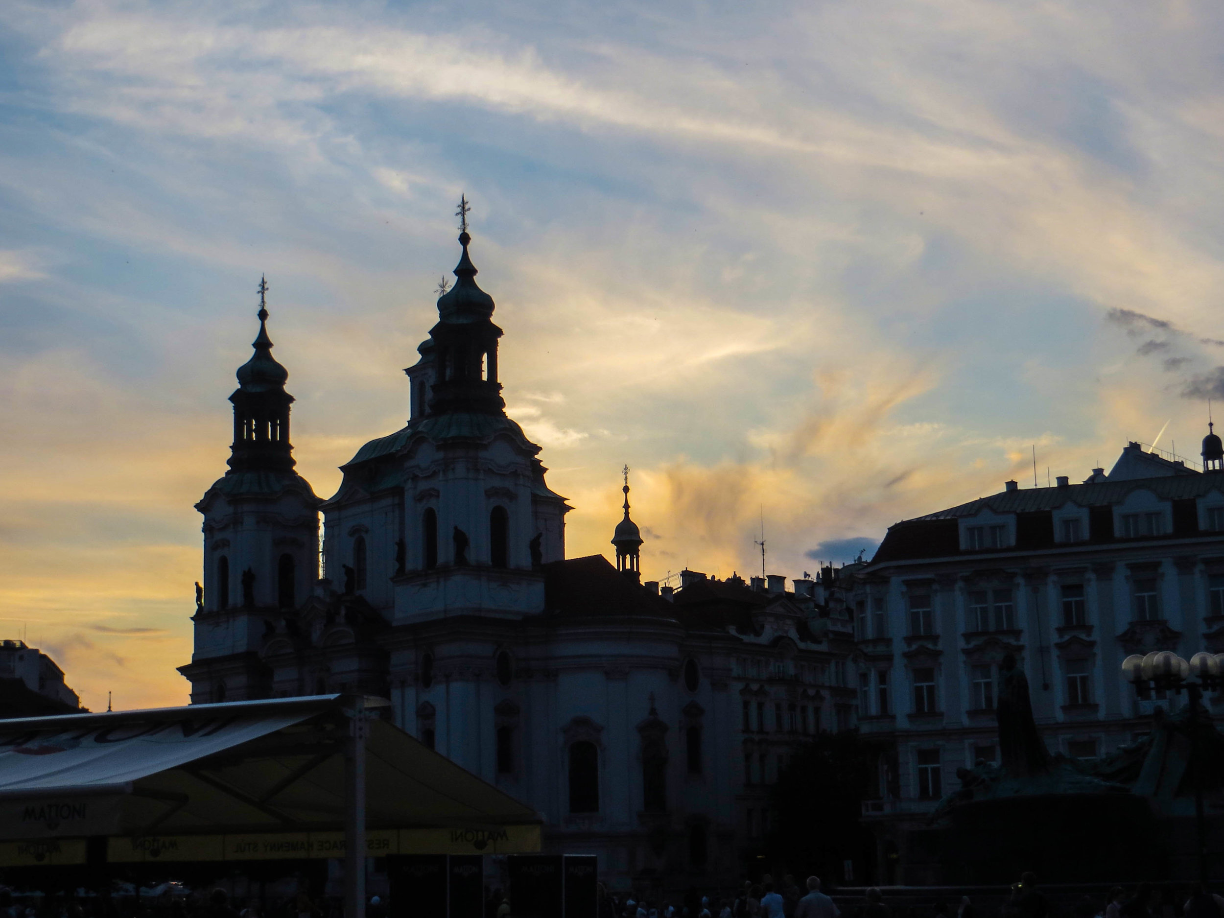
Prague is the historical capital of Bohemia. Through the last few hundred years, the boundaries in this part of Europe have been notoriously fluid. The map here has been redrawn quite a few times as Empires have risen and fallen, but Bohemia has always been a notable region with a strong cultural identity. Today, Bohemia is more or less synonymous with the Czech Republic (formerly part of Czechoslovakia, and recently renamed to simply “Czechia”). With 2.6 million people living in its metro area, it’s the 14th largest city in the European Union. However, what it lacks in size relative to other European capitals, it more than makes up for in clout. When it comes to history and culture, few cities pack a punch in quite the same way Prague does.

In July of 2012, a few friends and I were leaving Spain and embarking on what would be my first ever Euro-trip. In deciding where we wanted to go, I'd be lying if I told you that Amsterdam's famously progressive drug laws did not play a role in our decision to come to here. So our motives may not have been entirely academic, but once we arrived, I was enraptured. Amsterdam turned out to be one of the most beautiful cities that I had ever had the privilege of exploring. I’ve traveled a lot more today than I had back then, and Amsterdam is STILL one of the prettiest cities I’ve ever seen. We spent 5 days here, and in that time, I took more photographs than I had of any place I had visited prior.

If you've been a reader for any amount of time, you probably know that I started this website when I moved to Hanoi, Vietnam to work as an English teacher. However, you might NOT know that Hanoi was actually the 2nd time I had lived internationally. The first time was my study abroad, during which I spent a semester living in Madrid, Spain.
This is the first installment of what is going to be a #ThrowBackThursday series. I'll be digging up some choice photos from my time in Europe, re-editing them, and sharing some thoughts and/or stories about each of the places I visited. So let's get to the good stuff!

Tucked away in almost the exact center of the Smoky Mountains, this city an artsy, crunchy, progressive safe-haven, full of art galleries, beer breweries, wilderness exploration outfitters, and organic grocery stores. It’s pretty much the dream! Many people who come here do so as a stop-over before excursions into Great Smoky Mountains National Park, but the city itself is becoming a destination in its own rite. Cue our visit.

With a population of just 179,139 (as of 2017), Chattanooga is the 4th largest city in the state of Tennessee, behind Nashville, Memphis, and Knoxville. It's just over a 2 hour drive southeast from Nashville, and is a relatively short commute to other major metropolitan areas such as Atlanta and Huntsville. The biggest sectors of Chattanooga’s economy are automotive manufacturing, shipping, and logistics, which are all quite industrial. However, this came as sort of a surprise to me given how quickly the “hipster” demographic is taking control of Chattanooga. This place is a serious contender to become Appalachia’s Brooklyn in 10 years, but it’s true identity is never really going to change.

Boston has a lot of cool history. Even if you don't feel like you know very much about Boston, you still probably already knew that. This was the city where the Revolutionary War started! The Boston Tea Party, Paul Revere's Midnight Ride, the Salem Witch Trials—the early history of the Boston area is rich with some of the most riveting stories that American history has to offer. And moving into the modern era, Boston still managed to be the site of some of America's most interesting historical sagas, from the Boston Strangler, to the Great Molasses Flood. However, to me, one story stands out above the rest, and it didn't happen all that long ago.
The story I'm talking about is the heist of the Isabella Stuart Gardener Museum, which happened in 1990.

Today, we're going focus in on a couple of my favorite pieces of Boston. The first is the famous Boston Public Library, and the second is the unusual measuring system that is painted onto the Mass Ave bridge. These have both been the source of some intrigue for me, and are academia-adjacent, so I’m combining them into the same article.

I should start by telling you that Gangi (pronounced "gan-chee") isn't *technically* a ghost town. It's actually trying REALLY hard not to be. In an effort to revitalize this town, the mayor of Gangi decided to start selling the vacant houses to outside investors for €1.00 a piece. This insane bargain comes with 1 string attached: that you will spend no less than 35,000 EUR (43,212-ish USD) to fix up the house within 5 years. Yes, this is 100% true, and if you want to, you really could buy one of these houses right now. Mull it over as you read this article.

Just 2 hours south from Catania, down the eastern coast of Sicily, sits a the city of Siracusa (a.k.a. Syracuse). You may recognize this name from history books about the very distant past. Syracuse makes appearances in tales and legends that stemmed from a great many famous Empires over the course of Mediterranean history, most notably the Greeks, Romans, and Byzantines. Oh, and it makes a cameo appearance in the Bible. It was described by early Roman officials as "the greatest Greek city and the most beautiful of them all."
Suffice to say, this place has some serious history behind it. Are you ready to see what’s going on in 2018?

Catania is the second largest city in Sicily. The population of Catania proper is about 320,000, but there are a combined 1.1 million people who live in the metro area. In Italy overall, Catania is the 10th biggest city, and the 7th largest metro area. This is a major population center for Sicily, second only to Palermo, which will be our last stop on this trip. Catania is not the most well-known place, but it's definitely not small either. It's actually really big, especially by Sicilian standards. But Catania's burgeoning population should be surprising. This isn't exactly prime real estate.
Why? Because of Mount Etna.

First of all, it's pronounced "mar-sa-chlok." There are about 3,500 people that live in Marsaxlokk and they are called the Xlukkajri (sorry, no idea how to pronounce that one). Though it might look like vacation paradise (and it totally is) Marsaxlokk is also a real town. The waterfront is the most iconic area of this town but turn off of Xatt is-Sajjieda down any side street and you will be quickly find yourself in everyday Malta. Similar to Valletta, the buildings are all a sandy color of beige, giving the impression that you are walking through an entire city of sandcastles. It's pretty picturesque.

I think that most people who visit Malta arrive suffering from an information deficit, because one of the first tourist attractions any local will tell you to see is a 45 minute movie explaining things. Indeed, at first glance, the Maltese capital city, Valletta, will leave you incredulous. I think that everybody who lives there knows that it requires some explanation. All that I kept thinking when I first arrived was "How did this place come to be and how do I know so little about it?" Well the movie answers those questions, and more. But for now, you'll just have to hear it from me!

Tunisia was going to be my second country in Africa, so I was excited to at least get a taste for it. We didn't have much time here, but we would still be able to see a decent chunk of Tunis. The flight here from Algiers was short but green and scenic as we made our way horizontally across the top of Africa. And as our plane made its final decent over northern Tunisia, I was excited. Here are a few pictures I snapped out the window. Drink 'em in, because everything went to shit from here.

To finish this series on Algeria, we're going to dive headfirst into the legendary Casbah of Algiers. This is the oldest neighborhood in Algiers, and many locals would also say that it's the most dangerous. In fact, the vast majority of locals that we asked about it told us that they themselves would not walk through this neighborhood alone. Yikes!
Now, if you've been following this series on Algiers/Algeria, you know that I've been preaching about how unexpectedly safe Algiers turned out to be. So it might seem odd that I'm now telling you about a place that is supposedly so dangerous. Well let me kick this off with a spoiler for you: the Casbah isn't so bad.

Today we're going to be doing a double-header: Cherchell and Tipaza. These places are not quite on the level of Timgad, but they are still going to be interesting and gorgeous. So buckle in kids! It's time to drive out into rural Algeria for some adventuring!
So, if you've been following this series on Algeria, you know that I was traveling with my mother. One little-known fact about my mom is that she's secretly a bad-ass and had actually lived in Algeria briefly in 1980. So this was a long-awaited return trip for her. During that time, although she did spend some time in Oran and Algiers, the majority of her stay was spent in a tiny town called Cherchell (pronounced "share-shell")...
At a glance, much of Algiers is almost a mirror image of its former colonizer, France, which sits just across the Mediterranean. Visually, it is defined by Parisian-style buildings, almost all of which are colored white. However, in spite of its surreal visual similarities with France, it only takes about 10 seconds of walking the streets of Algiers to realize that it is a world all its own.
I’m going to tell you this up front: I LOVE this city.

We arrived at the foot of Via della Conciliazione in later afternoon. The sky was gray, and the air held a cold moisture. We followed the masses of people up the road towards the giant stone gates. On either side of these gates, giant Roman columns stretched off endlessly. These marked the border between Italy and Vatican City. Perched on either side of the entrance were Italian military outposts manned by heavily armed but very bored-looking soldiers.
Crossing into Piazza San Pietro, though an international boundary, was decidedly anti-climactic. However, what we found on the other side of this plaza blew us away.

Something like 90% of all tobacco in Cuba comes from the Pinar del Río province, and Viñales is the cultural center of this province. That means that, if you have ever had the pleasure of smoking a Cuban cigar, this is (probably) where it came from. But Viñales has a lot more to offer than just agriculture; it's also a UNESCO World Heritage site, as well as a national park in Cuba.

Matanzas is a small sea-side city that sits 56 miles (or 90 kilometers) east of Havana, on Cuba's northern coast. It's located in the Bay of Matanzas and is the capital of a province that is also called Matanzas, and it was definitely one of my favorite places in Cuba.
We arrived in Matanzas via camione, and then our adventure began...
Spoiler alert: this was one of my favorite places that we visited during our time in Cuba.

After decades of harsh political rhetoric, assassination attempts, international crises, violent incidents, and economic sanctions, the American and Cuban governments have taken the first step towards making nice. The first direct international flight from the U.S. to Cuba touched down in August of 2016 so, for Americans, Cuba is now open for business!
Er, well, sort of.

Of all the amazing pieces of civilization subsisting out here in the Westfjords, none sparked my interest like these tiny Icelandic churches. These little structures were often the only sign of human life for miles in any direction. Each time we caught a glimpse of the small pointy steeple from our place on the road, we would come to a screeching halt and dive off down the nearest dirt road to explore. No two of these churches were the same. Each was completely unique, and a few of them had even been left unlocked!

This quest brought us to the edge of the world, literally, to the bone-chillingly massive cliffs of Látrabjarg. Here’s a spoiler alert for you: it was mind-blowingly gorgeous. A friend of mine recently pointed out that I’ve said similar things about a great many of the places I have visited, so let me up the ante a bit: this was one of the top 5 most beautiful places I’ve seen, EVER.

Ísafjörður [ees – ah – fyur – thur] is the capital of the Westfjords, which are a remote Icelandic province in the far northeastern reaches of the country. It translates to something like “Ice Fjord,” which is pretty fitting, and a shining example of Iceland's love for hyper-literal names. Today we’ll begin by talking about the Westfjords as a whole, but first, some clerical housekeeping…

When you think about Iceland, what do you think about? Probably green mountains and a beautiful, rugged coastline, right?
Well that's just one piece of the geothermal puzzle that is Iceland. Iceland's interior is a very different place. It's a vast, inhospitable, volcanic desert. And in this enormous highland desert, conditions are punishing, and water is scarce (unless it's in the form of a glacier).
It's basically Mordor.
Season 1
Aired 2014 - 2016
Season 1
Aired 2014 - 2016
Major Series in Season 1 📎
Living Abroad in Hanoi, Vietnam 🇻🇳
Indonesia: Island-Hopping From Bali to Flores 🇮🇩
Middle Vietnam 🇻🇳 + Cambodia 🇰🇭
Adventures in Bangkok, Thailand 🇹🇭
Traveling Through Burma/Myanmar 🇲🇲
Life in Dhaka, Bangladesh 🇧🇩
India: Bengal to Rajasthan 🇮🇳
India: Jammu & Kashmir 🇮🇳
Adventures in Istanbul, Türkiye 🇹🇷
Adventures in Northern Italy 🇮🇹
Featured Season 1 Articles ⭐️
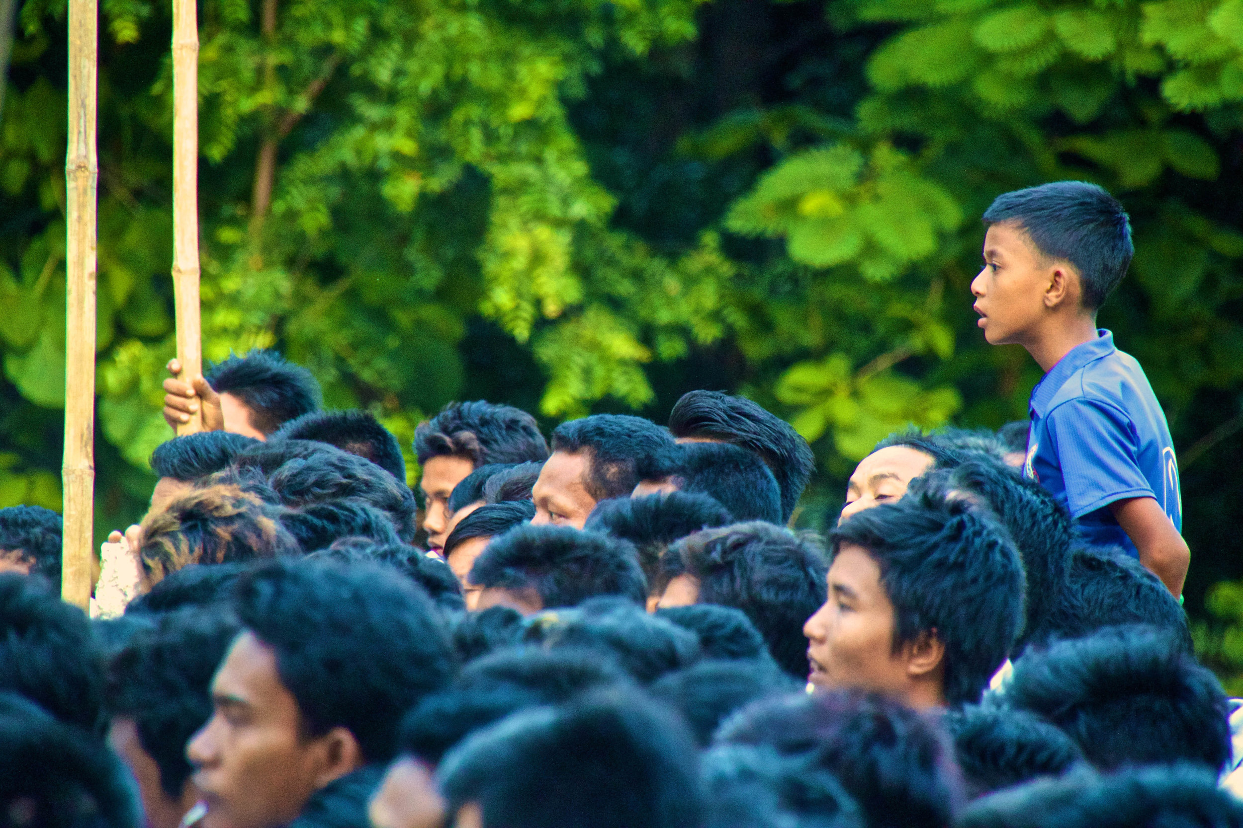
My experiences abroad forced me to confront unfamiliar things in a way that drastically fast-forwarded my personal growth. And as much as I hate articles like this one, I figured that it might be prudent to crystallize a few pieces of this wisdom I’ve gained and share them with you, for whatever they're worth. So what are my big takeaways after all this time?

This is Part 2 of my time sneaking around Venice, seeing everything this amazing city has to offer, and spending as little money as possible in the process. Here we'll go through extensive photo galleries, which stretch well into night time on the canals, as well as meet the infamous Plague Doctor.

With places like Florence and Rome literally at my fingertips, it might be considered an odd move to choose to visit Genoa instead. Genoa had always fascinated me though. Nobody ever talks about it, but, if Google Images was to be believed, it's a gorgeous seaside city! Let's check it out...

I would be so racist against Indian people by now if I hadn’t taken so many trains. In a place like India, my white skin makes me a huge target because of my perceived level of wealth. As such, most of the interactions I have with locals are about money, and the unfortunate majority of them are not positive. Traveling through this kind of environment, it's easy to get cynical. My saving grace throughout my whole time in India was my time on the trains.

Mumbai's Kamathipura is the oldest red-light district on the Indian subcontinent, and is the 2nd largest on the entire continent of Asia. The 1st largest is Calcutta, which is something that I didn’t realize when I was actually there. If I had we probably would have paid it a visit, like we're about to do in Mumbai.
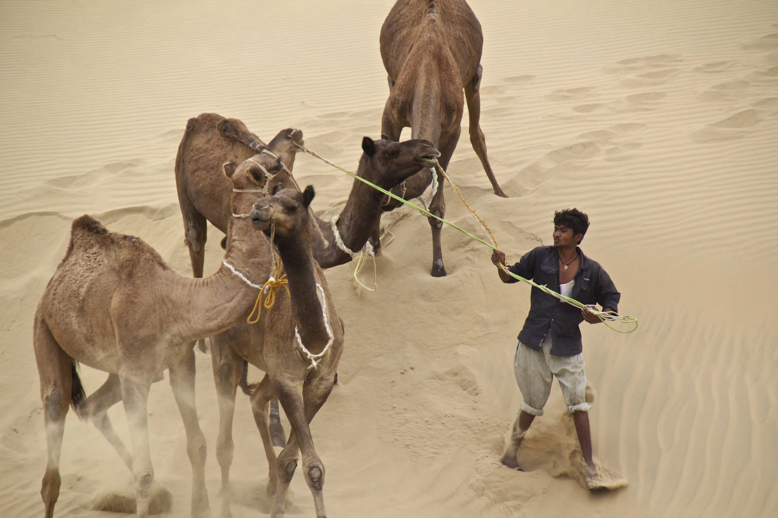
After a day's train ride out towards the West Indian border from Jodhpur, I arrived in Jaisalmer. From Jaisalmer, I hired a jeep to take me farther out into the nothingness of the Thar Desert, stopping through an old Rajasthani ghost town on the way. The last article left off where the road ended. We had been on rough, gravel roads for hours at this point, so we were on the actual edge of India. From here there would be nothing but sand and shrubs until Pakistan. So where were we...

This was a highly anticipated destination for me. A long, long time ago, in my suburban, Midwestern, teenage angst, amidst my endless internet searches for all the far away places I would go one day (and boobs), I came across the work of a photographer named Steve McCurry. He had taken the most amazing photographs of places I had never even heard of, one of them being a city that was painted entirely blue, in some far off land. I was enthralled as I clicked through the pictures of children running down the distinct, baby blue alleyways. I don’t remember ever bothering to see exactly where the photos had been taken, as the practicalities of actually getting to places like this had no application for the younger me, who was trapped. The older me however, made a point to dig these photos back up, and figure out how to get himself there.

It was another 20 or 30 minutes through the canyon before we finally saw Turtuk off in the distance. As we approached, the canyon grew wider ahead of us, and we saw a small collection of trees. It wasn't long before we were in the middle of those trees, and I was taken completely by surprise by what we found. Tucked away in such a remote part of the Himalayas, Turtuk was like a lot like Shangri-La. Despite its harsh, rugged surroundings, this village was a little slice of heaven.

At 18,380 feet (or 5,602 meters) above sea level, Khardungla Pass is the highest motorable road in the world. To put altitude in perspective for you, that's almost 13 times the height of the Empire State Building. It's a little less than the length of 115 (American) Football fields. It is the equivalent to about 3.5 miles. It is also 780 feet higher than Everest Base Camp.
So let's get into it!

If anybody remembers my “travel plans” post about India, one of the big things that I wanted to do was to get to a place called the Spiti Valley in India’s Northern Himalayas. The Spiti Valley would have been cool, but it was just an idea; in reality I just wanted to see the Himalayas, in some way, shape, or form.
Life happened, and I ended up in Leh.

I'm going to kick this post off with some history, and work my way up to the problem I almost had with the Bangladeshi police. It's going to be heavy on writing and light on pictures, so if that's okay with you, let's get started.

Waking up in Dhaka I hear the ringing of bells on rickshaws, people yelling, and dogs barking. I am staying on the 9th floor of an office building that rises high over the slums on Dhaka’s southwestern outskirts. I look out the window, and I can see a rainstorm blowing in from the south. The Muslim call to prayer eerily wafts over the half-finished buildings all around me from the local mosques.

Bagan is a pretty picturesque place, but for me, these 9th century Buddhist ruins, cool as there were, were only part of the story. The people of Bagan were also awesome to interact with, which is sort of a rarity for a traveler. If we’re being honest here, most local people who talk to you when you’re traveling are trying to sell you something. It’s pretty rare to travel in the developing world and have somebody talk to you with no ulterior motive. You have to get pretty far off the beaten path for that. That is what makes Burma so great.

When I got to the ticketing counter for Tiger Air, I told the woman at the counter that I was traveling to Yangon. She looked skeptical. “You’re traveling to Yangon? Really?” she said, squinting.
“Uhh… yes?” I replied groggily.
I was required to go through security twice before I got on my flight (the second time at the gate) and when I finally did, the plane was only about 1/3rd full. It was not a smooth flight, so while I’m white-knuckling my seat, let me fill you in on Burma really quick.

During one of my rainy days in Sa Pa, one of the hostel workers told me about an organization that had just been initiated that allowed foreigners the chance to have a question and answer session with former Viet Cong soldiers, and interact with children who were growing up with disabilities caused by Agent Orange. I was beyond excited to hear that such an organization existed. This was going to be the real deal.
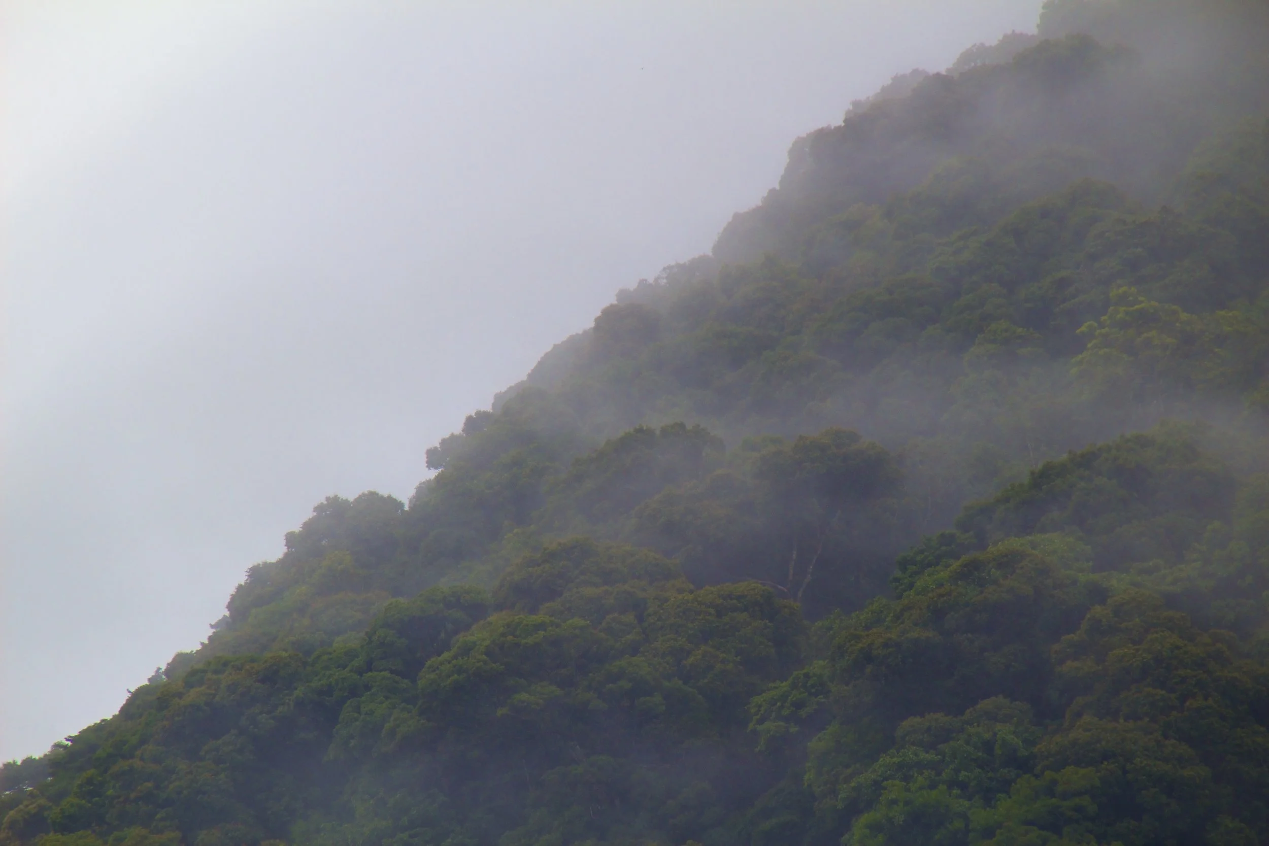
Ba Vì Mountain is just a couple hours drive West of Hanoi. It’s supposed to be beautiful, so my roommate and I decided to make a motorbike trip of it. I’m going to tell you now – our first attempt was a miserable failure. It was not until our second attempt that we summited that S.O.B.
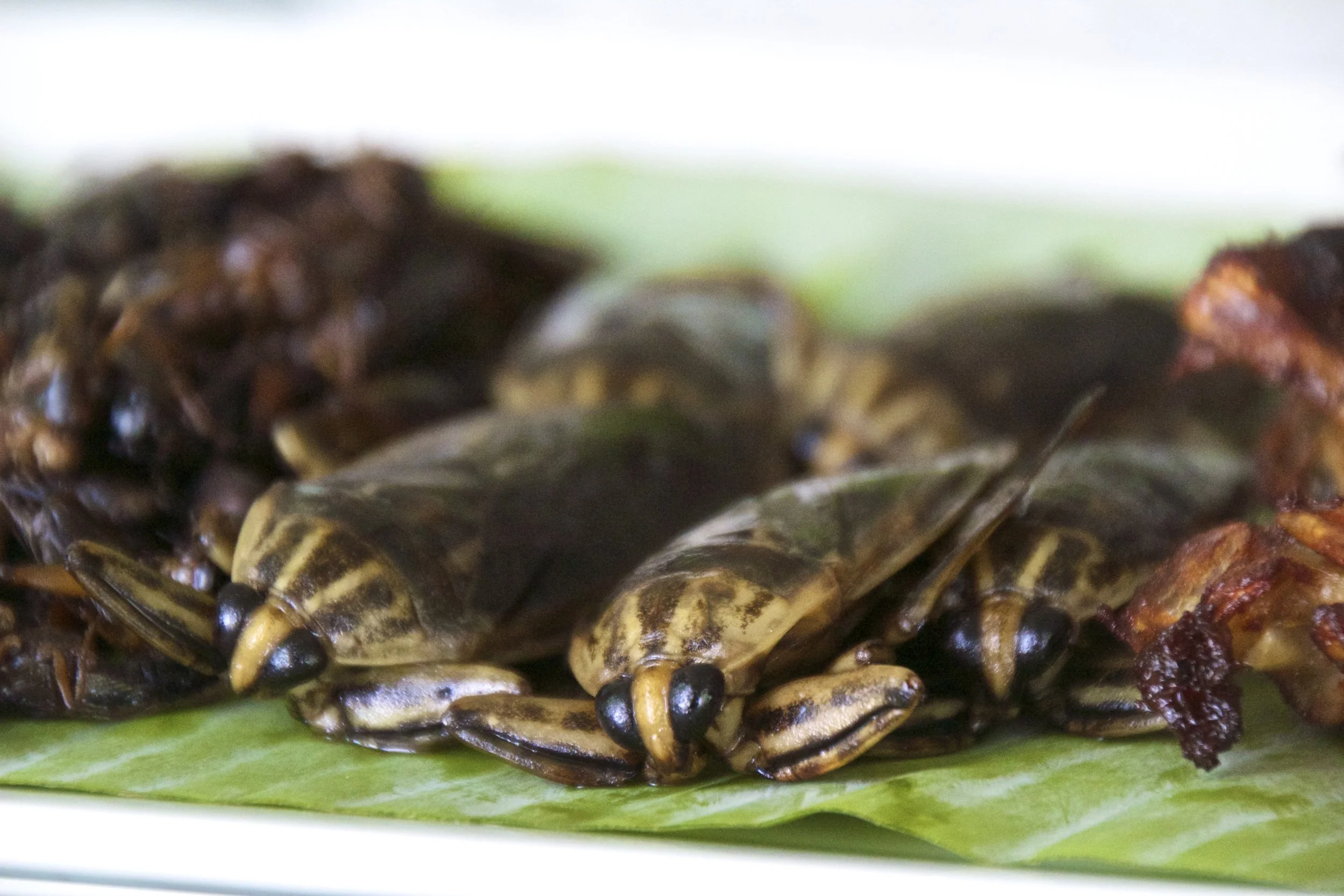
Thailand is known all over the world for, among other things, its food. And I wanted to try some authentic Thai food. “The weirder the better” I told my hosts. They were pretty amused with my antics and sent their maid to the market for some goodies. I would have liked to see the market but I ate all the food just the same. So let’s start the count down of strange foods. We’ll order these according to weirdness and save the weirdest for last.
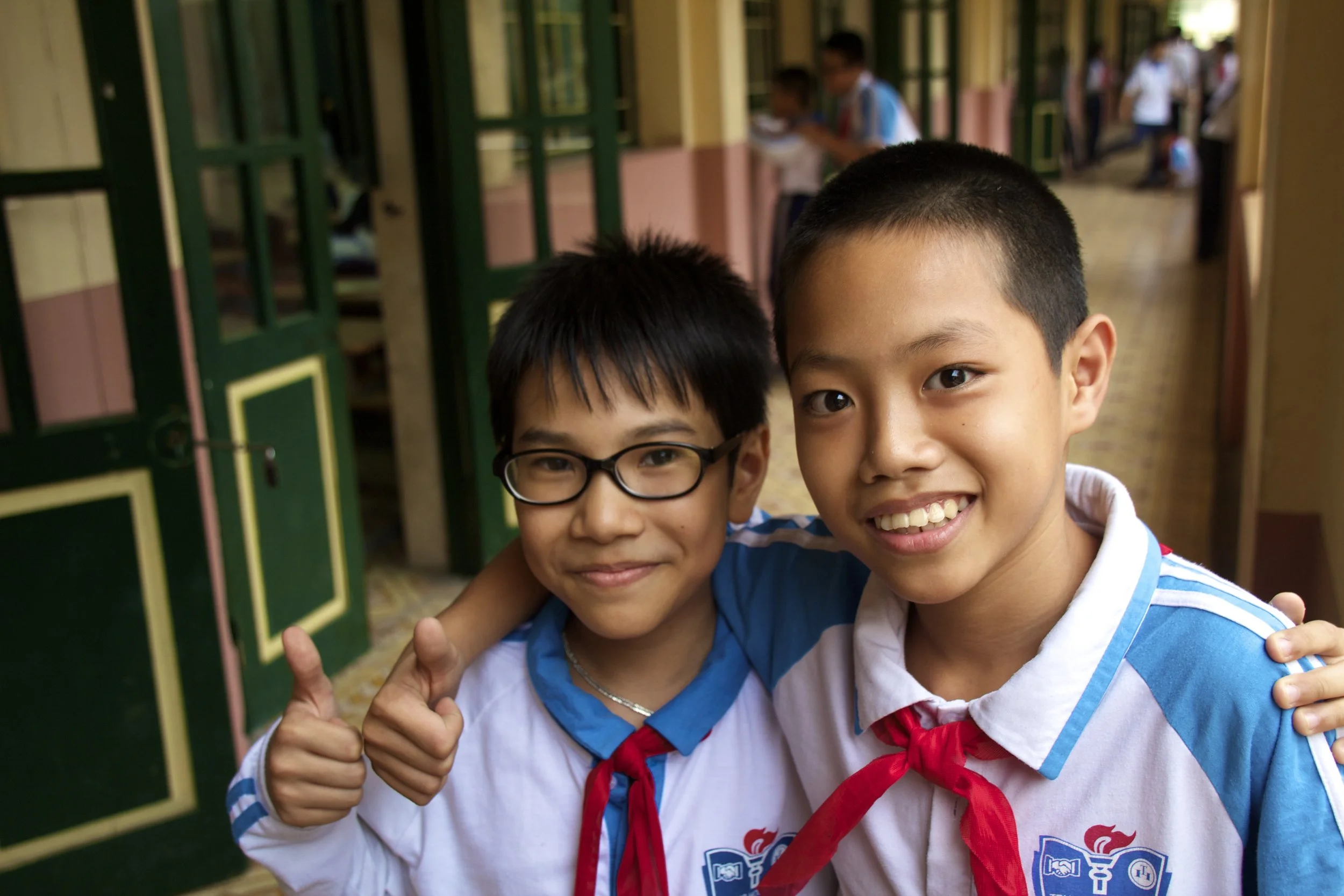
Most of what happens to me in the classroom isn't enough to merit its own extended blog post. But as the Vietnamese school year comes to a close, I want to share a collection of stories from my classes. This is the first of 2 installments of the teaching 'story basket'. So without further adieu, here are 4 little windows into what class with Peter is like.

Hội An was a very important trading post of the old world. It was the opinion of most Chinese and Japanese merchants that Hội An was the best trading post in Southeast Asia, if not Asia at large. However, thanks to a treaty signed with the colonizing French, Đà Nẵng eventually became the port of choice in lieu of Hội An. Also, due to a build up of silt at the mouth of the river, Hội An became all but inaccessible to the large ships that used to frequent its docks. The effect of this was isolation. The ancient town of Hội An was all but forgotten about during Vietnam’s tumultuous next 200 years.
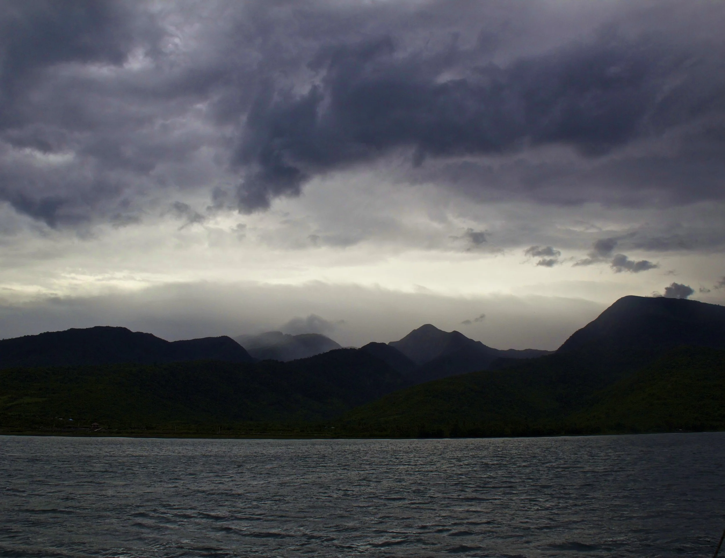
We sat on the deck of the boat eating our dinner together. Nobody was speaking. We were not in good spirits. Lightning flashed silently off in the distance in all directions with increasing frequency. The coast of Sumbawa sat calmly a few hundred meters away. I watched the lights twinkle from shore, wishing I was there instead of on this boat. With the wind picking up, we could all feel the storm coming.
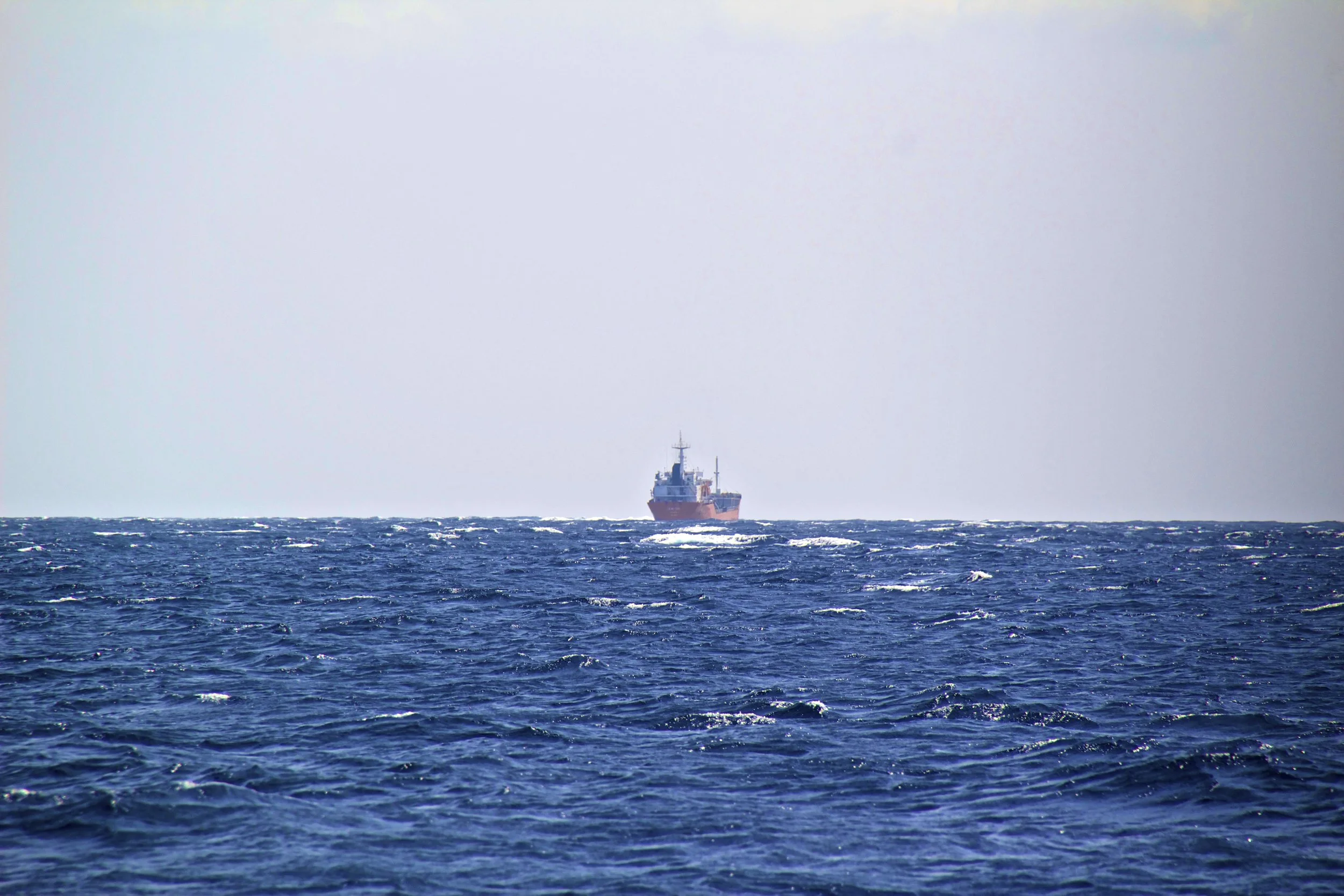
The rest of us, strangers to one another at this point, looked at each other, and then with an uneasy shrug climbed down onto the deck of this tiny boat. It bobbled precariously with every passing wave. One thing was certain: this was going to be interesting. So let’s fast-forward a little bit, shall we?

We were driving overnight and I was doing my best to sleep but it was tough with our bus driver trying to break some sort of land speed record on the winding, bumpy mountain roads. It didn’t help that I had to twist and mangle my long white-person legs into terrible positions to fit into my seat in the first place. We made it to Mù Cang Chải a little bit before sunrise. This town would serve as our ‘base camp.’
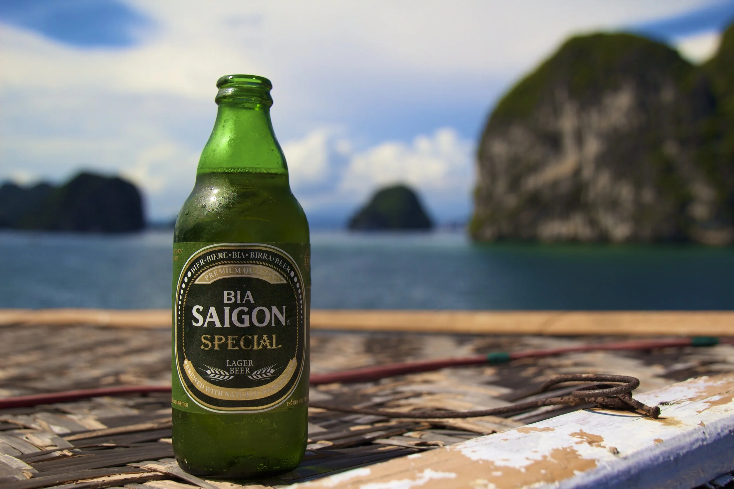
Within a few weeks of arriving in Vietnam I had the blessing of more than one day off work in a row. It would be the only time that this would happen naturally (that is, without twisting any arms) until February so I wanted to make the most of it. I asked everybody I knew (which at that point was not a lot of people) what their plans were for the Holiday but nobody’s off-time coincided with my own. It was two days before my holiday and I had become gloomily resigned to not doing anything. But then one of my roommates’ plans changed at the last minute.

Welcome to my travel blog. The point of this blog is first to keep everybody updated on what I am doing and verify to the world that I am still among the living. Secondly, this blog will chronicle my story as I make my way through uncharted waters. Hopefully it can serve as encouragement for anybody else out there considering doing the same thing.
Jack the Ripper committed a string of 5 murders over a 10-week period in the autumn of 1888, in the then-impoverished East End of London. Specifically, this all went down in and around an area called Whitechapel. What better to do in London for Halloween than go on a late-night Jack the Ripper historical tour? That was the itinerary for Halloween 2025. On Halloween night, we put on our coats and hopped on the tube to meet our tour group in Whitechapel (East London).