

👇 LET’S GET some fresh air, eh? 👇
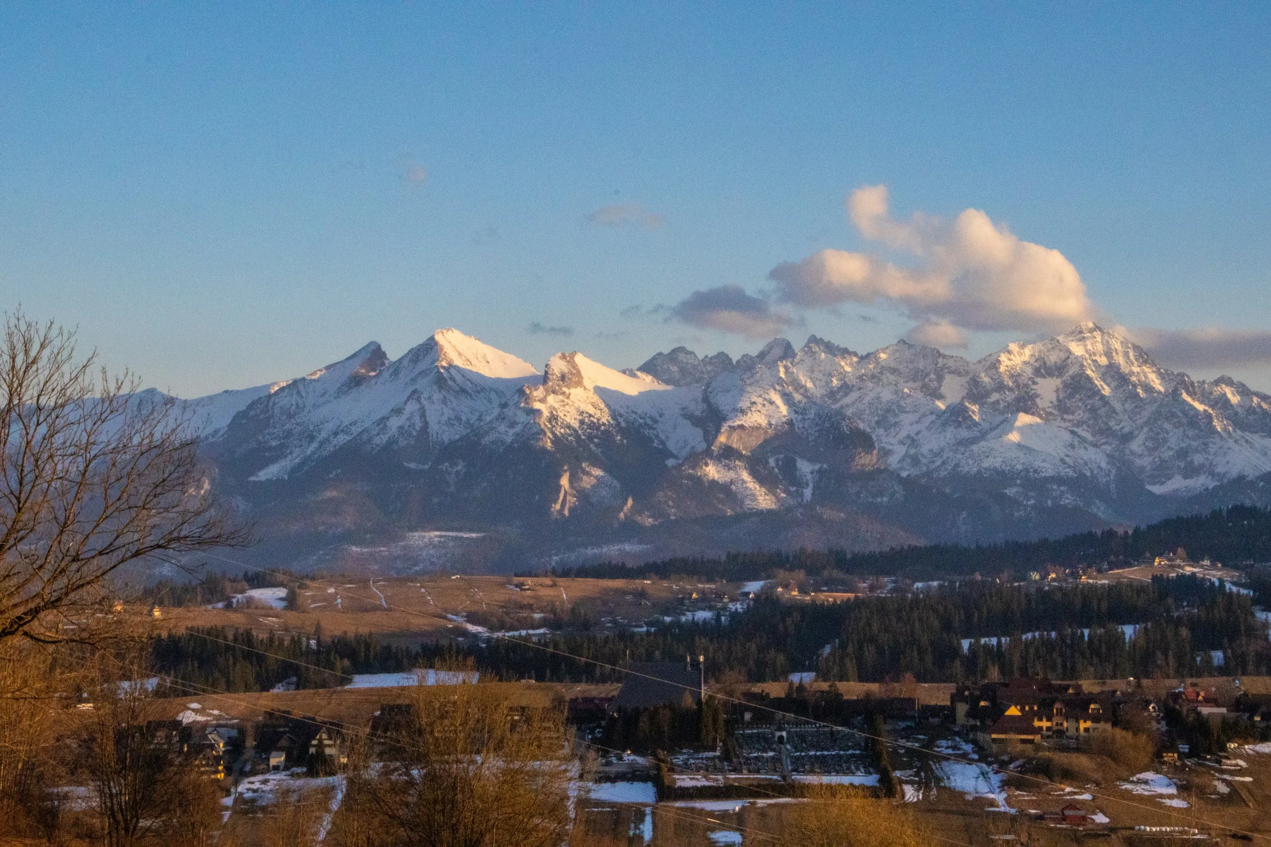
Poland’s reputation is for being an overwhelmingly flat country, and that is mostly true, but its far southern border, which it shares with Slovakia, is marked by a particularly jagged section of the Carpathians known as the Tatra Mountains. Although they are much smaller than other European mountain ranges—such as the Alps, Pyrenees, and Caucasus—they are extremely dense, rugged, and beautiful. In fact, they are SO beautiful that—although they only stretch about 57 km (35 miles)—the Polish and Slovakian sides receive a combined ~8.5 million visitors per year, skewed toward the Polish side. That makes them the most intensely visited mountain landscape per square kilometer in Europe. And yet, I’d never even heard of them before this trip!
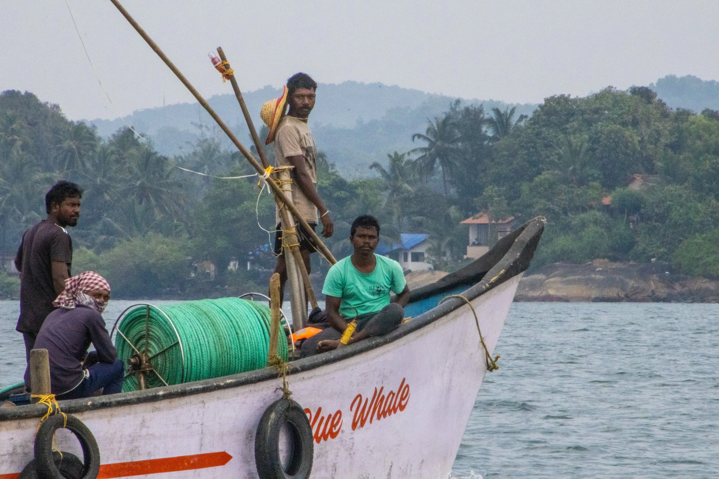
So, what exactly is Goa? Because it’s so tiny, I was surprised to learn that it is actually a stand-alone state in India, on the same administrative level as Uttar Pradesh, Rajasthan, or Maharashtra! Indeed, it is the smallest state in India, and its modern-day borders correspond to the legacy boundaries of Portugal’s once-upon-a-time colony on the Indian Subcontinent.
We mostly associate India’s colonial period with Great Britain, but France and Portugal both had small carve-outs in South India too. When the British finally left India shortly after WWII, the newly independent Indian government had expected Portugal to pull out of Goa as well, but Salazar (dictator of Portugal at the time) had other ideas. Long story short, India reclaimed Goa from Portugal via military force in 1961. The story of Goan identity as it relates to India and Portugal is quite complex, so I won’t delve into it fully here; hopefully in a future article. But I will tell you that Portuguese culture is still part of Goa’s DNA. It’s even got a large catholic population, which is quite out of place in India.
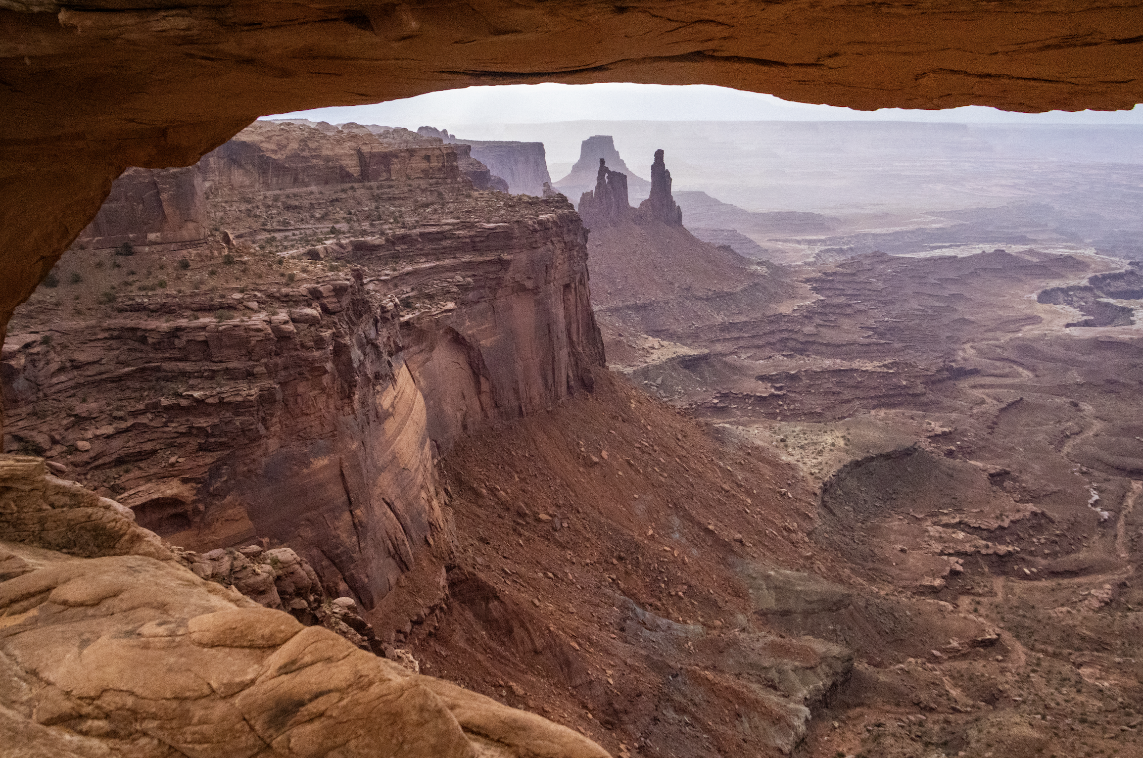
Finally, we arrive at Canyonlands National Park, which is the largest and most remote place we will visit on this trip by far. A couple hours southwest of Moab and Arches, Canyonlands spans an area of more than 300,000 acres. It is not a place that can be seen fully in a single day… but we’re going to do our best. Indeed, this particular trip will be most confined to the northern regions of the park, but I want to underscore that there is a LOT more of this landscape that we won’t see today.
As you will see, Canyonlands is a VAST area of canyons carved by mighty rivers that still flow through them to this day. Thousands of feet above the water, towering mesas look out across seemingly endless canyon-scapes. It offers more than a few STUNNING views.
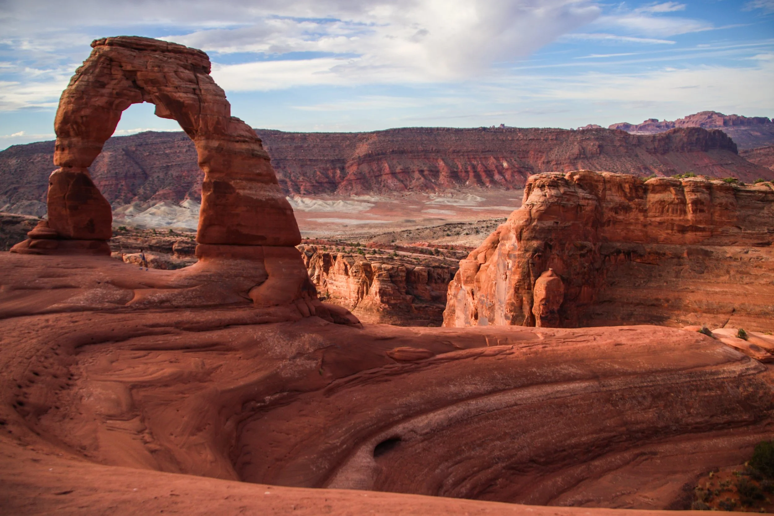
There are lots of famous rock formations in Arches National Park, but the most famous of them all is called “Delicate Arch”. We wanted to get there early in the day and experience sunrise within the park, which meant that we have to get moving at the butt-crack of dawn. In the gentle early morning light, our rental car carried us out of Moab and up a steep switch-back road into the park. Mind you that Moab is already ~4,025 ft (1,227 m) above sea-level. Arches actually gets as high as ~5,653 ft (~1,723 m) above sea-level, and—despite being only ~5 miles (8 km) away from downtown Moab—is usually 5–10°F (~3-6° C) colder. That being said, both Moab and Arches get HOT in the summer. The record high in Moab was 114°F (~46°C), and summer highs frequently exceed in 100°F (38°C) within Arches. So, heat is a hazard here! Consequently, sunrise/sunset exploration tends to be preferred, with many visitors retreating to Moab for a nice air-conditioned siesta in the middle of the day.
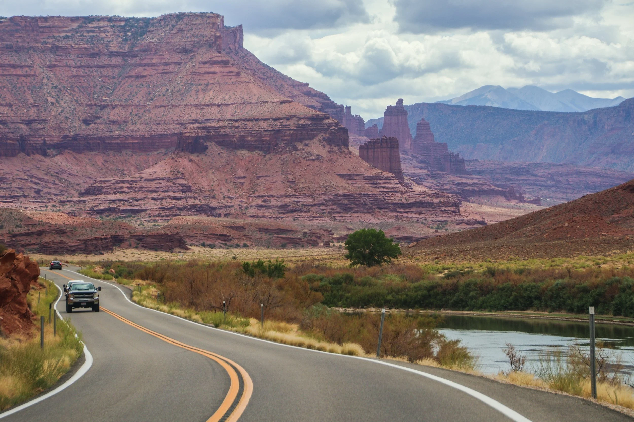
The road you are about to see was an important regional access point long before Moab was ✨M0aB✨—it was (and still is) important for ranching and river access. AND, it was apparently an important area for Uranium mining in the mid-1900s. But the human element of this road is really besides the point; unlike the rigid grid systems you will find in a lot of US infrastructure, this road works with nature, snaking through this canyon, following the river wherever it goes. In this sort of geography, you’d really have no choice but to build this road this way. That’s one of the magical things about traveling out west: the natural features become far too big for humans to tame.
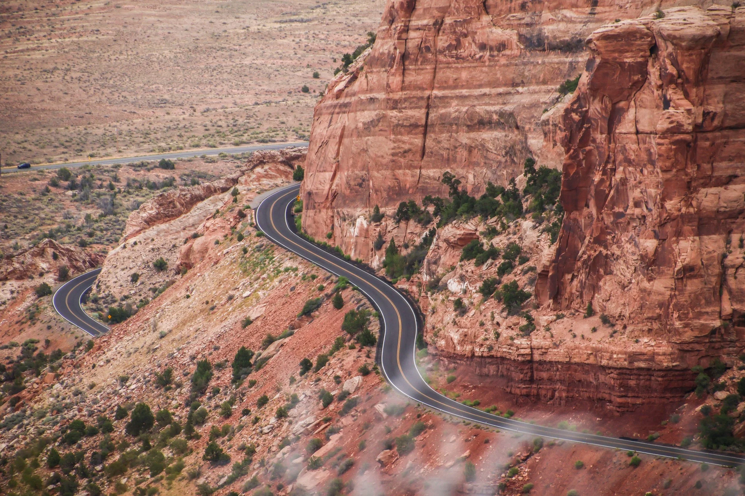
Colorado National Monument isn’t a single landmark, but a large area of landscape, which includes massive rock formations, deep canyons, and rugged plateaus, all of which were carved over millions of years by wind and water. The primary thing to do here is the Rim Rock Drive, which is a 23-mile-long paved road that brings you past a great many breathtaking views over dramatic sheer cliffs and expansive valleys. There are lots of places to stop along the way, many of which have their own hiking trails and camp sites. Today, we’re going to drive the Rim Rock Road.
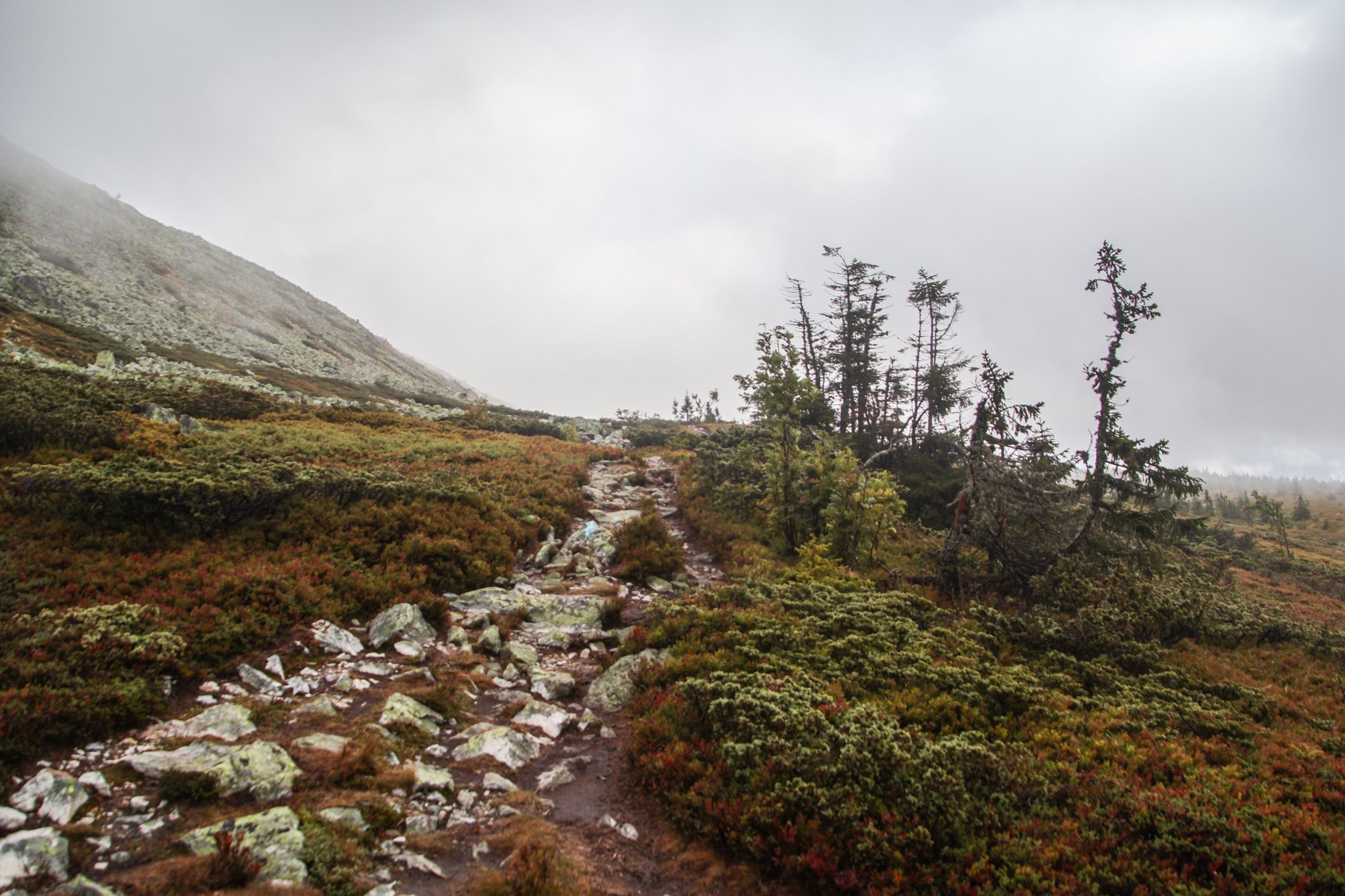
I was excited to see some of Norway’s legendary mountains! Unfortunately, Freyr (the Norse god of good weather) was otherwise occupied during my visit. During our entire stay in Trysil, the landscape was covered in a thick fog and a cold, driving rain. It was perfect weather to cuddle up with a good book in a mountain cabin… but we had other plans.
Bright and early, we set out into the cold, foggy wetness to complete our hike. There were about 5 minutes where the sun managed to poke through the cloud cover, so I’ll show you those photos first. We were not in a particularly scenic part of the trail during that fleeting moment, but even then it was clear that—had we been able to see the landscape around us—it would have been incredible. The sun reveals a stunningly bright color palette on the grass around us.

Maasai Mara—which is often locally referred to as simply, “The Mara”—is the name of a giant nature preserve in southwest Kenya. Its namesake, the Mara River, runs through it, and the word “Maasai” refers to the original tribal inhabitants of this area, who can still be found here today.
Well, as far as I know, the only difference between Maasai Mara and the Serengeti is the border between Kenya and Tanzania. The Mara is the Kenyan side, while the Serengeti is the Tanzanian side. Looking at the map, it might be tempting to think that Maasai Mara is the lesser of the two experiences because it’s so much smaller than the Serengeti, but—while I have not personally experienced both—I’m told this is not the case.
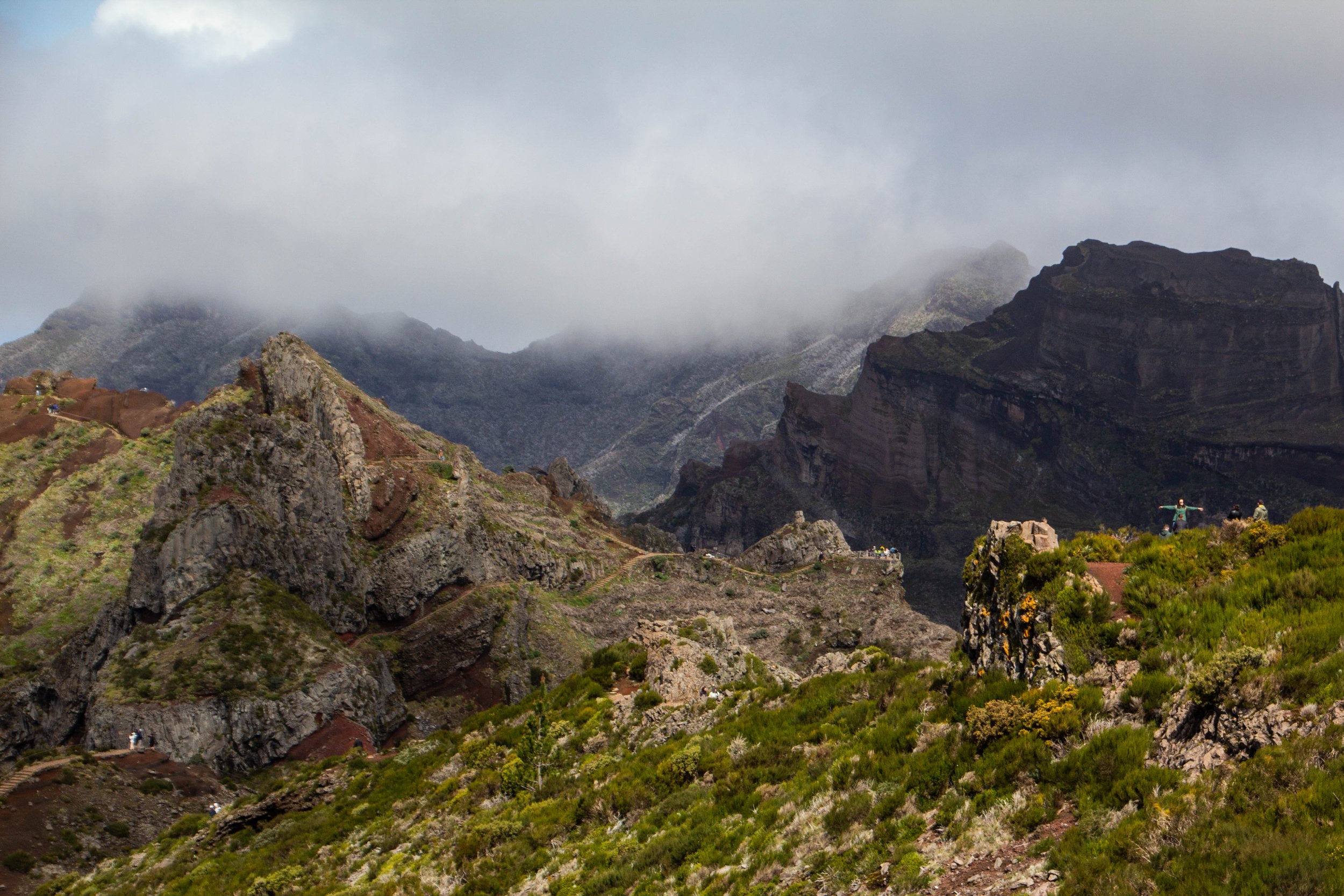
The #1 rated hike in Madeira on AllTrails is the one that from Pico do Areeiro to Pico Ruivo. These are the two highest peaks on Madeira. And in the middle you pass over Madeira’s 3rd highest peak: Pico das Torres. AllTrails ranks this hike as “Hard” and I think most people who do it would agree. But there’s some serious hype around this trek!
“It’s gonna be the coolest hike of your life” my friend said to me confidently after we landed in Madeira.
“…Like, my life specifically?” **Subtext: “You don’t think I’ve done any other cool hikes?” 🥺
“No, dude, like the coolest hike of anyone’s life.”

When you fly into Madeira—assuming you are coming from Europe, which is undoubtedly the most common flight path—you will fly over this jagged, sun-soaked rocky outcropping. Even from the window of the plane, it seems really long. It makes an impression on you immediately that Madeira is going to be a rocky, mountainous place. Which is true. I had sort of forgotten about this little land formation until I looked at the map on the morning of this hike (I wasn’t responsible for planning this portion of the trip 😂)—it turned out, we would be hiking out to the very end of it!
At the time of our visit, Farol da Ponta de São Lourenço was the 2nd most popular hike in Maderia on AllTrails, which I just found out has this cool map embed feature. So here’s the info from AllTrails: it’s categorized as an “intermediate” hike, and you can probably knock it out in a few hours. There are definitely som very steep stretches of trail, but there are also flatter portions where you can catch your breath. And there is also a little oasis in the middle of it in the form of a cafe! I have no idea how these restock that place.
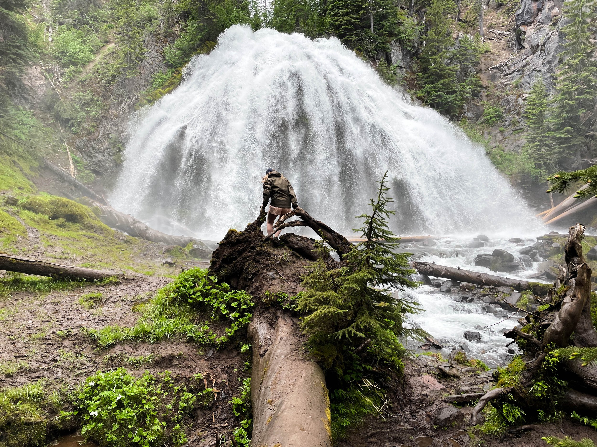
Chush Falls (pronounced “shoosh”) is actually nestled right up against the Sisters Mountains and Broken Top. The drive to get to this trailhead was about an hour from Tam McArthur Rim, all over gravel roads. Oh, and it was absolutely STUNNING. Honestly, even if you don’t do this hike, the drive is still well worth the effort. This was already bringing me closer to these mountains than I had yet been. Looking up at the snowy slopes, I could see every little rock and wisp of cloud clearly and was able to even capture some of this with my camera. And, miraculously, the weather really was clearer over here.

This many mountains is just insane to me. Prior to this trip, this was not what I pictured when I thought of Oregon. This was downright RUGGED! And it was gorgeous. The three mountains in closest proximity to Black Butte, and to one another are the Three Sisters for which this area is named: Middle Sister, North Sister, and South Sister. All three of these mountains are sleeping volcanoes. The North and Middle Sister last erupted ~14,000 years ago and scientists think it’s unlikely that they’ll ever erupt again. However, the South Sister erupted as recently as 2,000 years ago, and could feasibly erupt again. There have been sporadic reports of volcanic rumblings deep within South Sister since 1866, and there have been a couple of minor scares since the late 1980s. Nothing has ever happened, but there is a big pot of magma a few miles beneath the peak of South Sister. Did I mention that South Sister is also the easiest of these mountains to climb? Sign me up for that!! 😵
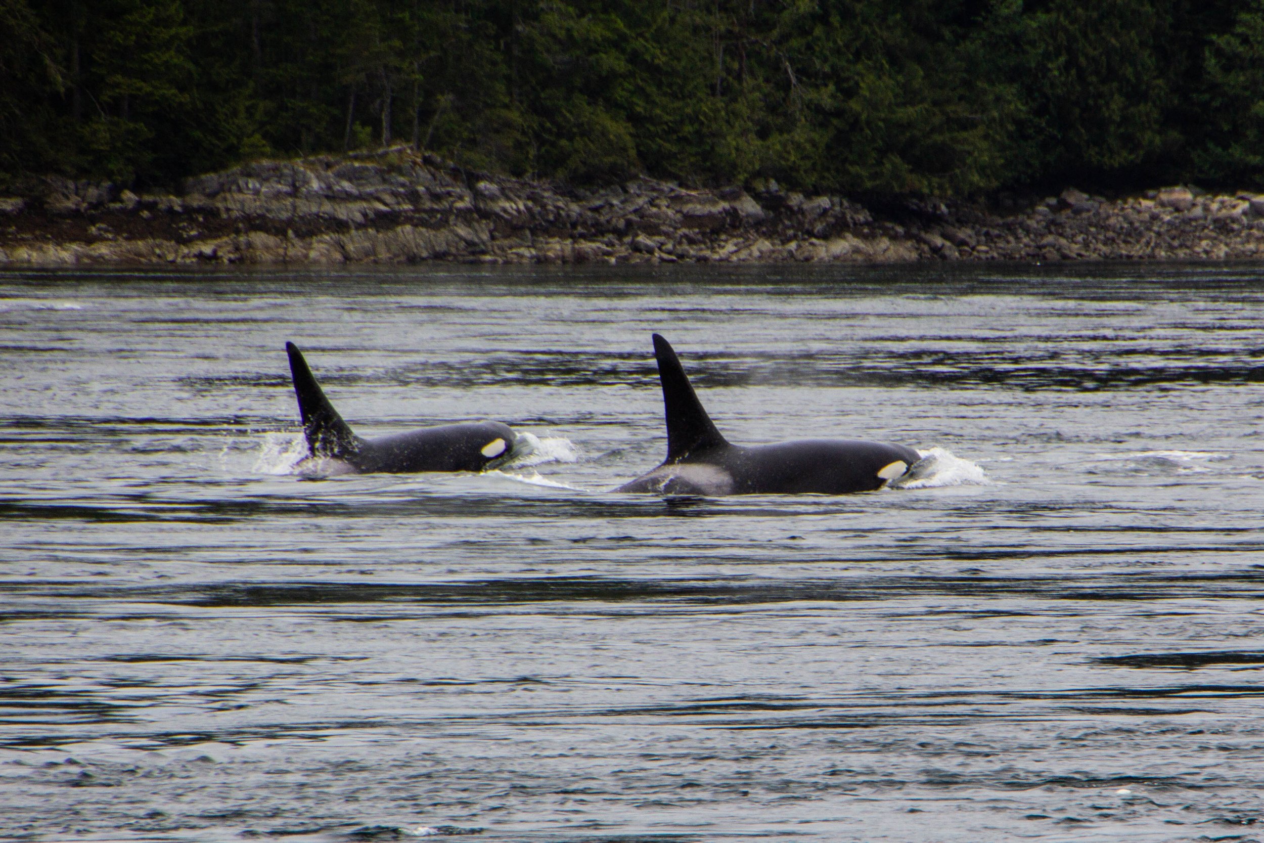
Orcas, or Killer Whales, were something of a feared creature in the olden days. Apparently, back in the 1800s when this part of the world was first being explored by Europeans, their technical/scientific classification was actually “Monster.” Hilarious as this might seem, it does make some sense. Black whales with sharp teeth and shark fins? Yeah, that would have definitely felt somewhat monstrous to me if I was an early sailor of these waters. The conventional wisdom of the day was that, if you fell in the water, you needed to get out ASAP so an Orca wouldn’t eat you. If you hadn’t already guessed this, there is, in fact, no record of an Orca ever eating a human. But this was still a legitimate fear as recently as the 1960s when they actually mounted a machine gun on a coastal bluff known as Chatham Point with the aim of shooting as many Orcas as possible. 🤯 Somehow, for the time when this gun was actively scouring the seas, the Orcas stayed clear of this area and there were no casualties. So Orca/human tensions have never escalated to be anything more than a cold war. And it was not long after this that human sentiments toward Orcas began to change for the better.

Avatar Grove is well-named; it really does feel like something out of Avatar. Or maybe Jurassic Park. It is a tangled, mossy labyrinth of ancient, knotted trees rising out of an infinite carpet of prehistoric-looking ferns. Each tree branch is draped with moss, similar to the way Spanish Moss hangs from every tree in Savannah—but in a green, lush, distinctly Pacific Northwest kind of way. Every little detail of this place was fascinating and photogenic. From the mossy, leafy forest floor, to the canopy high above our heads, every inch felt like its own world.

In the last article, we checked out Sombrio beach, which I think is likely the most easily-accessible stretch of coastline in the Port Renfrew area, and also the place that resembles the classic “beach” (i.e. sand, waves, etc) most closely. However, the majority of Vancouver Island’s coastline is not as easy to access and is NOT your classic sandy beach. This is a rocky, mossy, rugged, chaotic, windswept boundary zone, perpetually pounded with massive waves, riddled with lively tide pools, and entirely unaccommodating to the “beach vacation” experience. It’s also extremely cool.

To give you an idea of exactly how isolated this place is—the one gas station in the area was out of service during our visit, so we had to drive 2.5 hours EACH WAY to get to the next nearest gas station. We had been advised to stock up on groceries in Victoria before coming out here because we’d have to travel similar distances to find a supermarket. Also, Port Renfrew apparently experiences random rolling blackouts from time to time. When the power went out on our last day, we stopped by a local hotel & restaurant that had a generator running to ask how long these blackouts usually lasted—they told us that the last one lasted 2 days. 🤯 Suddenly, the flashlights we found waiting for us in our Airbnb made a ton of sense. That’s part of the deal out here!

“……Paraguay?” I asked through a confused squint. I did not recognize this name, but it sounded a bit like Paraguay, even though this guy was clearly not from South America.
“No… Haida (exaggerated pause) Gwaii.”
Google that. Google “Haida Gwaii.” I had never even heard of this place. And I have heard of most places.
That is the kind of place that Victoria serves as a way-point for. It’s a completely different world that awaits up here. But I’m getting ahead of myself. First, let’s take a walk around Victoria…

We already talked about how close into the mountains Vancouver is. I have never seen anything like it—at least not for a city as big as this. Northern Vancouver is literally built into the sides of the Cascades, with its streets and buildings sloping up the sides of the mountains as far as physics will allow. So when you start driving northward from Vancouver, you will find yourself in the mountains pretty much instantly. The drive up follows the coastline of a rugged Pacific fjord that comes to a head in the gorgeous little town of Squamish, and from there it’s all mountains. Here’s a map of the trip. It might not look like a huge distance on the map, but’s 2.5 to 3 hour drive to get up there from Vancouver.

You can’t actually drive all the way out to Tomales Point. There’s a parking lot and a trailhead next to the historic Pierce Ranch. From there, it’s a 9.4-mile round trip hike to get all the way out to the tip and back. Over the course of this route, there’s a total elevation gain of 1,177 feet. Honestly, it’s a pretty easy hike. I did this when I was fresh off a particularly rough COVID infection, still trying to get my mojo back, so this should give you no pause.

Point Reyes National Seashore is a prominent peninsula/cape land formation that juts out of the California coast just north of San Francisco, in Marin County. Bounded by Bolinas Lagoon on the south and Tomales Bay on the north, it’s well known as a beautiful Northern California nature destination. There’s some mildly interesting history here, but mostly it’s just gorgeous. And to raise the geological stakes a bit, the San Andreas Fault is what separates this area from mainland California. That will show up in the pictures I have coming up for you in some cool ways.

When you picture LA, what comes to mind?
I’m guessing that most of you didn’t say “mountains.” Or maybe all of you did and I’m the one who wasn’t “hip”. But the following was actually news to me: LA is actually surrounded by some formidable topography! And a lot of it is a lot closer to the city than you might think. The map below shows the terrain in 3D, and you’ll see that there are a number of different mountainous areas to be considered here, but today we’re going to be in the one highlighted in blue. Those are the Santa Monica Mountains.

Literal paradise.
Ushguli is a small cluster of towns that sits right on the Georgia-Russia border in the mountainous northerly region of Svaneti. It’s remote, difficult to access, and it’s got a population of less than 250 people. And yet, a quick Google image search for Georgia (the country of Georgia) will often return images of Ushguli even above images of the capital city. Clearly there is something special about this place.

The Caucasus Mountains don’t hold many superlatives or titles because, compared with other major mountain chains like the Andes or the Himalayas, they’re boxed into a pretty small area. They also rise up basically straight from sea level (they border the Black Sea to the west and the Caspian to the east), so there was virtually no chance of them having the highest anything. Compare that with the Rockies—driving west across the U.S., by the time you get to Denver, which is still in the Great Plains, you’re already more than a mile above sea level! So the Caucasus range flies below the radar, but once you get yourself into the middle of it, it’s pretty overwhelming. It is a world unto itself, with all sorts of interesting secrets and idiosyncrasies. Today we’re going to focus on glaciers.

Finally, we arrived at our destination. Before we re-enter our narrative, let me introduce you to the famous Georgian mountain town of Kazbegi. It’s basically just famous because the mountain peak that towers over this little town is particularly dramatic and maintains a snowcap year round. This Mount Kazbek. In short, it’s super pretty! Everybody I had brushed elbows with up to this point in my trip recommended Kazbegi profusely.

For my American readers, I’m gonna go out on a limb here and say that there is no way in hell that you don’t know what Napa Valley is. But for my readers from abroad, I’ll explain just in case. Napa Valley is America’s postcard wine country. There are pockets of vineyards all over the country of course (Oregon is a notable wine producer as well), but Napa Valley is the epicenter of wine culture and cultivation in America. Napa Valley refers to a large fertile valley full of vineyards in Napa County, California, which just on the north side of the San Francisco Bay. Driving north through Napa Valley, there are a few towns that you will pass through, the first of which is also called Napa. The next major towns before the northern end of the valley are Yountville, St. Helena, and Calistoga.

This quest brought us to the edge of the world, literally, to the bone-chillingly massive cliffs of Látrabjarg. Here’s a spoiler alert for you: it was mind-blowingly gorgeous. A friend of mine recently pointed out that I’ve said similar things about a great many of the places I have visited, so let me up the ante a bit: this was one of the top 5 most beautiful places I’ve seen, EVER.

The Westfjords (or, in Icelandic, Vestfirðir), is the name given to the enormous peninsula jutting out from Iceland to the northwest, towards Greenland. In these fjords are some of the most remote places and unforgiving terrain that Iceland has to offer. Only Iceland's interior is more difficult to travel through. After having driven the long road through Sprengisandur, I can personally attest to this. The views we saw from these roads in the Westfjords were absolutely stunning—beautiful enough that I felt that they merited their own article, so here is some of what we saw...

When you think about Iceland, what do you think about? Probably green mountains and a beautiful, rugged coastline, right?
Well that's just one piece of the geothermal puzzle that is Iceland. Iceland's interior is a very different place. It's a vast, inhospitable, volcanic desert. And in this enormous highland desert, conditions are punishing, and water is scarce (unless it's in the form of a glacier).
It's basically Mordor.
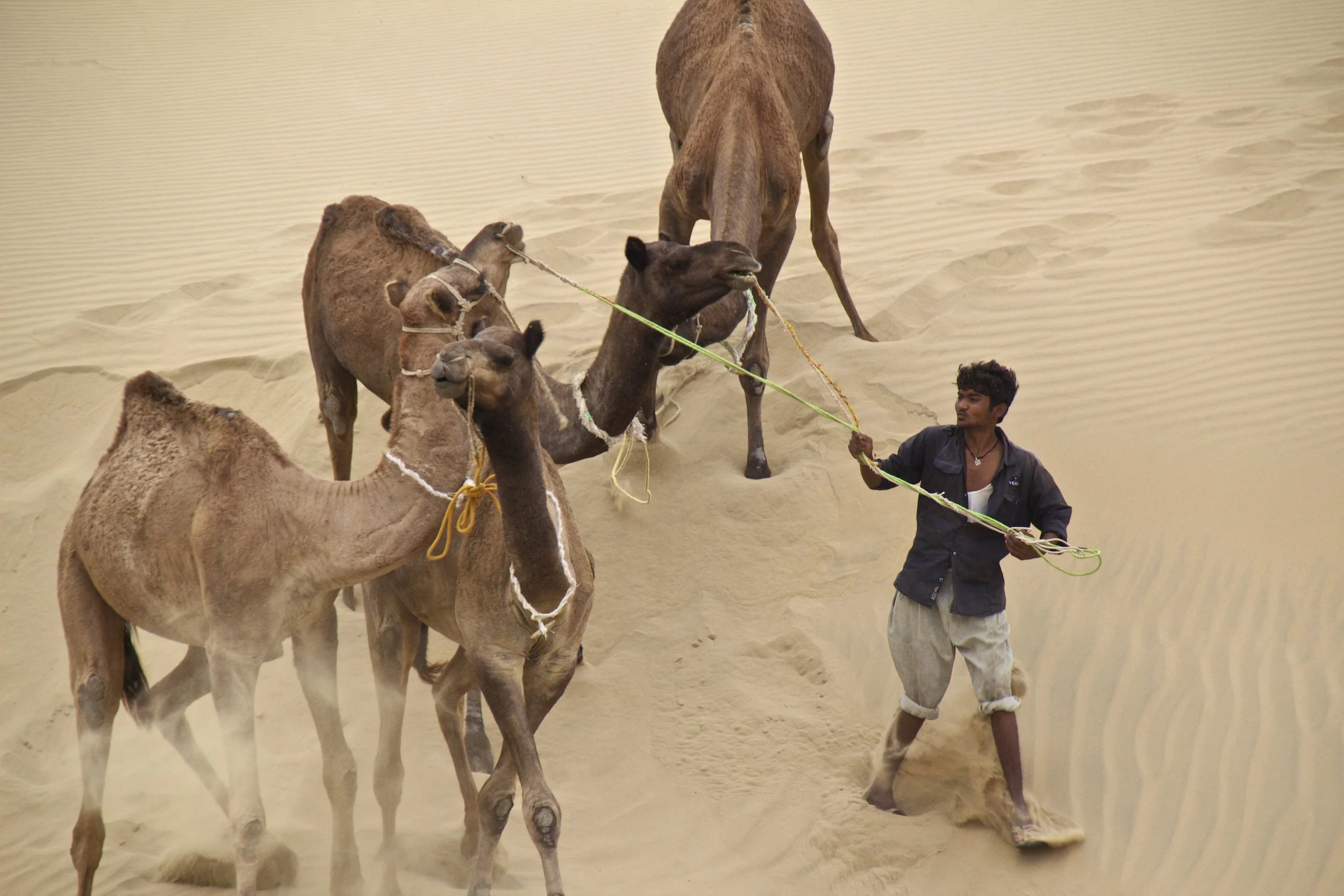
After a day's train ride out towards the West Indian border from Jodhpur, I arrived in Jaisalmer. From Jaisalmer, I hired a jeep to take me farther out into the nothingness of the Thar Desert, stopping through an old Rajasthani ghost town on the way. The last article left off where the road ended. We had been on rough, gravel roads for hours at this point, so we were on the actual edge of India. From here there would be nothing but sand and shrubs until Pakistan. So where were we...

Let’s start with size. Mexico City is really, really big. In fact, Mexico City proper has almost 9 million people and Mexico City metro is home to a whopping 21 million people, which just a few million less than Beijing. This makes it the largest population center on the entire continent of North America—bigger even than New York, LA, Chicago, Toronto, etc. It also puts Mexico City comfortably in the top 10 largest cities in the world.

Some cities hit you with strong vibes the minute you step out of the airport, and those vibes set the tone of your entire stay. But Tbilisi was an interesting one, because I really didn’t feel anything when I arrived here. Or ever, in the 7 nights I spent in this city. I was expecting some sort of strong, emotive, post-Soviet energy of a fledgling nation determined to get on its feet regardless of Russia’s endless attempts to undermine its sovereignty (or, you know, something like that) … but I felt nothing. Because, as it turns out, Tbilisi is a city with absolutely ZERO pretense.

Varanasi is known as the holy city. It is said that all the Hindu Gods live here. After finding enlightenment under the Bodhi Tree, Buddha came here to do his first teaching. There is also a sizeable Muslim community here. The city is therefore packed with religious landmarks and temples.
So, the “Sisters” are a series of massive hills that have each essentially been sliced down the middle by natural erosive processes to reveal massive, sheer cliffs that stretch along the English coastline like a series of rolling waves. To make the scene all the more striking, these cliffs are entirely white. Perhaps you’ve heard of the “White Cliffs of Dover”? This is part of the same system of cliffs, which is called the “South Downs”, but Seven Sisters is arguably even more iconic because the entire stretch has been kept completely natural and undeveloped. The white color comes from the fact that the earth here is made of an extraordinarily pure form of limestone: chalk! Indeed, the earth here contains about 98–99% calcium carbonate, with very little clay or sand, making them appear dazzlingly white! They stay so white because they are in a constant cycle of erosion, where after some time the outer layers of chalk crumble away revealing fresh, white chalk.