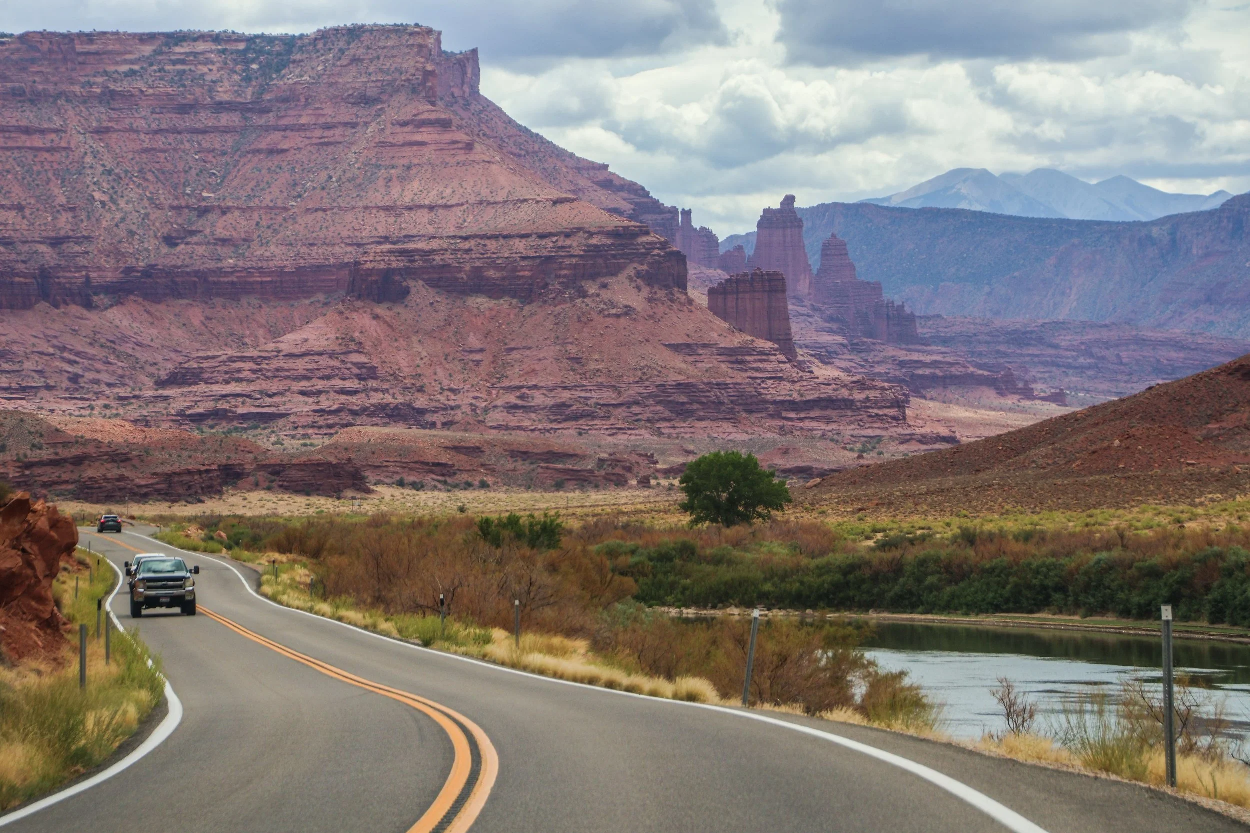
The road you are about to see was an important regional access point long before Moab was ✨M0aB✨—it was (and still is) important for ranching and river access. AND, it was apparently an important area for Uranium mining in the mid-1900s. But the human element of this road is really besides the point; unlike the rigid grid systems you will find in a lot of US infrastructure, this road works with nature, snaking through this canyon, following the river wherever it goes. In this sort of geography, you’d really have no choice but to build this road this way. That’s one of the magical things about traveling out west: the natural features become far too big for humans to tame.
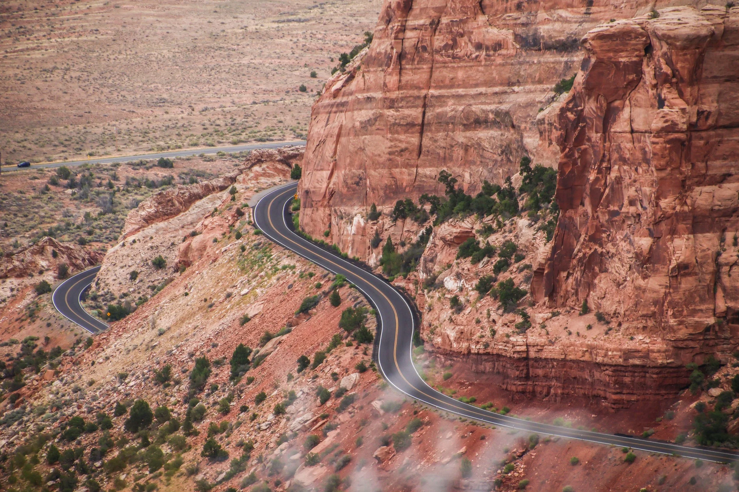
Colorado National Monument isn’t a single landmark, but a large area of landscape, which includes massive rock formations, deep canyons, and rugged plateaus, all of which were carved over millions of years by wind and water. The primary thing to do here is the Rim Rock Drive, which is a 23-mile-long paved road that brings you past a great many breathtaking views over dramatic sheer cliffs and expansive valleys. There are lots of places to stop along the way, many of which have their own hiking trails and camp sites. Today, we’re going to drive the Rim Rock Road.
When you fly into Madeira—assuming you are coming from Europe, which is undoubtedly the most common flight path—you will fly over this jagged, sun-soaked rocky outcropping. Even from the window of the plane, it seems really long. It makes an impression on you immediately that Madeira is going to be a rocky, mountainous place. Which is true. I had sort of forgotten about this little land formation until I looked at the map on the morning of this hike (I wasn’t responsible for planning this portion of the trip 😂)—it turned out, we would be hiking out to the very end of it!
At the time of our visit, Farol da Ponta de São Lourenço was the 2nd most popular hike in Maderia on AllTrails, which I just found out has this cool map embed feature. So here’s the info from AllTrails: it’s categorized as an “intermediate” hike, and you can probably knock it out in a few hours. There are definitely som very steep stretches of trail, but there are also flatter portions where you can catch your breath. And there is also a little oasis in the middle of it in the form of a cafe! I have no idea how these restock that place.